Your challenges and needs
BRGM is committed to an open-data approach and disseminates geoscientific knowledge through its various websites. However, these data are sometimes available in formats that make it difficult to re-use the data. In order to facilitate access to this information, there is a need to develop custom-built solutions such as APIs.
These are IT solutions that connect applications to each other in an agile manner and in particular, facilitate the sharing of data. APIs offer several advantages:
- They are easy to use, with formats that are easy to work with to access information.
- They help optimise your IT development processes by:
- combining data from several sources;
- responding faster to requests;
- enabling request automation;
- saving storage space by using but not archiving data; and
- providing access to continuously updated data in real time.
- They provide valuable decision support, once they are integrated with your own dashboards, interactive maps and reports.
Our added value
As the leading institution for the production of geological and environmental data, BRGM manages the entire life cycle of these data across all its areas of expertise, including water, hazards, geothermal energy and geology.
Its multidisciplinary teams of computer engineers and scientific experts will work with you to develop effective APIs that meet your needs and ensure that they provide:
- simple formats suitable for data re-use (CSV, JSON);
- support on understanding the data and how to use the APIs through training tailored to your needs;
- secure, high-quality data hosted by BRGM;
- compliance with standards such as Swagger, an open-source API toolset; and
- support for answering your questions and taking your comments on board.
BRGM uses robust IT infrastructure and efficient management methods to provide durable API platforms and to help disseminate, protect and consolidate the use of these data.
A few references
- Hub’eau: a permanent service providing access through APIs to data from the French water information system (SIE), such as on water abstraction, groundwater quality, etc.
- Géorisques: a web portal for disseminating data on hazards, including a Géorisques API containing various data on natural hazards, such as seismic zoning, flood areas, etc.
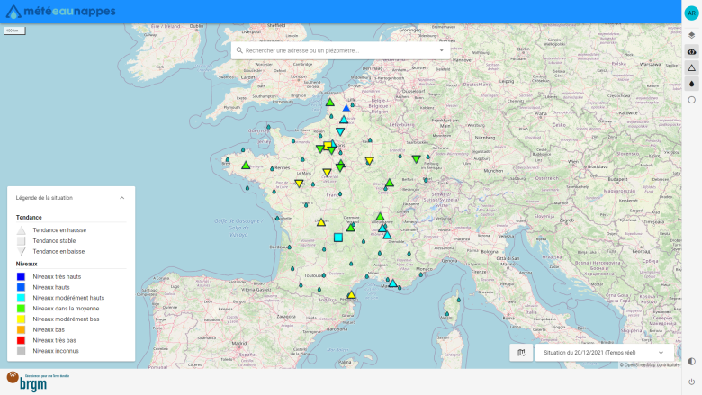
- MétéEAU Nappes: an innovative web platform that predicts/simulates groundwater levels for up to 6 months ahead, using water-related APIs.
References
Solutions


