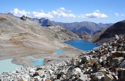
The Jonquilles River, Corrèze The Jonquilles River, Corrèze
Change the text size
Website accessibility
  • fr
  • en
The Jonquilles River, Corrèze The Jonquilles River, Corrèze
InfoTerre
The portal for access to BRGM geoscientific data
BRGM Job offers
Join the French geological survey
Annual report
BRGM's highlights and key results.
BRGM History
History of the BRGM, the French geological survey
Operational post-mining
Mine safety and risk prevention
Other websites
  • RGF - French Geological Reference Platform
  • ADES - Groundwater data access portal
  • Géorisques - A portal to better understand the risks in France
  • Géothermies - All about geothermal energy
  • Minéralinfo - The French portal for non-energy mineral resources
  • BRGM Training - Continuing professional training
  • HAL-BRGM - BRGM's scientific publications
All websites
BRGM logo with the French Republic logo
French
geological
survey
The Jonquilles River, Corrèze The Jonquilles River, Corrèze
  • Public partner, local government
    Public partners: BRGM at your side
    Expert studies
    Our solutions
    French regional network
    References and projects
    Public reports
    Scientific publications
    Websites, apps and databases
    Contacts
  • Company
    Working with the BRGM, a guide
    Innovation and transfers
    Our solutions
    References and projects
    Laboratories and technological platforms
    Continuing professional training
    Websites, apps and databases
    Becoming a BRGM supplier
    Contacts
  • Researcher
    Scientific research
    Public reports
    Scientific publications
    References and projects
    Laboratories and technological platforms
    Websites, apps and databases
    Books and geological maps
    Continuing professional training
    Doctorates and post-doctorates
  • Student
    Higher education
    Jobs and careers
    Doctorates and post-doctorates
    Work-study contracts and internships
    Websites, apps and databases
    Books and geological maps
    Public reports
    Scientific publications
    News
  • Teacher, pupil
    Discovering the Earth Sciences
    Lumni Enseignement, BRGM's educational resources
    Higher education
    Websites, apps and databases
    Books and geological maps
    Public reports
    Scientific publications
    News
  • Journalist
    News and press releases
    Events
    References and projects
    Public reports
    The BRGM at a glance
    Newsletter
    Press desk
  • Citizen, citizen's group
    News
    Events
    Jobs and careers
    The BRGM at a glance
    French regional network
    Discovering the Earth Sciences
    Undertakings
    Newsletter
    Results and data
The Jonquilles River, Corrèze The Jonquilles River, Corrèze
  • Challenges
    Challenges
    • Geology and knowledge of the subsurface
    • Groundwater management
    • Risks and spatial planning
    • Mineral resources and the circular economy
    • Subsurface potential for the energy transition
    • Digital data, services and infrastructure
  • Activities
    Activities
    • Scientific research
    • Expert studies
    • Innovation and transfers
    • Analysis and experimentation
    • Mine safety and risk prevention
    • Higher education
    • Continuing professional training
    • Knowledge dissemination and open science
  • Becoming a partner or client
    Becoming a partner or client
    • Companies: working with the BRGM, a guide
    • Public partners: BRGM at your side
    • Our solutions
    • Laboratories and technological platforms
    • Becoming a BRGM supplier
  • Identity
    Identity
    • The BRGM at a glance
    • Strategy
    • Governance
    • History
    • Undertakings
    • Subsidiaries and holdings
  • Results and data
    Results and data
    • References and projects
    • Public reports
    • Scientific publications
    • Software
    • Websites, apps and databases
  • In France and worldwide
    In France and worldwide
    • French regional network
    • Europe
    • International
  • News
  • Events
  • Educational area
  • State of groundwater
  • Jobs and careers
  • BRGM Publications
  • Newsletter
  • Contacts
Field survey in Gabon, Africa Field survey in Gabon, Africa
Breadcrumb
  • Home
  • Results and data
  • References and projects

References and projects

References and current scientific projects of BRGM, the French geological survey.
Reset
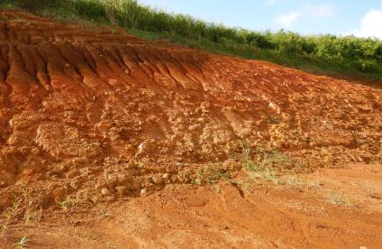
Installing the fertile soil pilot at the La Hisse site (Saint-Samson-sur-Rance, 2022). Installing the fertile soil pilot at the La Hisse site (Saint-Samson-sur-Rance, 2022).
Current project
SURICATES: reusing sediments to improve regional resilience
18 Sep 2023
Taking samples from the surface layer of a 100-year old technosoil Taking samples from the surface layer of a 100-year old technosoil
Reference, completed project
ReCon Soil: developing sustainable soils from construction waste
5 Sep 2023
A mountain house destroyed by a landslip near Gazost, Hautes-Pyrenees A mountain house destroyed by a landslip near Gazost, Hautes-Pyrenees
Reference, completed project
PYRMOVE: managing the risk of landslides in the Pyrenees
18 Jul 2023
Banner Water for Tomorrow. Banner Water for Tomorrow.
Reference, completed project
Water for Tomorrow: Working together to create and test innovative and holistic water management solutions
5 Jun 2023
View (from left to right) of the Balaruc peninsula, the Etang de Thau, Sète and the Mediterranean (Mont Saint Clair, Sète, 2020). View (from left to right) of the Balaruc peninsula, the Etang de Thau, Sète and the Mediterranean (Mont Saint Clair, Sète, 2020).
Reference, completed project
Dem'Eaux Thau: management of groundwater resources in a coastal karst aquifer
24 May 2023
1:250,000 geological map of the Occitania Region. 1:250,000 geological map of the Occitania Region.
Current project
ALARIC: production of the 1:250,000 digital regional geological map of Occitania
15 May 2023
Blue marl topped near Barrême in the French Alps Blue marl topped near Barrême in the French Alps
Reference, completed project
PITEM RISK: action on natural risks management and communication in the ALCOTRA Alpine area
15 Mar 2023
Bidart beach, Pyrénées-Atlantiques Bidart beach, Pyrénées-Atlantiques
Programme
The iRiMa programme: structuring and reinforcing the science of risk prevention and management in France
23 Jan 2023
Geological map of France Geological map of France
Programme
The subsurface as a common good: a research programme for the responsible and sustainable use and exploitation of the subsurface
20 Jan 2023
Very high-resolution seismic acquisition campaign on the Guadeloupean island shelf (Guadeloupe, 2021) Very high-resolution seismic acquisition campaign on the Guadeloupean island shelf (Guadeloupe, 2021)
Reference, completed project
Characterisation of sandy stocks on the Guadeloupean island shelf for beach nourishment
3 Jan 2023
Digital twin of the Vienna underground Digital twin of the Vienna underground
Programme
JUNON: digital twins working for natural resources
7 Dec 2022
Homepage of the BDLISA website Homepage of the BDLISA website
Reference, completed project
BDLISA, the French hydrogeological database
29 Nov 2022

Pagination

  • Current page 1
  • Page 2
  • Page 3
  • Page 4
  • Page 5
  • …
  • Next page
  • Last page
3D scan of an underground cavity as part of a stability diagnosis 3D scan of an underground cavity as part of a stability diagnosis
Newsletter
Subscribe to the newsletter
Contacts and access
Contacts
Press desk
Access maps
Follow us
  • Accessibility
  • Legal information - Credits
  • Personal data protection
  • Cookie management
  • Access to administrative documents
  • RSS feeds
BRGM logo with the French Republic logo
Logo Certification ISO 9001 et 14001 HRS4R logo France 2030 logo EuroGeoSurveys logo
BRGM - 3 avenue Claude-Guillemin - BP 36009 45060 Orléans Cedex 2 - France - Tel.: +33 (0)2 38 64 34 34
Newsletter

Subscribe to our newsletter and receive our news every month!