The need
Following BRGM's preliminary assessment of the rock-related risks at the Maïdo site in a crisis management situation, the local authority has decided to prohibit access to the edge of the Maïdo rampart (the 2nd most important tourist site on Reunion Island), to relocate a school and to close several accommodation facilities and a clinic located below the rampart. In order to clarify the diagnosis, which was carried out as a matter of urgency, and given the stakes involved, the Environment, Planning and Housing Department (DEAL) commissioned BRGM to characterise the permanent rock-related risks on the site.
The results
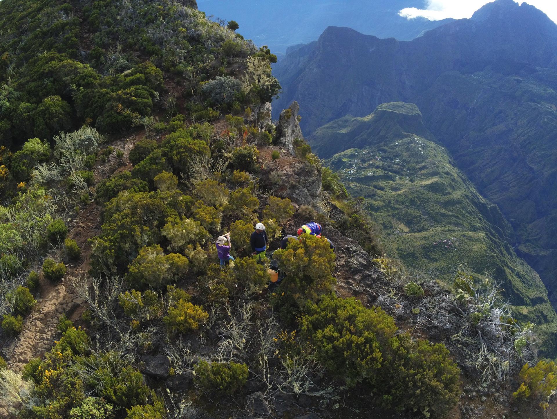
BRGM used the following methods to determine the overall permanent rock-related risks at the Maïdo site:
- 3D modelling of unstable rock falls which subsequently showed that the empirical methods used in crisis management were conservative for this configuration of the rampart;
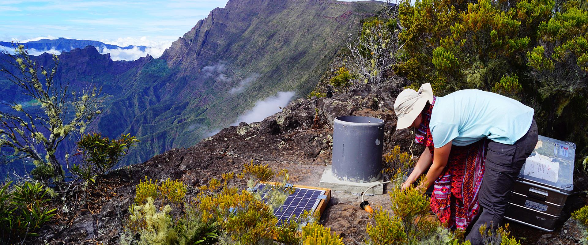
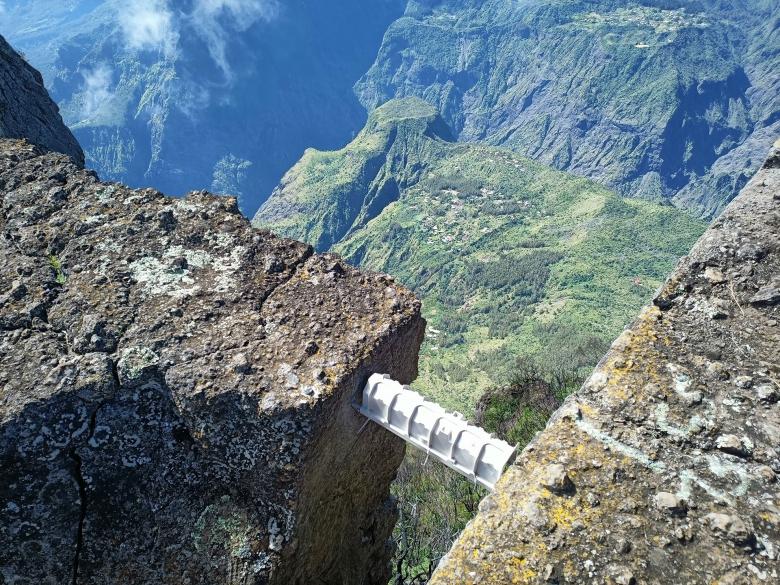
- Installation of a partly automated, durable, multi-scale auscultation system to monitor rock instability at the top of the rampart, providing continuous operational multi-scale monitoring reference data;
- Regular photogrammetric monitoring of the topography of the wall, seismic noise measurements at the top of the rampart and muographic tomography of the rampart: combining these three methods using cutting-edge techniques has refined our understanding of the risk of collapse and falling boulders.
Muon telescope: the Maïdo rampart under close monitoring
Transcription
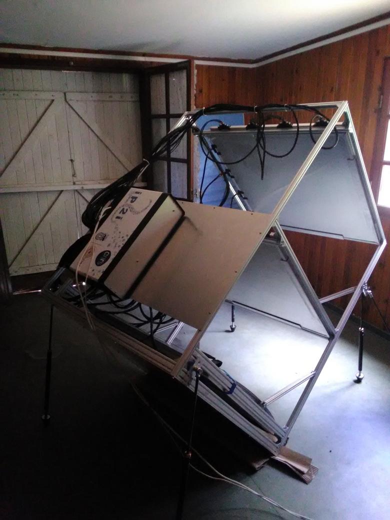
For the first time, a muon telescope is being deployed on Réunion Island. It was airlifted to the heart of the Cirque de Mafate. Set up in a shelter, it will remain on site for 6 months. Its mission is to visualize the interior of Maïdo, a 1,000m-high rampart, to monitor and predict the risk of landslide. This rampart, like many on Réunion, is subject to decompression phenomena, which explains the appearance of cracks below the crest, a few meters from the edge, or even a few dozen meters, and at Maïdo, along a stretch of 130m, almost right up to the access road. How deep are they? What are the cross-section volumes? Are they close to breaking? The largest cracks are at the edge of the rampart. In November 2020, a fire apparently widened some of the cracks. BRGM Réunion monitors the evolution of these cracks. The risk is primarily to anyone in the area. The view makes it a popular tourist site. There are also major issues below, where there is a village with several dozen inhabitants: Roche Plate. We know it will definitely give way, we need to determine when and predict probability. Meanwhile, 1,000m below... The muon telescope is pointed at the cracks at the top of the rampart. Its purpose is to record the muons traversing the rampart. But what are muons? Particles from space are constantly striking the Earth. They disintegrate into showers of elementary particles, electrons, positrons, neutrons and, smallest of all, muons. The particles we look at are produced in the air, high up in the atmosphere, on the other side of the Maïdo here. They cross the Maïdo and reach this device. The telescope records the trajectories of the millions of muons crossing the rampart. Exactly the same thing happens when you have an X-ray at the hospital. We obtain an image highlighting the contrast between dense and less dense zones. BRGM wants to ascertain the shape and depth of cracks in the rampart so as to assess the volume of rock likely to break away, making it possible to model the risk to inhabitants and infrastructures. This technology has already been used to view large archeological objects, like the Pyramid of Giza, as well as large geological objects, like volcanoes. But it's the first time the telescope has been used to image the density on such an immense cliff. For 6 months, the telescope will also record any evolution of the cracks to further improve understanding of the risk.
Using the results
The conclusions of this work will help to provide a knowledge base and decision-making support for the public authorities in managing the rock-related risks at the site, including in the event of a new crisis and with a view to sustainable redevelopment. The conclusions will also contribute to scientific mediation on this site.
In addition, reproducible methods were developed and validated in a rock wall context under this study, to characterise rock-related risks.
The partners
- Environment, Planning and Housing Department (DEAL) of Reunion Island
- IRIS Instruments
- Institute of Physics of the 2 Infinities of Lyon (IP2I)

This comprehensive study has clarified the level of risk using a large number of tools and methods to reduce uncertainties as far as possible. Simple, low-cost tools have also been developed in the course of the operation for continuous monitoring of changes in the mountain range. By continuing to monitor this site, essential data will be obtained to help make future crisis management decisions.


