BRGM’s open science policy
BRGM, the French geological survey, is a leading national and European player in the field of science and information on ground and the subsurface and its resources. It plays an increasing role as a widely acknowledged centre for ground and subsurface data both for the French Government and for European infrastructures such as the European Plate Observing System (EPOS) and the European Geological Survey Alliance EuroGeoSurveys and international ones, in particular for OneGeology.
As the manager of a very large number of open-access databases, which are part of its public-policy support activities, it is committed to sharing the results of its research activities as much as possible.
Open science policy developed in 2022
BRGMs open science policy aims to standardise practices at the level of the institution and to accelerate the process in all the scientific fields covered by the French geological survey.
BRGM's open science policy is to open up data, source codes and knowledge generated with public funds as its general practice, while respecting confidentiality legislation and rules with respect to National Security, business secrecy and defending national sovereignty.
Ensuring compliance with French open science and data policy and regulations
BRGM has played a pioneering role in the movement to open up data and ensure their interoperability in France for over 20 years. In accordance with French and European regulations, the institution guarantees that all publicly funded results, source codes and scientific research data, are made available, in the interests of transparency and in the hope of helping to develop direct or indirect economic activity. As an economic player, BRGM will also be able to participate, on its own behalf, in the development of digital services for which a fee will be charged and which will exploit free data and codes from a wide variety of sources.
Ensuring that the intellectual property of scientific results and data is respected
The aim of BRGM's data and source code policy is to make scientific results, source codes and data as accessible as possible in accordance with the provisions of open science, but also to protect them as much as necessary, when the rules governing intellectual property, confidentiality, sovereignty or economic stakes so dictate. BRGM undertakes to identify the legal framework for the data, source codes and scientific results it produces, or which are entrusted to it by partners or which it purchases. This implies taking the management of metadata, source codes (inter/external embargo, cause, duration) into account in the information system, to determine the appropriate user rights.
Managing scientific data throughout their life cycle by applying the FAIR principles
All the knowledge and data acquired or produced by BRGM for its research or consultancy activities must be managed according to the FAIR principles, using a process laid down in BRGM's quality management system. Consequently it must apply FAIR principles throughout the data cycle from the acquisition of raw field data or experimental and analytical data to transformed data and digital results. All the data produced must be systematically described and saved in BRGM's digital platforms to enable subsequent reuse. It should adopt industry standards, when possible, to manage scientific data and source codes and ensure their future interoperability and therefore re-usability.
Ensuring that data and results are maintained and disseminated in the long term
As a public research institution, BRGM is responsible for ensuring that data is maintained and not compromised in the long term. Beyond a regulatory objective, the challenge is to capitalise on the knowledge of the subsurface on a national scale, as part of an aggregative approach, to assist in the development of new uses while having extended series of data on the subsurface and the environment and make them available to all.
Baromètre de la science ouverte du BRGM
BRGM, a key player in the dissemination of geological and environmental data
BRGM makes its geological and environmental data available through various digital technologies. High value-added information: a valuable decision-making tool. This public institution is committed to open data and knowledge.
On its portal InfoTerre, BRGM provides free and open access to its geological reports and maps, data from its information banks (subsoil data bank, industrial sites, natural hazards, etc.) and a large quantity of other geoscientific data.
In particular, from the infoTerre portal, BRGM provides free downloads of:
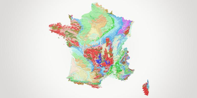
- its vectorised and standardised geological maps on a scale of 1:50,000 and the geological map of metropolitan France on a scale of 1:1,000,000. These are decision-making support tools for public authorities, planners and consultancy firms in various fields such as regional planning, mineral resource prospecting, groundwater exploration and protection, pollution control, natural risk prevention and soil characterisation;
- the Subsoil Data Bank (BSS), which lists the material safety data sheets of more than 800,000 structures, associated with more than 2,000,000 pages of technical documents. This data bank contains raw geological and technical information relating to underground structures: location, purpose, geological description and technical borehole data.
On request from the public authorities, BRGM also coordinates and manages several dozen websites and databases in the fields of geology, natural hazards (Géorisques), water (ADES), mineral resources (Mineralinfo), geothermal energy (Géothermies), etc.
To ensure easy access to its data from any point in the country, BRGM also provides three mobile applications: i-InfoTerre (mobile version of the InfoTerre web portal), InfoNappe (on groundwater) and InfoGéol (on the geology of France).
Data interoperability: solid expert knowledge
BRGM, a major player in the collection, enhancement and provision of geo-referenced environmental and geoscience data, was one of the pioneers in thinking up and conceptualising the principle of information system interoperability. Through its involvement in establishing and implementing standards for processing and distributing geo-environmental information, it has accumulated expert knowledge that is regularly sought in research projects and partnerships in France and Europe.
BRGM is therefore closely involved in the construction of standards in the OGC (Open Geospatial Consortium) and the IUGS-CGI (Commission on Geoscience Information at the International Union of Geological Sciences). It is one of the main contributors to the establishment of the rules and standards of the European INSPIRE directive, which in the long term aims to put all European public environmental information online. It also plays an essential role in international initiatives (GEOSS, OneGeology).
Data, services and digital infrastructures: a strategic challenge for BRGM
BRGM collects, hosts and disseminates geological and environmental data, which are also used as raw material for new science. It is one of the main national and European reference establishments with regard to the management of the geoscientific and environmental data cycle.

