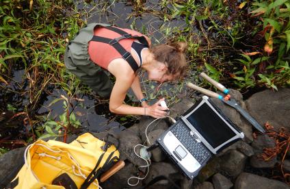
La rivière des Jonquilles, Corrèze
Change the text size
Website accessibility
  • fr
  • en
La rivière des Jonquilles, Corrèze
InfoTerre
The portal for access to BRGM geoscientific data
BRGM Job offers
Join the French geological survey
Annual report
BRGM's highlights and key results.
BRGM History
History of the BRGM, the French geological survey
Operational post-mining
Mine safety and risk prevention
Other websites
  • RGF - French Geological Reference Platform
  • ADES - Groundwater data access portal
  • Géorisques - A portal to better understand the risks in France
  • Géothermies - All about geothermal energy
  • Minéralinfo - The French portal for non-energy mineral resources
  • BRGM Training - Continuing professional training
  • HAL-BRGM - BRGM's scientific publications
All websites
BRGM logo with the French Republic logo
French
geological
survey
La rivière des Jonquilles, Corrèze
  • Public partner, local government
    Public partners: BRGM at your side
    Expert studies
    Our solutions
    French regional network
    References and projects
    Public reports
    Scientific publications
    Websites, apps and databases
    Contacts
  • Company
    Working with the BRGM, a guide
    Innovation and transfers
    Our solutions
    References and projects
    Laboratories and technological platforms
    Continuing professional training
    Websites, apps and databases
    Becoming a BRGM supplier
    Contacts
  • Researcher
    Scientific research
    Public reports
    Scientific publications
    References and projects
    Laboratories and technological platforms
    Websites, apps and databases
    Books and geological maps
    Continuing professional training
    Doctorates and post-doctorates
  • Student
    Higher education
    Jobs and careers
    Doctorates and post-doctorates
    Work-study contracts and internships
    Websites, apps and databases
    Books and geological maps
    Public reports
    Scientific publications
    News
  • Teacher, pupil
    Discovering the Earth Sciences
    Lumni Enseignement, BRGM's educational resources
    Higher education
    Websites, apps and databases
    Books and geological maps
    Public reports
    Scientific publications
    News
  • Journalist
    News and press releases
    Events
    References and projects
    Public reports
    The BRGM at a glance
    Newsletter
    Press desk
  • Citizen, citizen's group
    News
    Events
    Jobs and careers
    The BRGM at a glance
    French regional network
    Discovering the Earth Sciences
    Undertakings
    Newsletter
    Results and data
La rivière des Jonquilles, Corrèze
  • Challenges
    Challenges
    • Geology and knowledge of the subsurface
    • Groundwater management
    • Risks and spatial planning
    • Mineral resources and the circular economy
    • Subsurface potential for the energy transition
    • Digital data, services and infrastructure
  • Activities
    Activities
    • Scientific research
    • Expert studies
    • Innovation and transfers
    • Analysis and experimentation
    • Mine safety and risk prevention
    • Higher education
    • Continuing professional training
    • Knowledge dissemination and open science
  • Becoming a partner or client
    Becoming a partner or client
    • Companies: working with the BRGM, a guide
    • Public partners: BRGM at your side
    • Our solutions
    • Laboratories and technological platforms
    • Becoming a BRGM supplier
  • Identity
    Identity
    • The BRGM at a glance
    • Strategy
    • Governance
    • History
    • Undertakings
    • Subsidiaries and holdings
  • Results and data
    Results and data
    • References and projects
    • Public reports
    • Scientific publications
    • Software
    • Websites, apps and databases
  • In France and worldwide
    In France and worldwide
    • French regional network
    • Europe
    • International
  • News
  • Events
  • Educational area
  • State of groundwater
  • Jobs and careers
  • BRGM Publications
  • Newsletter
  • Contacts
Field survey in Gabon, Africa
Breadcrumb
  • Home
  • Results and data
  • References and projects

References and projects

References and current scientific projects of BRGM, the French geological survey.
Reset
Carte du potentiel géothermique sur nappe (meilleur aquifère) sur le territoire alsacien.
Reference, completed project
Atlas of near-surface geothermal resources in Alsace
6 Sep 2022
The ReunEM heliborne geophysical survey, Reunion Island
Reference, completed project
Plaine des Fougères (Reunion Island): deep geophysical, geological and hydrogeological characterisation
6 Sep 2022
Salle de la direction de l’animation des acteurs du bassin d’Arcachon, pilotée par le BRGM (Arcachon, 2021).
Reference, completed project
Coastal flooding: a full-scale crisis exercise in Gironde
6 Sep 2022
Confortement d’une maison endommagée par le séisme du Teil (commune de Viviers, 2020).
Reference, completed project
Creation of an observatory to analyse post-earthquake reconstruction in the municipality of Le Teil in Ardèche
6 Sep 2022
A street in Amatrice after the August 2016 earthquake, Italy
Reference, completed project
Assessment and prevention of seismic risk in the Saint-Louis Conglomeration (Haut-Rhin)
6 Sep 2022
Présentation du plaidoyer lors des journées de sensibilisation à la géothermie (Paris, 2022).
Reference, completed project
The case for geothermal energy in swimming pools and water parks
6 Sep 2022
Acquisition de données géophysiques électriques sur un profil traversant une piste (Grand Santi, 2021).
Reference, completed project
Using groundwater to secure the drinking water supply in the town and surrounding villages of Grand Santi (French Guiana)
6 Sep 2022
Ancienne cavité militaire en partie maçonnée et prolongement d’une galerie avec roche à nu (Cherbourg-en-Cotentin, 2021).
Reference, completed project
Inventory and assessment of the risks associated with the presence of cavities in the city of Cherbourg-en-Cotentin
6 Sep 2022
Carte géologique et pédagogique de Lyon et ses environs.
Reference, completed project
Educational maps illustrating the challenges of the subsurface
6 Sep 2022
Forage d’eau situé à côté de la station de traitement des eaux souterraines (Beignon, 2019).
Reference, completed project
Scientific assessment of the causes behind drops in river levels in bedrock areas of the Aff valley
5 Sep 2022
La Thur, en amont du lac de Kruth-Wildenstein (Haut-Rhin, juillet 2019).
Reference, completed project
Impact of climate change on the water resources of the Vosges basement
2 Sep 2022
The Ray-Pic waterfall, Ardèche
Current project
Explore2: the future of water
30 Aug 2022

Pagination

  • First page
  • Previous page
  • …
  • Page 2
  • Page 3
  • Current page 4
  • Page 5
  • Page 6
  • …
  • Next page
  • Last page
3D scan of an underground cavity as part of a stability diagnosis
Newsletter
Subscribe to the newsletter
Contacts and access
Contacts
Press desk
Access maps
Follow us
  • Accessibility
  • Legal information - Credits
  • Personal data protection
  • Cookie management
  • Access to administrative documents
  • RSS feeds
BRGM logo with the French Republic logo
Logo Certification ISO 9001 et 14001 Logo EuroGeoSurveys Logo AllEnvi
BRGM - 3 avenue Claude-Guillemin - BP 36009 45060 Orléans Cedex 2 - France - Tel.: +33 (0)2 38 64 34 34
Newsletter

Subscribe to our newsletter and receive our news every month!