DEM'Eaux Thau: a tool for managing the region's groundwater
Objectives and needs
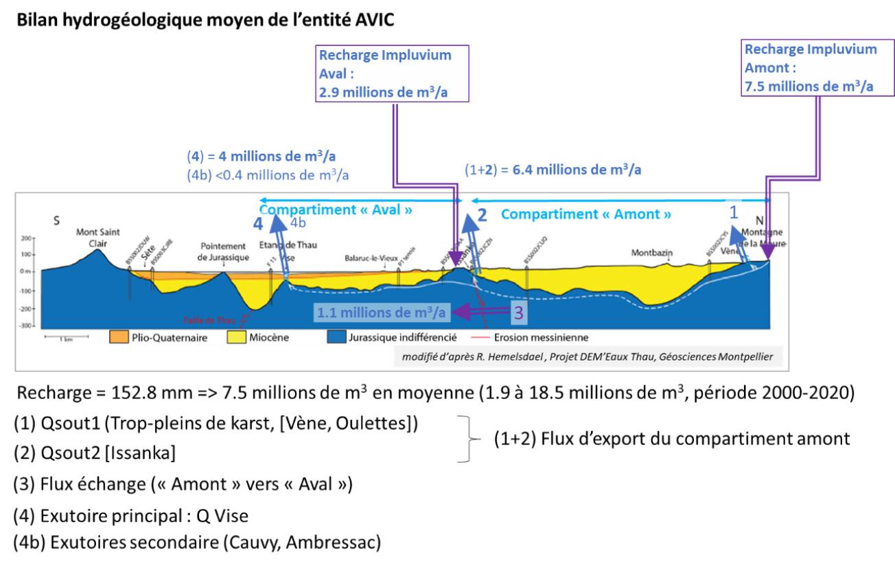
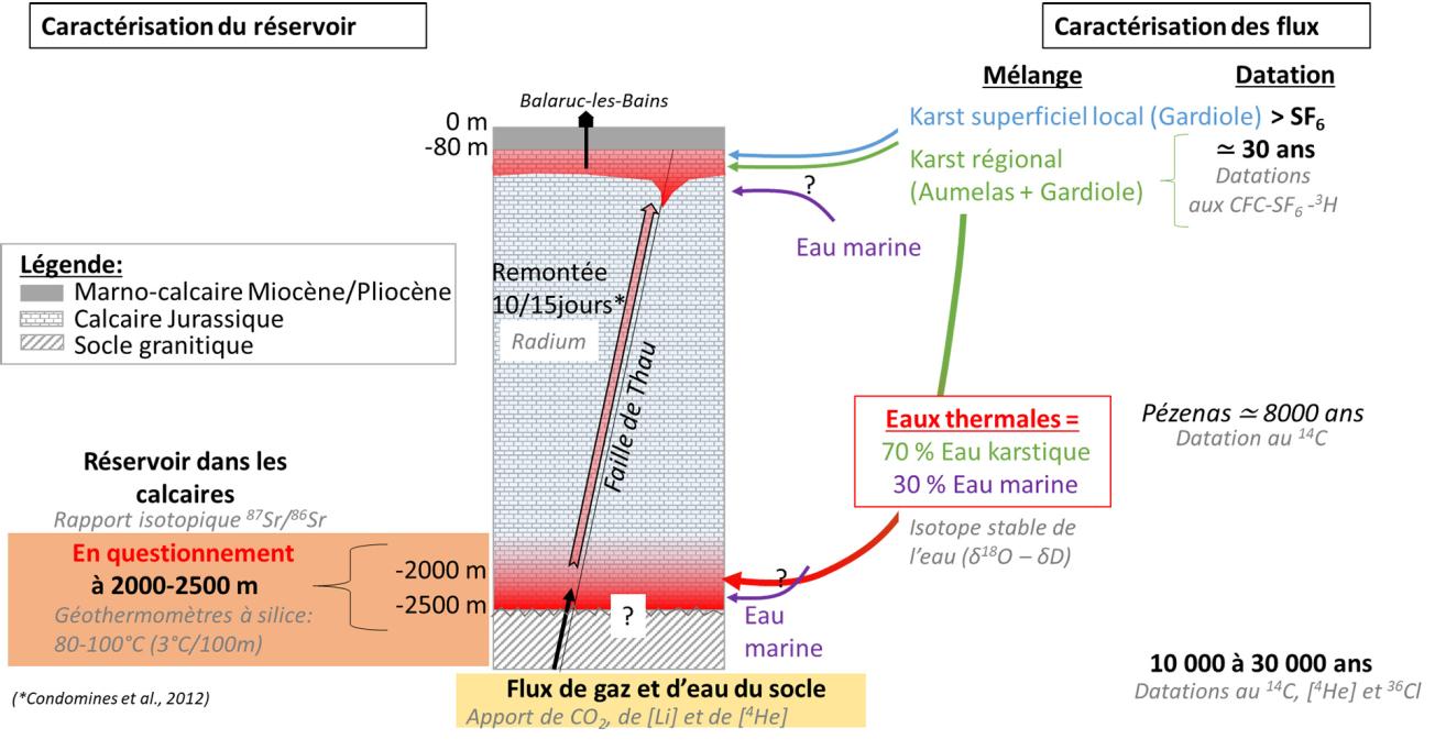
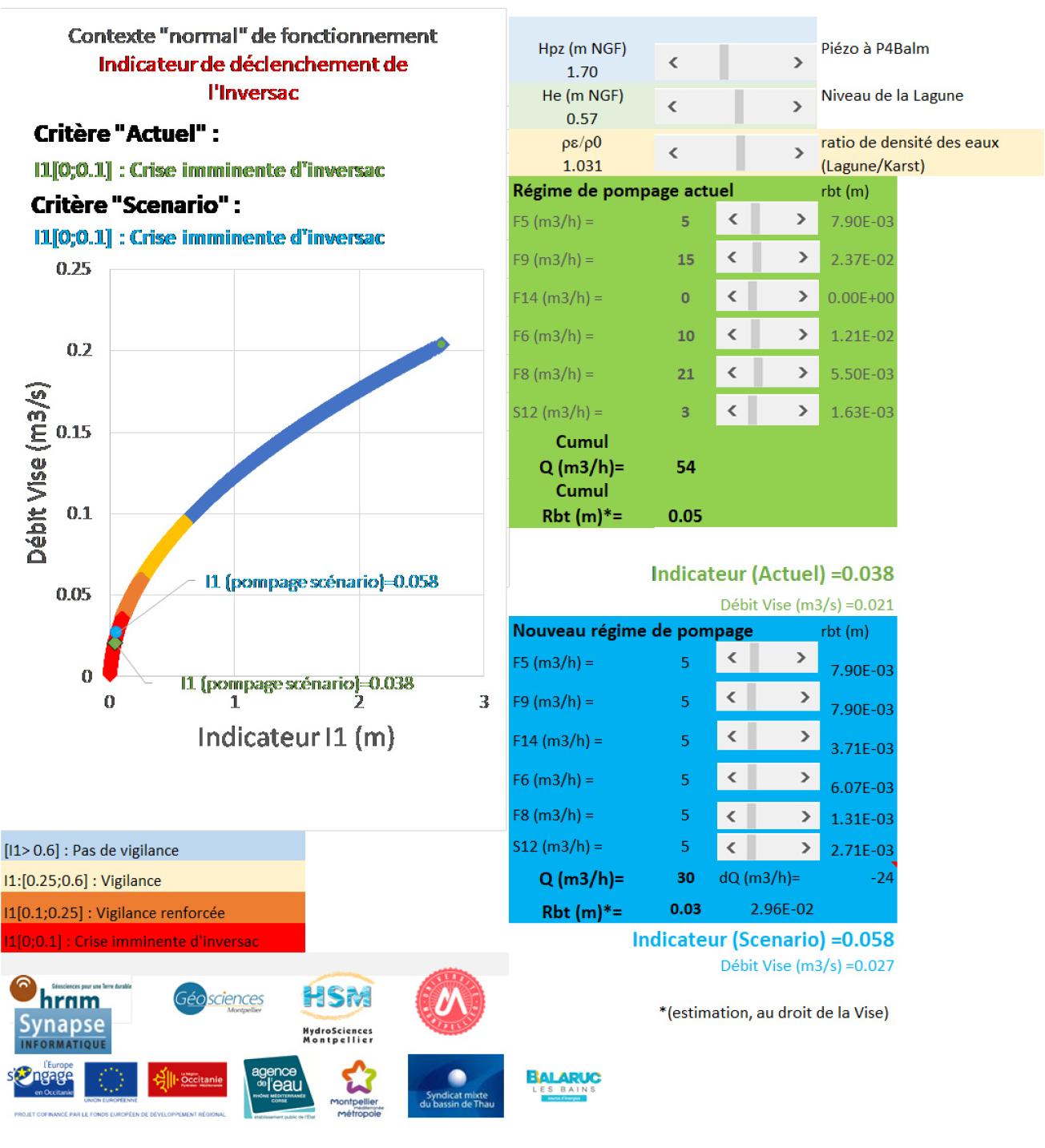
The underground water resources of the karst limestone formations of the Montpellier western fold are of major interest for the region, for the supply of drinking water (town of Sète, Syndicat Intercommunal d'Aduction en Eau Potable Balaruc-Frontignan, Syndicat Intercommunal d'Adduction d'Eau des communes du Bas Languedoc), but also for economic development, in particular shellfish farming/fishing in the lagoon, as well as for the spa on the Balaruc-les-Bains peninsula (the leading spa in France with more than 50,000 guests coming to "take the waters" in 2019), and irrigation. The site is located at the convergence of underground waters coming from various surface and deep reservoirs: cold karst waters of the Causses d'Aumelas and the Gardiole, waters of marine origin (lagoon and sea) and hot and mineralized thermal waters. These different reservoirs interact with each other through complex processes whose determinants are not all understood.
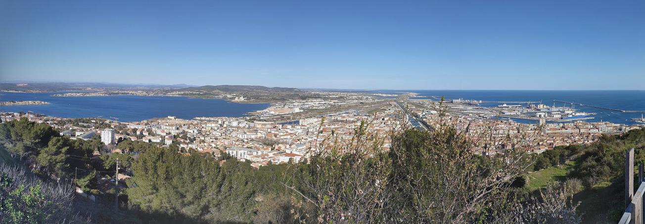
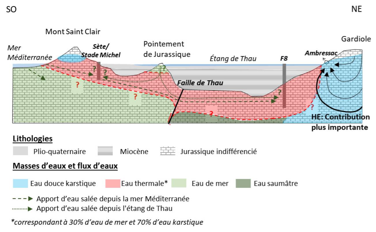
View (from left to right) of the Balaruc peninsula, the Etang de Thau, Sète and the Mediterranean (Mont Saint Clair, Sète, 2020).
© BRGM - Claudine Lamotte
This karst aquifer is subject to temporary brackish water intrusion phenomena (called “inversac”) via the submarine Vise spring in the Thau Lagoon, less than 200 m west of the Balaruc-les-Bains peninsula. Since the end of the 1960s, seven inversac phenomena have been detected. During this phenomenon, which can last several months (about 6 months in 2010 and 2014, and nearly 18 months in 2020-2022), the Vise spring, instead of supplying fresh water for the aquatic life of the Thau lagoon, absorbs brackish water from it, leading to progressive and recurrent salinisation of the aquifer. This phenomenon led, among other consequences, to the abandoning (in 2014) of the Cauvy spring in Balaruc-les-Bains as a supply of drinking water.
Thus, given the different issues at stake in this coastal area, the different stakeholders need a groundwater management tool.
What is the reverse flow (inversac) phenomenon?
Work programme
This scientific study was conducted by a multidisciplinary team in order to characterise the geology, geomorphology, hydrodynamics, hydrogeology and geochemistry of the Thau hydrosystem. The researchers then pooled and discussed their different observations to build a comprehensive conceptual model of the functioning and dynamics of the aquifer. This was achieved in various ways by means of geophysical imagery, drilling a borehole in Sète and constructing a multi-borehole platform in Balaruc-les-Bains, including one shaft nearly 780 m deep, designing and installing custom-made equipment for the Vise spring, and unprecedented sampling campaigns (180 samples, more than 3,000 analyses).
Focus on some of the results
The list below will be updated with links to the documents as they are produced.
- Final synthesis report of the DEM'Eaux Thau project
- Synthesis and preliminary use of data on the Thau hydrosystem (34)
- Geophysical investigations (CSEM, gravimetry and seismic) in the Balaruc-les-Bains area - Acquisition report
- Modelling and 3D inversion of electromagnetic data from a controlled source in the Balaruc-les-Bains area
- The “Stade Michel” borehole in Sète (34) - Construction file
- Instrumentation of the Vise spring in Balaruc-Les-Bains (34) - Final report
- DEM'Eaux Thau: results of artificial tracer tests
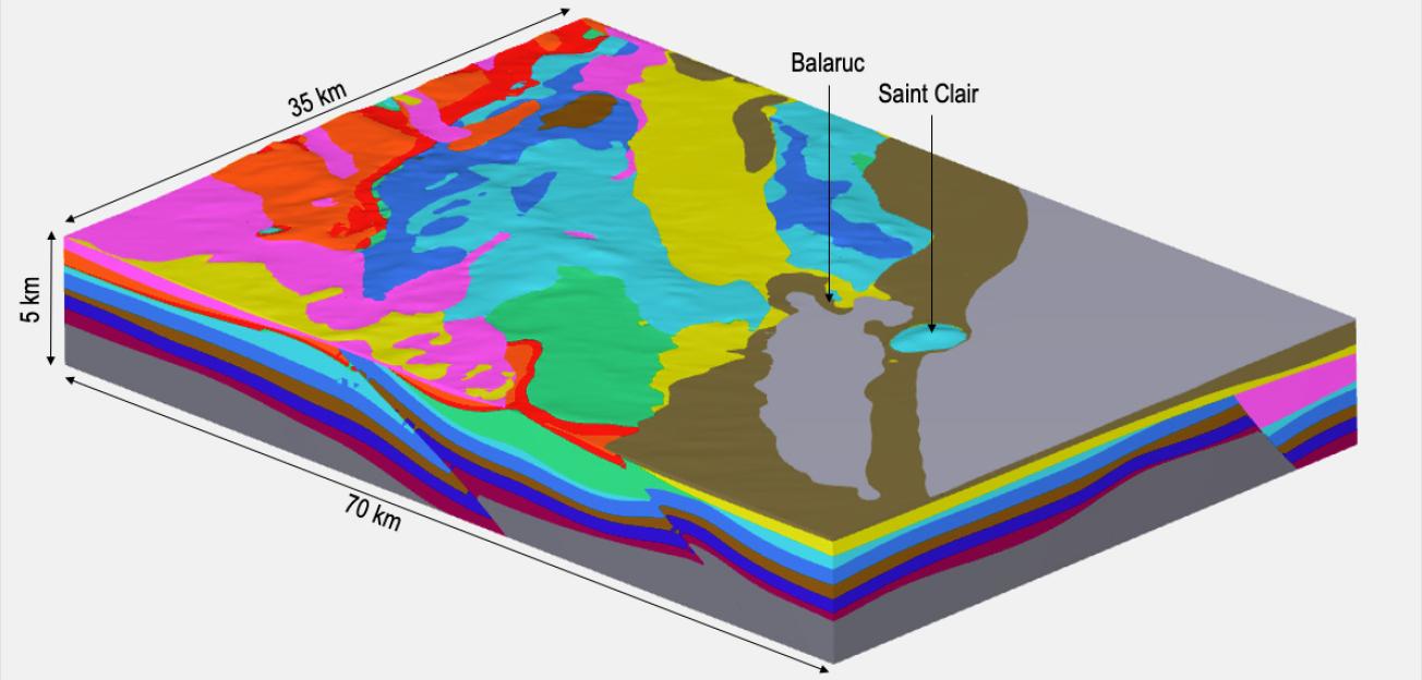
- Construction of a 3D geological model of the Montpellier-Sète sector and the Thau Lagoon
- Geochemical analysis report - Inputs from the 2018-2019 spatial campaigns
- Geochemical analysis report - Inputs from the monthly campaigns and the 2020-2021 inversac
- DEM'Eaux Thau platform - 1st acquisitions on the Vise spring, DEMT1, DEMT2, DEMT3, DEMT4 boreholes
- Inversac of the submarine Vise spring under the Thau lagoon: mechanism and modelling
- Numerical hydrogeological modelling of the Thau karst aquifer
- Follow Dem'Eaux Thau platform : infrastructure and equipment
- Follow Dem'Eaux Thau platform : observation and management tool
All the results of the DEM'Eaux Thau project
Financing
The project has a budget of 5.3 million euros, 42% of which is financed by the Ministry of Higher Education and Research and the Occitania Region (as part of the 2015-2020 State-Region Plan Contract), 11% by the European ERDF fund, 17% by the Rhône-Méditerranée-Corse Water Agency, 4% by Montpellier Méditerranée Métropole, 2% by Balaruc-les-Bains and 1% by the Syndicat Mixte du Bassin de Thau. The remaining 23% of the project's funding comes from contributions made by most of the partners.
Partners
- BRGM (coordinator)
- Geosciences Montpellier
- HydroSciences Montpellier
- Synapse Informatique
- SMBT

Logos of the funders and partners of the Dem'Eaux Thau project.
© Dem’Eaux Thau

