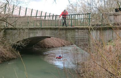
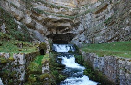
La rivière des Jonquilles, Corrèze
Change the text size
Website accessibility
  • fr
  • en
La rivière des Jonquilles, Corrèze
InfoTerre
The portal for access to BRGM geoscientific data
BRGM Job offers
Join the French geological survey
Annual report
BRGM's highlights and key results.
BRGM History
History of the BRGM, the French geological survey
Operational post-mining
Mine safety and risk prevention
Other websites
  • RGF - French Geological Reference Platform
  • ADES - Groundwater data access portal
  • Géorisques - A portal to better understand the risks in France
  • Géothermies - All about geothermal energy
  • Minéralinfo - The French portal for non-energy mineral resources
  • BRGM Training - Continuing professional training
  • HAL-BRGM - BRGM's scientific publications
All websites
BRGM logo with the French Republic logo
French
geological
survey
La rivière des Jonquilles, Corrèze
  • Public partner, local government
    Public partners: BRGM at your side
    Expert studies
    Our solutions
    French regional network
    References and projects
    Public reports
    Scientific publications
    Websites, apps and databases
    Contacts
  • Company
    Working with the BRGM, a guide
    Innovation and transfers
    Our solutions
    References and projects
    Laboratories and technological platforms
    Continuing professional training
    Websites, apps and databases
    Becoming a BRGM supplier
    Contacts
  • Researcher
    Scientific research
    Public reports
    Scientific publications
    References and projects
    Laboratories and technological platforms
    Websites, apps and databases
    Books and geological maps
    Continuing professional training
    Doctorates and post-doctorates
  • Student
    Higher education
    Jobs and careers
    Doctorates and post-doctorates
    Work-study contracts and internships
    Websites, apps and databases
    Books and geological maps
    Public reports
    Scientific publications
    News
  • Teacher, pupil
    Discovering the Earth Sciences
    Lumni Enseignement, BRGM's educational resources
    Higher education
    Websites, apps and databases
    Books and geological maps
    Public reports
    Scientific publications
    News
  • Journalist
    News and press releases
    Events
    References and projects
    Public reports
    The BRGM at a glance
    Newsletter
    Press desk
  • Citizen's group, citizen
    News
    Events
    Jobs and careers
    The BRGM at a glance
    French regional network
    Discovering the Earth Sciences
    Undertakings
    Newsletter
    Results and data
La rivière des Jonquilles, Corrèze
  • Challenges
    Challenges
    • Geology and knowledge of the subsurface
    • Groundwater management
    • Risks and spatial planning
    • Mineral resources and the circular economy
    • Subsurface potential for the energy transition
    • Digital data, services and infrastructure
  • Activities
    Activities
    • Scientific research
    • Expert studies
    • Innovation and transfers
    • Analysis and experimentation
    • Mine safety and risk prevention
    • Higher education
    • Continuing professional training
    • Knowledge dissemination and open science
  • Becoming a partner or client
    Becoming a partner or client
    • Companies: working with the BRGM, a guide
    • Public partners: BRGM at your side
    • Our solutions
    • Laboratories and technological platforms
    • Becoming a BRGM supplier
  • Identity
    Identity
    • The BRGM at a glance
    • Strategy
    • Governance
    • History
    • Undertakings
    • Subsidiaries and holdings
  • Results and data
    Results and data
    • References and projects
    • Public reports
    • Scientific publications
    • Software
    • Websites, apps and databases
  • In France and worldwide
    In France and worldwide
    • French regional network
    • Europe
    • International
  • News
  • Events
  • Educational area
  • State of groundwater
  • Jobs and careers
  • BRGM Publications
  • Newsletter
  • Contacts
Field survey in Gabon, Africa
Breadcrumb
  • Home
  • Results and data
  • References and projects

References and projects

References and current scientific projects of BRGM, the French geological survey.
Reset
Fontaine sur le site de Saint-Thomas Les Bains à Fontpédrouse (Pyrénées Orientales).
Reference, completed project
Valeautherm Occitania: developing the geothermal potential of thermal spas
12 Sep 2022
Profondeur du toit des cavités visitées, d’après le levé au scanner laser mobile (Montmorillon, 2021).
Reference, completed project
Searching for cavities under the church of Montmorillon (Vienne département) by combining microgravimetry and 3D laser scanning
12 Sep 2022
Modélisation de l‘impact d’un tsunami (2022).
Reference, completed project
Natural hazard simulation tool for sustainable spatial planning in the French West Indies
9 Sep 2022
Visite de surveillance et scan 3D réalisés dans une ancienne crayère dans le cadre de l'Observatoire des cavités de Châlons-en-Champagne (Marne, 2021).
Reference, completed project
Monitoring and searching for underground cavities in Châlons-en-Champagne (Marne)
9 Sep 2022
Cartographie des cibles exploratoires de géothermie profonde et des installations en fonctionnement.
Reference, completed project
Development of deep geothermal resources in France
9 Sep 2022
Plage de Grande Anse Macabou (Le Vauclin, 2013).
Reference, completed project
OLiMar: the creation of an observatory for coastline dynamics in Martinique
8 Sep 2022
Observation de la morphologie karstique dans la chaîne des Alpilles (Saint-Rémy-de-Provence, 2021).
Reference, completed project
Alternative groundwater resources: deep karst in Provence
8 Sep 2022
Carte géologique du Quaternaire au 1/1 000 000e avec un zoom sur la zone sud-est.
Reference, completed project
Geological Quaternary map on a scale of 1:1,000,000
7 Sep 2022
Exemple de carte lithologique à 1/100 000e disponible dans l’atlas réalisé par le BRGM.
Reference, completed project
Construction sector in French Guiana: inventory and atlas of raw material reserves
7 Sep 2022
Déploiement d’échantillonneurs passifs et prélèvements ponctuels, Bassin de l’Ourovéni, juillet 2021.
Reference, completed project
Improving knowledge of pressures on the Mayotte land-sea continuum and of the quality of water there
7 Sep 2022
A gauche : Banque Gravimétrique de la France : localisation des 430 000 stations gravimétriques. A droite : Base des données aéromagnétiques de la France : localisation des 146 campagnes de la métropole.
Reference, completed project
Exploitation and valorisation of gravimetric and aero-geophysical databases
7 Sep 2022
Mesures de teneurs métallique par FluoX sur un site de stockage de sargasse (Terre de bas, Guadeloupe, 2019).
Reference, completed project
Sargassum-spreading sites in Guadeloupe: environmental impact
6 Sep 2022

Pagination

  • First page
  • Previous page
  • Page 1
  • Page 2
  • Current page 3
  • Page 4
  • Page 5
  • …
  • Next page
  • Last page
3D scan of an underground cavity as part of a stability diagnosis
Newsletter
Subscribe to the newsletter
Contacts and access
Contacts
Press desk
Access maps
Follow us
  • Accessibility
  • Legal information - Credits
  • Personal data protection
  • Cookie management
  • Access to administrative documents
  • RSS feeds
BRGM logo with the French Republic logo
Logo Certification ISO 9001 et 14001 Logo EuroGeoSurveys Logo AllEnvi
BRGM - 3 avenue Claude-Guillemin - BP 36009 45060 Orléans Cedex 2 - France - Tel.: +33 (0)2 38 64 34 34
Newsletter

Subscribe to our newsletter and receive our news every month!