The need
The Greater Lille area (Métropole Européenne de Lille or MEL) exploits a range of water resources, primarily the chalk aquifer, for its drinking water supplies. In order to gain a clearer understanding of the hydrodynamic role of tectonic faults in the circulation of water in the chalk aquifer, MEL and BRGM joined forces with the University of Lille as part of Géo2020, a project combining geophysical investigations with geological and hydrogeological studies.
Results
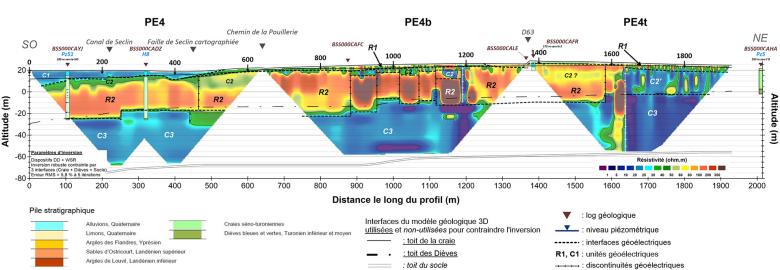
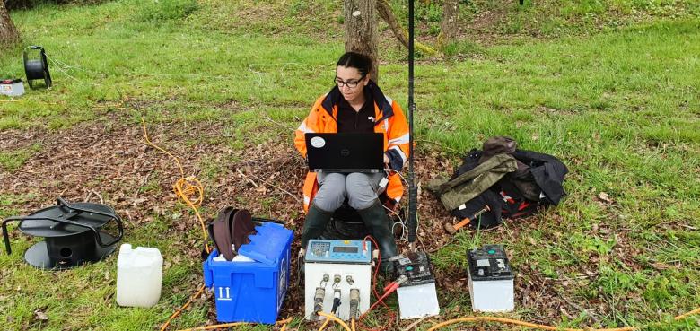
The geophysical approach was based on three methods of investigation: gravimetry, seismic imaging and electrical resistivity tomography. The results obtained showed:
- the presence of major faults in the bedrock affecting the Seno-Turonian chalk;
- secondary seismic discontinuities interpreted as intense fracturing of the chalk;
- that the main local fault is a complex horst and graben structure;
- that the presence of lateral variations in the chalk contributes to a better understanding of the heterogeneity of water chemistry;
- the presence of a significant gravimetric anomaly suggesting a collapse associated with a deep endokarst, resulting from the dissolution of Visean evaporites.
The hydrogeological approach implemented at the same time showed that a drop in water levels can have a considerable impact on the capacity of the aquifer to mobilise its water resources if transmissive fractures are present in the roof.

We have been working with BRGM for many years to gain a better understanding of flows in the chalk aquifer. We have acquired valuable knowledge from the tools created and the information obtained. However, we needed additional, more detailed information, as a result of climate change, quality issues and the ageing of our boreholes. This new information has enabled us to update the geological context and review the way we manage drinking water production.

Cross-section showing electrical resistivity in the chalk of the catchment area south of Lille (2021)
© BRGM
Using the results
The results of this study form a knowledge base that can be used by MEL in selecting sites for new boreholes. A number of recommendations were put forward to make sure that the hydrodynamic and geochemical characteristics of the aquifer are correctly assessed when new boreholes are drilled: electrical logging to establish the thickness of the productive part of the aquifer, gamma-Ray logging to determine the presence or absence of clay, micro-current meters, measurement of physico-chemical parameters, pumping tests.
The partners
- Greater Lille area
- University of Lille Oceanology and Geosciences Laboratory
Public reports
-
An assessment of the long-term viability of the Ansereuilles catchment field, with recommendations: Géo2020 project. Final report
-
Fonctionnement de l’hydro-système de la craie dans la région des champs captants du sud de Lille - Imagerie géophysique par gravimétrie, tomographie de résistivité électrique, sismique réfraction et réflexion haute résolution. Rapport final
-
Operation of the chalk hydro-system in the catchment area south of Lille - Geophysical imaging using gravimetry, electrical resistivity tomography, seismic refraction and high-resolution reflection. Final report


