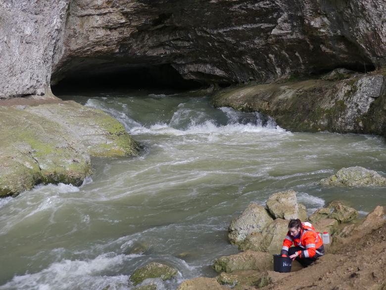
Sampling water for geochemical analysis to provide information on its origin and residence time in karstic aquifers (Sarrazine cave, 2021)
© BRGM
Issues and needs
The deterioration in river water quality in Franche-Comté over the last few decades is due in particular to excess nutrients resulting from past and ongoing human activity. In the Jura Mountains, the impact of agricultural practices and domestic and industrial waste disposal is compounded by the vulnerability of karst landscapes where water infiltrates easily, while limiting filtration processes at ground level.
International scientific work on the fate of pollutants in the environment is very poorly documented for karst environments and few references are available on the environmental impact of human activities in Franche-Comté.
Reducing the exposure of the population and, more generally, the environment, to diffuse pollution involves taking into account the combined effects of human activities and climate change on water resources. To tackle the problem of water contamination by nutrients, we need to know more about the following:
- changes in the quantity and quality of water resources, taking account of hydro-climatic changes, land use and nitrogen and phosphorus discharges;
- the hydrogeological functioning of karst aquifers and exchanges between karst formations and rivers;
- nutrient transfers from the ground surface to the subsurface, springs and watercourses.
This subsequently involves adaptation of the region adapting by taking remedial measures to reduce agricultural, domestic or industrial discharges.
There are multiple practical benefits. The purpose is to identify areas that contribute to pollution, to determine how the input of nutrients into water can be limited and to guide the management and adaptation of the area.

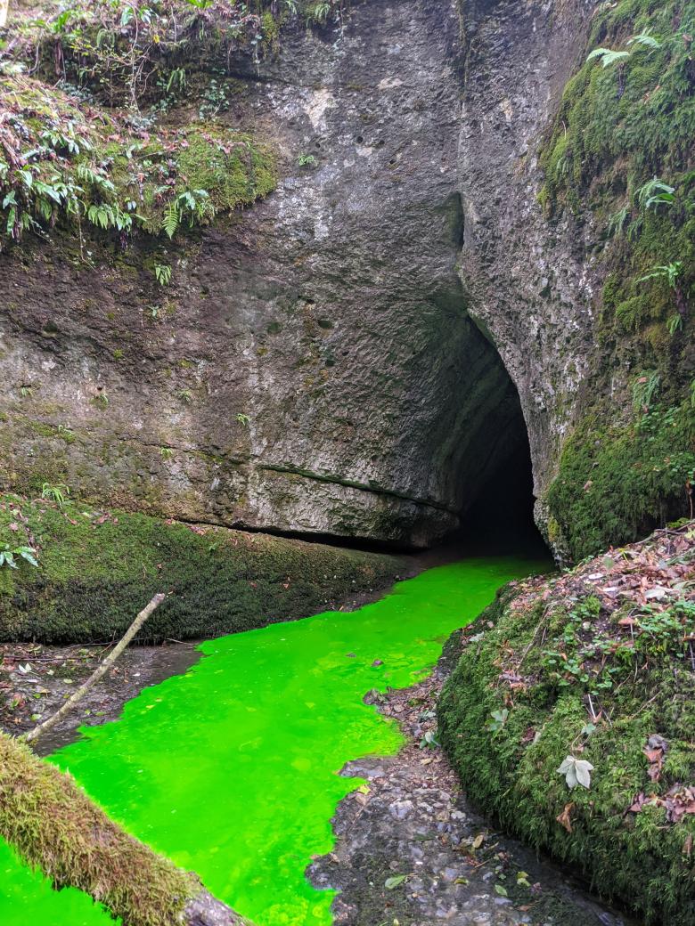
Artificial tracing to determine water transfer times from the surface to the Verneau spring (2020)
© BRGM
Work programme
The NUTRI-Karst project is divided into four tasks:
- Task 1: Studying the response of agro-hydro-systems in the Jura Mountains to climate change and human activities. The aim is to assess the large-scale effects of global climate change on river water quality in Franche-Comté by tracing medium- to long-term changes in the various climatic, agricultural, hydrological, physical and chemical variables and analysing the relationships between them using signal processing and statistical tools.
- Task 2: Hydrogeological characterisation and demarcation of areas contributing to river flow in karst systems and the Loue catchment area. The purpose is to gain a better understanding of what determines surface/subsurface interactions on the various scales of the aquifer and catchment area by applying a multidisciplinary approach (gauging & longitudinal profiles, artificial tracing, hydrogeochemistry) to the Loue catchment area, leading to a 3D hydrogeological model and the demarcation of areas contributing to river flow.
- Task 3: Studying transfers of nutrients of agricultural origin by focusing respectively on the ground surface, karst springs and the catchment area. The scientific objective is to gain a better understanding of the impact of agricultural practices and the dynamics of underground nutrient transfers towards springs and rivers. This task is partly based on data acquired by the QUARSTIC network on the various scales of the spring, the sub-basin and the Loue catchment area. The instruments at the Verneau pilot site for monitoring infiltration water (lysimeters, including for measuring water losses and water movements in the underground network) under this project will be used to characterise transfers on the scale of a plot that is representative of agricultural practices and the karst functioning of the main aquifers in the Loue catchment area.
- Task 4: Contributing knowledge to build a shared vision of the causes of disruption to rivers in Franche-Comté. The purpose is to establish a dialogue between those working in the field and scientists in order to share layman's and technical knowledge. This is a prerequisite for discussing the remedial measures to be taken. This task is based on surveys and participatory multi-stakeholder workshops with a view to drawing up a collective roadmap. Knowledge will also be transferred to farmers concomitantly with the publication of project results in technical journals and communication through regional seminars.
The NUTRI- Karst project at a glance
- 5 years, end of programme in 2024
- Scientific production by 2 agricultural scientists, 4 hydrogeologists, 1 geochemist and 1 technician
- Methods used: data production (physical and chemical, hydrogeological and agricultural monitoring), development of hydrogeological approaches dedicated to karst hydrosystems in cultivated areas (data analysis and modelling)
- A monitoring committee to bring together the various local stakeholders involved in the project, including local authorities (Départements, public river basin bodies (EPTB), public water development and management bodies (EPAGE), river basin associations, regional nature parks (PNR), etc.), government departments (Departmental Territories Directorate (DDT), Regional Environment, Planning and Housing Directorate (DREAL), French Biodiversity Office (OFB), Regional Food, Agriculture and Forestry Directorate (DRAAF)), the farming and fishery sectors and civil society (Comté Interprofessional Management Committee (CIGC), fishing federations, etc.)
- Partners:
- BRGM (coordinator)
- Doubs - Belfort Region Interdepartmental Chamber of Agriculture
- Funding: out of the total funding of 1.3 million euros, 50% is provided by the Rhône-Méditerranée-Corse Water Agency, with the remainder contributed by the partners.
To find out more about Task 1 (2023)
-
Final report: response of agricultural hydrological systems in the Jura Mountains to climate change and human activities
-
Article for the general public: In the Jura region, global warming is increasing nitrate pollution in rivers
-
Brochure(PDF, 9 MB)
-
Feedback to local stakeholders - 20 September 2023(PDF, 11 MB)


