The need
Currently, the soils and groundwater that make up the Quaternary multilayer in the Narbonne plain are saline to a greater or lesser extent depending on the area. This results in significant plant mortality. The Grand Narbonne Urban Community and the Narbonnaise en Méditerranée Regional Nature Park, which manage the area, have asked BRGM and the Institut Agro in Montpellier to identify the origin of this salinity and the functioning of this soil/groundwater system in order to make it easier to manage water resources in the long term.
Results
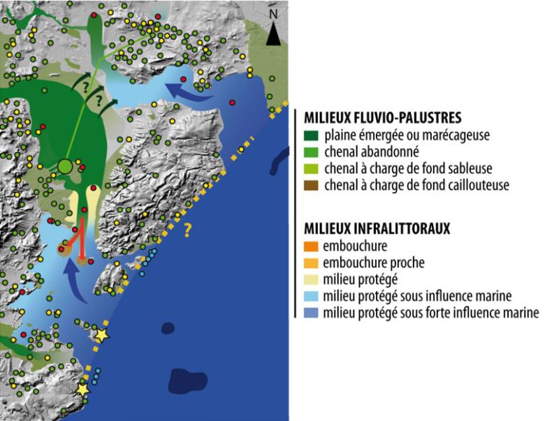
The spatial distribution of soil and groundwater salinity was mapped over the entire study area. A geochemical study revealed that the salt originated from brackish water infiltration. Discussions with UM3 archaeologists have confirmed the presence of salt works in the Middle Ages. The plain was subsequently drained and gradually desalinated by means of a system of waterways and by diverting a large amount of water from the Aude, particularly for agricultural purposes.
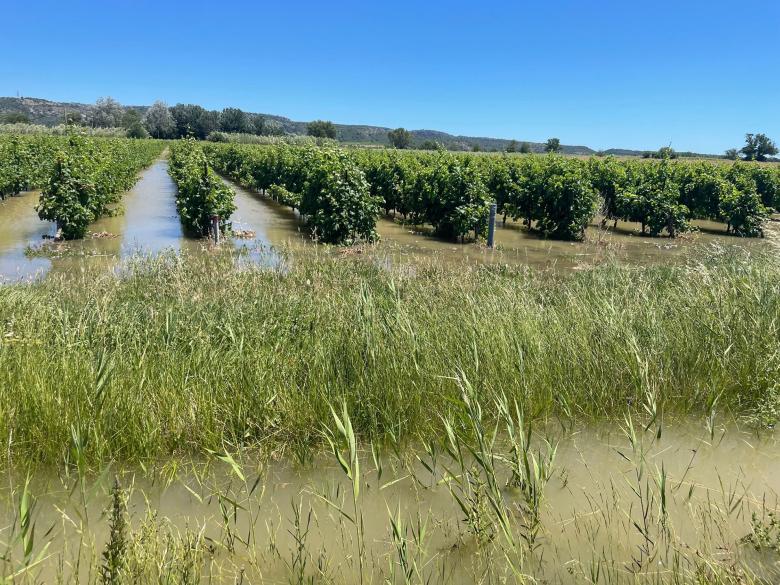
Today, plants can thrive despite the salt as a result of the large influx of fresh water during flooding. This influx reduces the osmotic stress suffered by plants. Replenishment of the water system (through rainfall, agricultural replenishment and flooding of the Aude) currently means that a lenticular freshwater aquifer can be maintained, which is beneficial to plants.

The scientific results of the SALIN project will now be used to support local stakeholders in taking steps to help the area adapt to the increasing scarcity of water resources. At the end of the project, it became clear that more consideration and knowledge would be needed to carry out these adaptations. In this context, a follow-up to the project is planned.
Using the results
Against a backdrop of climate change associated with a growing scarcity of water resources and the implementation of a Water Resource Management Plan (PGRE) aimed at reducing water abstraction from the Aude, the Narbonne plain will inevitably be managed and developed in a different way, taking into account the characteristics of the different sectors. The southern part of the plain close to the lagoons is highly vulnerable to climate change (rising sea levels). In the upstream areas, natural and anthropogenic recharge (and hence the water available for agriculture) is set to decline over the coming decades, seriously affecting plants in the saltiest areas. In future it will therefore be necessary to adapt practices in these areas of high agricultural and environmental economic value.
Partners
- Narbonnaise en Méditerranée Regional Nature Park
- Grand Narbonne Urban Community
- Agro Institute in Montpellier
- Occitania Region
- Rhône-Méditerranée-Corse Water Agency


