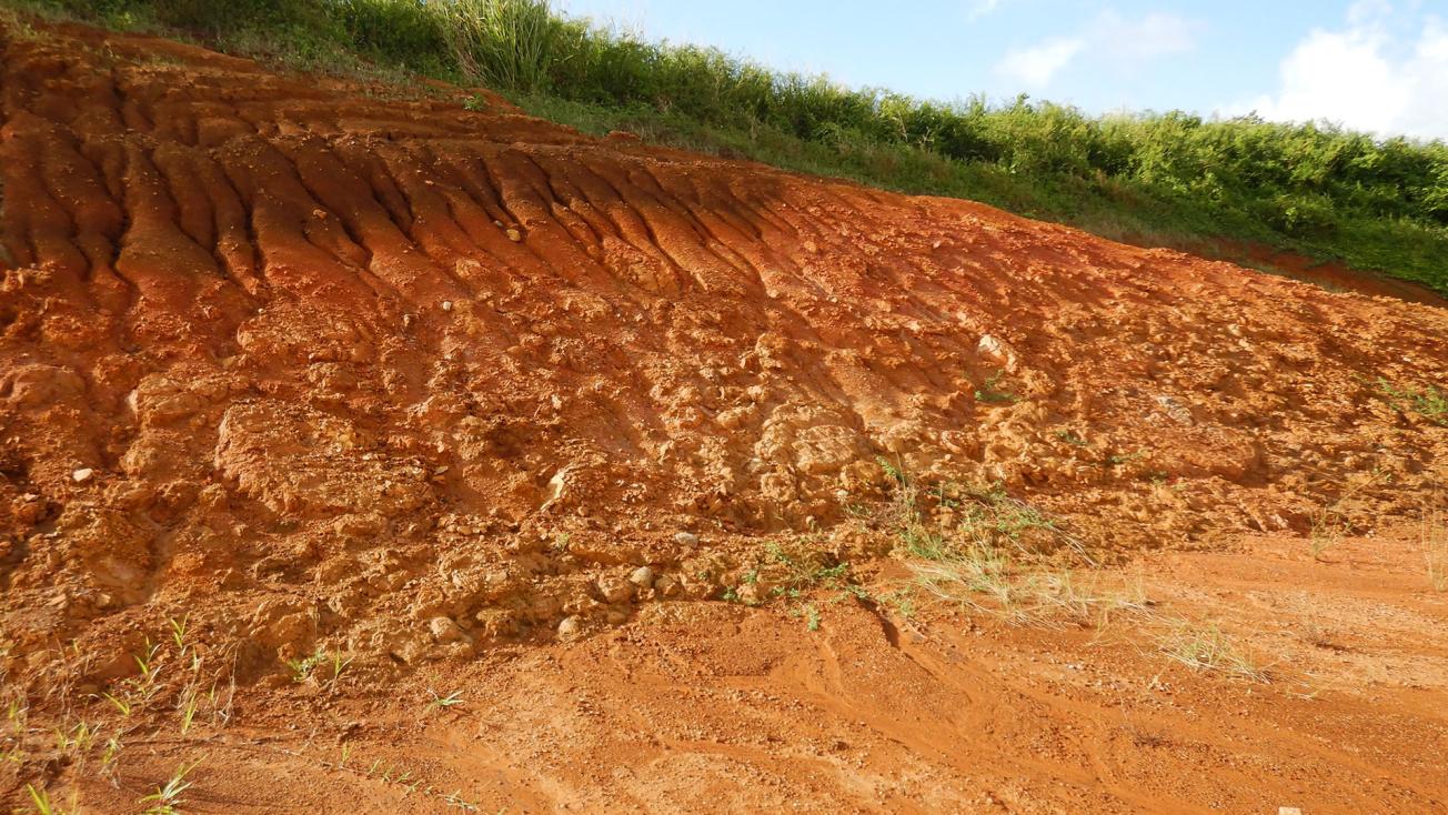
Profile of weathering of conglomerate deposits (Sainte-Marie, 2019).
© BRGM
The need
The territory of Martinique is particularly vulnerable to landslides due to increasingly intense climatic conditions in a geological context that is particularly affected by surface processes that the 1/50,000 geological map does not reveal. However, new concepts and methodologies developed in recent years now make it possible to characterise surface geological formations with precise resolution and to map them in a way that meets users' needs.

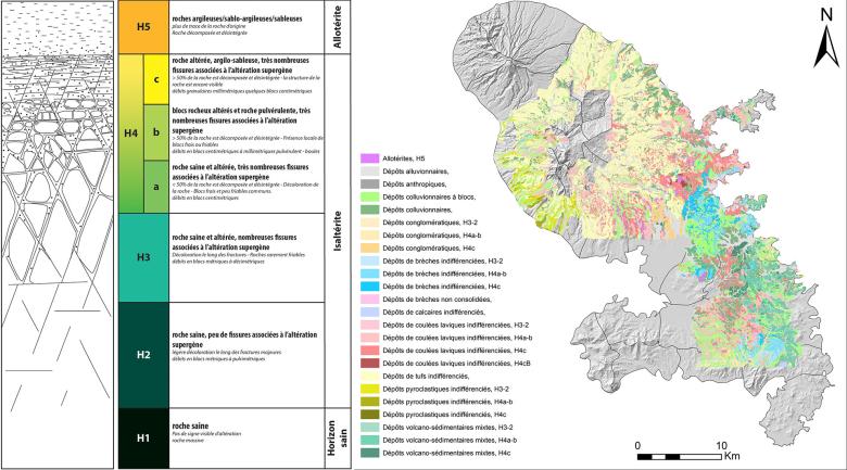
Description of a typical weathering profile and extract from the 1:25,000 map of surface formations of Martinique.
© BRGM
The results
BRGM has produced a 1:25,000 scale map of the surface geology of Martinique covering just over 650 km², i.e. around 60% of the territory. Drawn up through a combination of geology (field acquisitions) and geophysics (interpretation of helicopter-borne electromagnetic data), this precise map, adapted to users’ needs, describes in particular:
- the lithological nature of the outcropping rocks (slope formations, alluvial formations, undifferentiated breccia deposits, undifferentiated lava flow deposits, undifferentiated tuff deposits, etc.);
- the degree of weathering of the rocks is grouped in fine into four categories, corresponding to the levels mobilised by the major types of ground movement identified: the predominantly rocky parts [healthy horizon (H1) and overlying fissured horizons (H2 and H3)], the transition zone (H4a and H4b) and finally the loose horizons (H4c and H5 for alloterite).
The map is accompanied by a database listing over 5,000 outcrops and 18,000 photos.
Using the results
The map of surface geological formations is an essential knowledge base for risk experts, hydrogeologists and those in other geoscience disciplines. It is already being used for updating the landslide hazard map for Martinique. It enables geological knowledge to be improved and clarified so that the various uses of the subsurface can be optimised.
The partners
- Martinique Regional Directorate for Environment, Planning and Housing (DEAL)


