Your challenges and needs
There are large areas where the bedrock is very close to the surface, and the groundwater found there plays a significant role in the rural and economic development of the area concerned. This is all the more true in arid or semi-arid environments where there is little surface water to be drawn on.
Understanding the origins, geometry, hydraulic properties and behaviour of bedrock aquifers allows us to develop their potential. It has been demonstrated that the process of weathering transforms the properties of rocks, making them highly variable through the creation of 'random' cracks that make them permeable. Moreover, weathered rocks are more porous than parent rock and therefore have significant groundwater retention capacities.
The highly variable properties of these aquifers mean that specific prospecting and analysis methods are required to assess the capacity of these formations to supply water. The aim is to improve knowledge of the structure and hydrogeological functioning of these rocks, while ensuring the sustainable management of the aquifers.
Our added value
In response to the difficulties encountered in accessing and using this limited and sometimes overexploited resource, BRGM has developed comprehensive approaches for studying hydrogeological systems in bedrock environments. It implements methods and tools to exploit and manage the resource sustainably at the catchment basin level. Its interdisciplinary experts take into account the specific characteristics of your projects, in France or abroad, in order to:
- Optimise exploration operations and resource characterisation through:
- The use of techniques and methods to identify the best location for wells to improve the viability rate in terms of exploitable output;
- The characterisation and mapping of bedrock aquifer weathering profiles and their hydrodynamic properties (porosity, permeability, etc.);
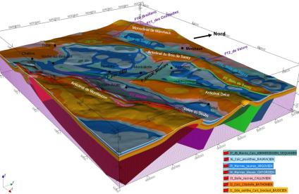
- The mapping of groundwater stocks and their exploitation potential at different scales;
- Geophysical prospecting devoted to hydrogeology in bedrock environments;
- The detection of fractured zones through the measurement of natural radon emissions.
- Optimise the management of the resources and their exploitation through:
- The analysis of linear features (structural alignment) using aerial photography and satellite images;
- The interpretation of hydraulic tests in fractured environments drawing on methods used in the oil industry;
- The assessment of the relationships between water tables and rivers;
- The hydrogeological review of groundwater flows, and notably the assessment of the natural recharge of aquifers;
- The development of predictive models to assess changes in the water tables over the medium (seasonal variation) and long term (climate change) so as to optimise the management of the resources.
Technical and digital facilities
- Groundwater observatory for bedrock aquifers in India
- French BRGM reference system on hydrogeological entities (BDLISA)
- OUAIP software: methods for assessing and interpreting pumping tests in fractured rock environments
- ESPERE application for calculating effective rainfall and aquifer recharge
- GARDENIA application for modelling the overall hydrology of a catchment basin
A few references
- Exploration for groundwater resources in bedrock aquifers in Brittany, Limousin, Lozère and the Vosges (RAPSODI project, BRGM/RP-56749-FR report);
- Mapping of Burundi's groundwater potential (Report);
- Hydrogeological map of France at a scale of 1:1,000,000 to locate aquifer-bearing geological formations;
- Drinking water supply for river-side villages in French Guiana (BRGM/RR-39192-FR report);
- Prediction of water inflow during the construction of a tunnel through a mountain range.
For more information
Research projects on hydrogeology in bedrock areas in West Africa and India, resulting in numerous publications, including:
- Maréchal, J.C., Dewandel, B. & Subrahmanyam, K. 2004: Use of hydraulic tests at different scales to characterize fracture network properties in the weathered-fractured layer of a hard rock aquifer, Water Resources Research, 40, 11;
- Dewandel B, Lachassagne P, Wyns R, Maréchal JC, Krishnamurthy NS (2006) A generalized 3-D geological and hydrogeological conceptual model of granite aquifers controlled by single or multiphase weathering. Journal of Hydrology 330 (1-2): 260-284.)
References
Solutions


