The need
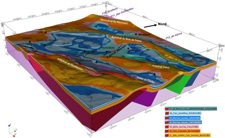
To offset the risk of water shortages in the Greater Besançon area, two boreholes were drilled in 2006 into the Jurassic deep karst limestone aquifer in the commune of Novillars to supply drinking water. The geological structure of the subsurface determines the circulation of deep water and consequently the way in which this water can be used and protected. BRGM was asked to resolve uncertainties about the geometry of the aquifer and the presence or absence of major faults, and implemented a three-stage programme: (1) construction of a 3D geological model from the available data in order to determine the best places for the seismic acquisition, (2) acquisition of two seismic reflection profiles totalling 6 km to generate an image of the limestone structure and (3) updating of the 3D geological model using the new data acquired.
The results
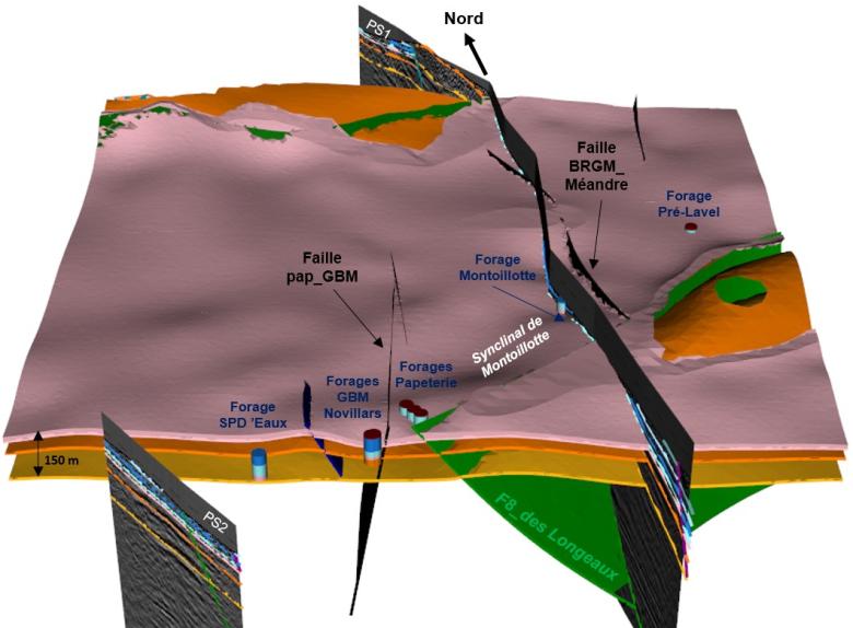
The contribution of seismic imagery to the 3D model has proved decisive in clarifying the extension, orientation, dip and displacement vector of known faults. This visualisation also revealed two completely new structures:
- A synclinal form of Jurassic limestone directly beneath the Montoillotte borehole;
- A North-South fault, known as the "Faille du Méandre".
The presence of a North-South fracture, that is probably more developed than it appears in the Novillars sector, has been confirmed by new geological observations in the field. It partitions and shifts the karst aquifer of Jurassic limestone on either side of these faults at depth, thus having a major effect in canalising the circulation of the water exploited at Novillars.

The study carried out by BRGM gives us a better understanding of our resource, which is the least sensitive to climate hazards. The results, delivered at the end of 2021, represent a crucial intermediate stage in understanding the aquifer and how to protect it, as well as for conducting future studies, steered by our scientific committee. In view of climate change, if our other water resources run out, we will be able to rely on this precious and reliable source.

Structuring of the Jurassic limestone aquifer exploited at Novillars (extract from BRGM GeoModeller software), 2022.
© BRGM
Using the results
The results of the study have improved established knowledge of the hydrogeological functioning of the karst Jurassic limestone aquifer. The 3D geological model enhanced characterisation of the catchment points of Novillars in order to improve their protection, but also to guide the siting of new catchment points if necessary. The geological model can also be exported to other hydrogeological modelling software (hydrodynamic, geochemical, etc.).
The partners
- Grand Besançon Métropole


