In order to improve the management of the region's groundwater, BRGM and the Departmental Councils of the Dordogne, Lot-et-Garonne, Lot and Charente – supported by the Nouvelle-Aquitaine Regional Council via the ERDF (European Regional Development Fund) and the Adour-Garonne water agency – are launching a hydrogeological research programme that will last several years.
In these four departments, more than half of all the water consumed by the local population, farmers and industry comes from groundwater. Groundwater also contributes enormously to maintaining the levels of local streams and rivers. However, this resource can sometimes become seriously depleted in certain areas or at certain times, and the situation is likely to get worse due to climate change. To avoid future conflicts over use and improve the management of this resource, the various local authorities concerned have decided to launch a vast research programme, managed by BRGM.
A campaign of heli-borne geophysical surveys across the 4 départements involved in the project
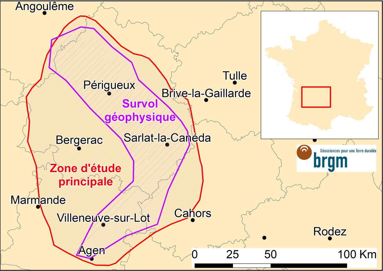
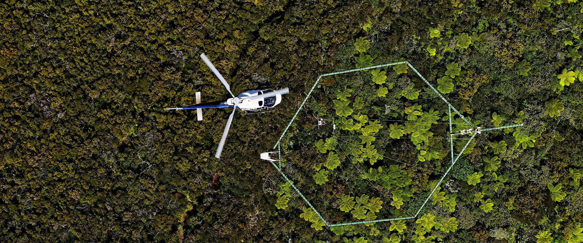
The project, baptised Eaux-SCARS, is scheduled to last six years. The first stage will involve the airborne acquisition of geophysical data. Over the course of two weeks (provisional schedule) starting on 6 September 2020, a helicopter, chartered by the Danish service provider SkyTEM, will fly over the north-eastern section of the Aquitaine Basin taking measurements. It will cover an arc-shaped strip that is 40 km wide and almost 200 km long, stretching from the south of Angoulême (Charente) in the north through the central sectors of Périgueux and Sarlat (Dordogne) to Agen (Lot-et-Garonne) in the south. It will carry a 20-metre-diameter antenna, designed for remote sensing of the subsurface. The aim of this heli-borne survey is to identify electrical resistivity contrasts in the rocks. The data obtained will enable geophysicists to determine the contours of the different geological layers and to better outline the groundwater tables, up to a depth of approximately 400 metres.
Innovative surveys over several years
These data will then be supplemented using modern techniques to reinterpret data from old oil surveys as well as with measurements from deep boreholes. Furthermore, thanks to the surface outcrops of the geological layers identified at depth, geologists will work in the field until 2022, searching for details that will enable them to complete the 3D model produced using these geophysical measurements.
Several other original initiatives are planned throughout the Eaux-SCARS programme in the region. Scientists from BRGM launched a series of groundwater measurement and analysis campaigns last spring. Starting this autumn, they will install instruments in streams, springs and boreholes to study changes in flow rates and groundwater chemistry over the course of several years. At the same time, consultation meetings will be organised with all the stakeholders involved in managing and exploiting the water resources in order to have a shared view and understanding of their current and future needs.
In addition, the drilling of a deep borehole is planned in the Dordogne as of 2022. This will allow core samples to be extracted from the deep geological layers and tests to be carried out to understand the relationships between the various superimposed aquifers.
Several university partners are involved in these surveys: Bordeaux University, Bordeaux INP-ENSEGID, and Paris-Saclay University. It will take several years to have a clear understanding of how these deep aquifers function and are renewed, notably in the context of global warming. At the end of the programme, the partners will have a solid scientific basis on which to build sustainable groundwater development strategies based on local needs and the capacities of the local environment.

Heli-borne geophysical campaign for the Eaux-SCARS project: main study area (red) and flyover area (purple).
© BRGM
One campaign for two projects
The geophysical survey campaign will incorporate the area covered by the Eaux-SCARS project as well as the area covered by another groundwater research programme – called ECORSE 82 – being carried out at the same time in the Tarn-et-Garonne département.
Since the end of the 1990s, the French Geological Survey has launched several airborne geophysical data acquisition campaigns, which have enabled us to acquire more detailed knowledge of France's subsurface. The new techniques developed over the last ten years and the use of helicopters have considerably improved the quality of the data obtained.


