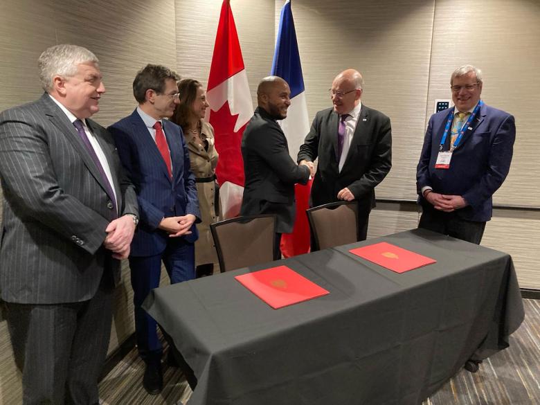
On 5 March 2024, Rinaldo Jeanty, Canada’s Assistant Associate Deputy Minister for Natural Resources, and Christophe Poinssot, BRGM Deputy Director General, signed a partnership agreement between the Canadian and French geological surveys.
© BRGM
BRGM and the Canadian Geological Survey are increasing their collaboration on a number of subjects of common interest, namely mineral resources, energy transition, groundwater management and the impact of climate change.
The agreement between the two organisations was signed on 5 March 2024 by Rinaldo Jeanty, Canada's Assistant Associate Deputy Minister for Natural Resources, and Christophe Poinssot, Deputy Director General, in the presence of Benjamin Gallezot, Inter-ministerial Delegate for the procurement of Strategic Ores and Metals, and French Ambassador Michel Miraillet.
It aims to promote joint research by the two geological surveys, the sharing of scientific and technical information and technology transfer, as well as discussions between scientists and the organisation of workshops and training courses.
Many subjects of common interest
The missions of BRGM and the Canadian Geological Survey have a number of areas of common interest, which are a focus of this partnership:
- Mineral resources: studies on the formation of minerals, including critical and emerging minerals.
- Energy resources: geothermal energy, hydrogen, work related to the energy transition and decarbonisation (in particular the capture, use and storage of CO2).
- Groundwater: data from fundamental research, hydrogeological studies and isotope geochemistry.
- Climate change and natural hazards: flooding, landslides, adapting to and/or mitigating climate change, etc.
- Geoscience data management: development of standards, digital technologies and advanced methods such as artificial intelligence/machine learning, predictive mapping, 3D modelling, digital twinning and quantum computing.


