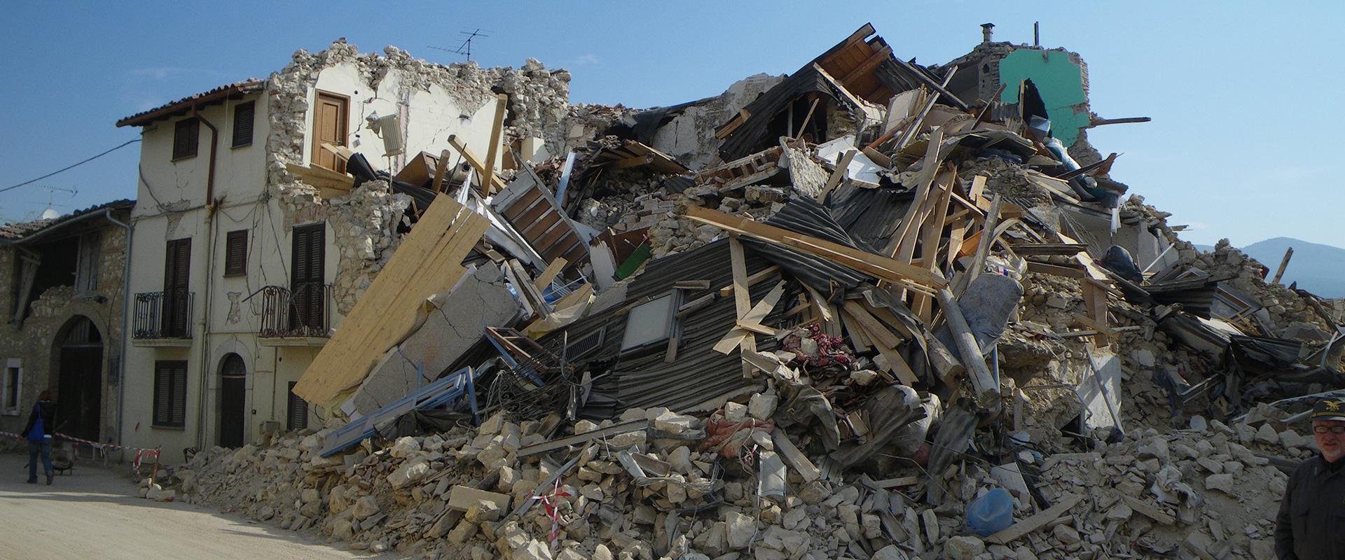
Le Teil in the Ardèche has 8000 inhabitants and was the epicentre of an earthquake. The village experienced high-magnitude seismic activity on 11 November 2019 at 11:52 am: local magnitude 5.4, and moment magnitude 4.9. There were no casualties, but major damage to property. People had to be displaced and the earthquake was felt as far away as Montélimar, some 7 km away (about 40,000 inhabitants).
The village is located on a known fault zone in the Rhone Valley. However, this was an event of rare magnitude in France. The last earthquake of this magnitude dated back to 1967, in Arette in the Bearn foothills of the Pyrenees, with a local magnitude of 5.3.
The earthquake in Le Teil had implications for the Cruas-Meysse nuclear power plant, 14 km away, which was shut down for a month, causing serious concern among the population in the region.
Reassessing earthquake hazards in France
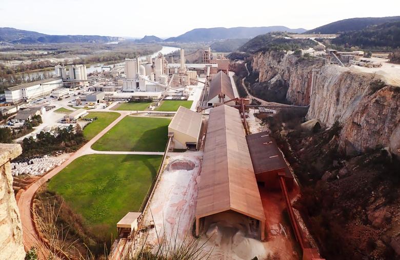
This earthquake was a significant event and most unusual for France. Seismologists immediately began to look into the matter. There is a quarry near the epicentre, which has been worked for a long time by Lafarge Holcim France, and the CNRS very quickly took up the issue. A study carried out in December 2019 by a working group of the French scientific community led by the CNRS concluded that while the earthquake was probably natural and not induced by human activity, the presence of the quarry could nevertheless have been a triggering factor. BRGM, doing joint research with the Lafarge Holcim cement group, has put forward another hypothesis. The results show that the event was triggered by the reactivation of a fault by hydraulic overpressure.
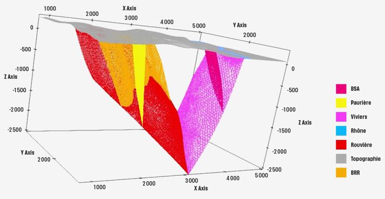
3D view of the fault system around the Le Teil quarry showing the intersection zones at depth. Geological model generated by GeoModeller.
© BRGM - Intrepid Geophysics
A complete 3D geological model of the area
BRGM researchers created mechanical models to take into account the particular configuration of the surface topography, but also the history of the volumes of material excavated by the quarrying operation since 1850 and the geometry of the fault system.
Soil humidity data acquired by the European SMOS satellite and modelling of the variations in height of the unsaturated zone using the BRGM ComPASS code showed that water infiltration affected the recharge, with hydraulic overpressure reaching a maximum precisely at the intersection of the fault system. This is an example of seismic action in the intraplate domain, with the possibility of simultaneous surface fractures on two distinct faults.
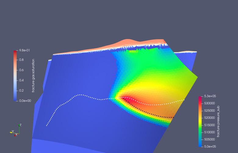
ComPASS code simulation of the hydraulic pressure variations on the La Rouvière fault in the month preceding 11 November 2019.
© BRGM
Hydraulic activation of the earthquake caused by heavy rainfall
The second stage of the work from February to May 2021 confirmed the initial programme and refined the results, in particular locating the area of maximum hydraulic overpressure at the intersection of the fault system.
This research confirmed the BRGM hypothesis: the earthquake could have been triggered hydraulically. BRGM demonstrates that there is of course no reason to dismiss a tectonic origin of the Le Teil earthquake. But it could also have been a tremor triggered by an external event: in this case, the hydraulic load due to a period of heavy rainfall in the month preceding the earthquake.
More broadly, the earthquake not only revealed the need to reassess the hazard in the area, but also reopened a debate on the nature of seismic activity in mainland France in the intraplate domain. BRGM is among the French organisations that collect seismological observations for France, and its role naturally includes this type of work.
This is also a highly original cross-disciplinary project combining geology, geophysics, geomechanics, seismology and hydraulics, and it opens up a new field of research on the subject of intraplate hydroseismicity on a European scale, all in connection with global climate change. Such hydroseismic hypotheses have already been put forward in the United States in the last 20 years. They have now been corroborated here in mainland France.

