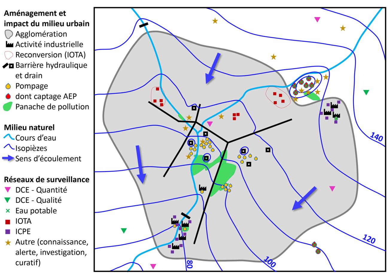
Impacts on groundwater and existing monitoring networks in the urban environment.
© BRGM
The need
There is generally very little knowledge of groundwater in urban areas, which poses many difficulties, particularly for the study of polluted sites and soils. To overcome these difficulties, new approaches are needed to better understand the complex functioning of groundwater in urban areas. The establishment of piezometric networks beneath urban areas is thus the first step in collecting data on groundwater quality, flow directions and levels. However, the implementation of such networks requires a common methodology at the national level.
The results
As each urban environment is unique, the methodology developed by BRGM will provide the essential guidelines for designing an urban monitoring network. The approach developed as part of this project and tested in the Lyon metropolitan area is divided into successive and complementary stages, so that all the specific features of the urban environment can be taken into account.
Beyond the technical aspects and the heterogeneity of the environment, a permanent network needs to federate stakeholders and to address the multiple problems concerning groundwater in urban environments. The first stage thus involves consulting stakeholders, in order to lay the foundations of the future monitoring network. The next steps consist in characterizing the hydrogeological functioning of the urban subsoil, in all its complexity. By interpreting and cross-referencing the data, developers can then produce a conceptual "source/transfer/target" model. The diagnostic elements are analysed to define the density and location of the monitoring structures and target the measurement programme. The final step is to carry out a regular review in order to optimise the monitoring.
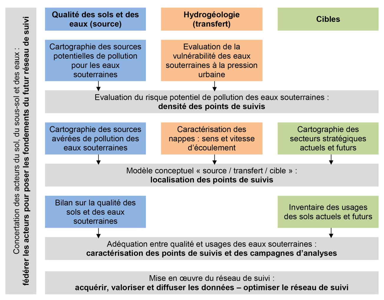
Conceptual model for designing a monitoring network.
© BRGM
Using the results
Setting up a monitoring network for a given area makes it possible to respond to the multiple problems of the urban environment and in particular to:
- have an overall vision of the state of groundwater by tracking changes in quality and level over time and space;
- meet requirements on groundwater quality and levels, in line with groundwater and land use, and particularly to protect vulnerable targets;
- anticipate the occurrence of pollution, characterise the migration of a known plume, assess the cumulative impact of several sources of pollution;
- ensure better protection of sensitive sectors and structures from the point of view of groundwater use.
More generally, the knowledge acquired by BRGM as part of this study will help shape future policies on groundwater management and, more broadly, on subsurface and soil management.
BRGM installed about fifteen piezometers in the city of Lyon to set up a monitoring network and simulate flooding events. With its expertise, we were able to create hydrogeological models. We transfer the data to engineering design firms to meet their needs in certain urban development sectors. These networks allow us to obtain valuable hydrogeological information for our urban development projects.

