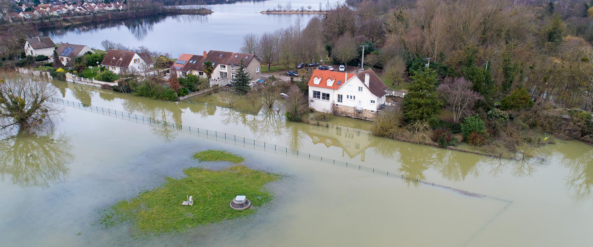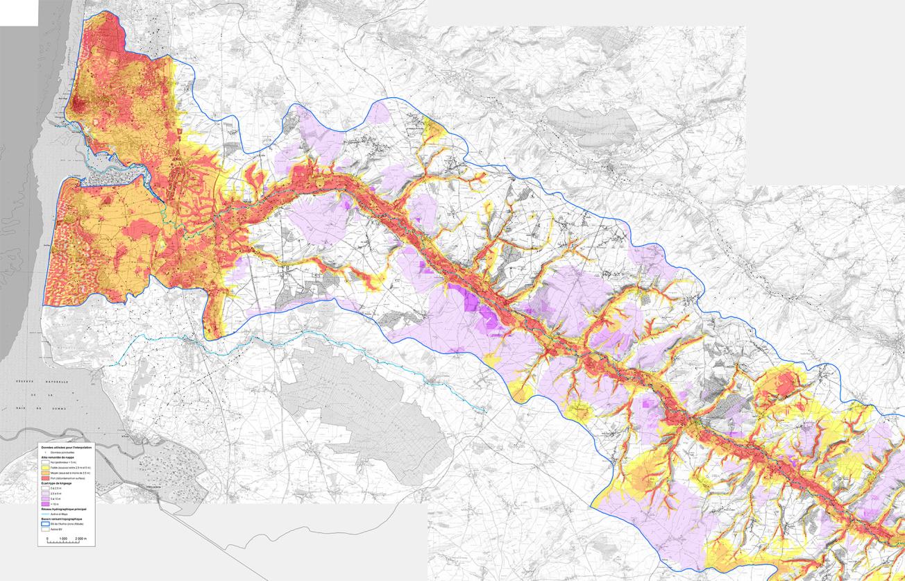
Mapping of rising water tables in the Authie basin.
© BRGM
The needs
Since 1 January 2018, associations of local authorities have taken over the responsibility for managing aquatic environments and flood prevention (Gemapi) and can now ensure the required continuity between water management and flood prevention.
In view of the issues at stake and the work already done in recent years on the various aspects of groundwater flooding risks, the State and its operators have identified a number of needs and asked BRGM to support departments of the State and local authorities in the following areas:
- methodological support and provision of technical expertise to departments of the State (development or revision of flood risk prevention plans (PPRi) and drawing up flood prevention action programmes (PAPI)) and to the bodies responsible for implementing such programmes;
- identifying and characterising the risk of flooding due to rising water tables;
- producing local maps of sensitivity to rising water tables.
The results
BRGM's work has improved the national map of sensitivity to rising water tables in certain areas, depending on the available data and various issues (Thève basin, Alsace alluvial water table, Arcachon basin, middle and upper Seine, etc.). Preliminary feasibility studies for risk prevention plans are also in progress or planned (Authie basin, Croult Petit Rosne basin, Thérain valley, Chiers basin, etc.).
Finally, methodological guidelines for the production of local sensitivity maps (except in karstic and urban contexts) have been produced. The methodology detailed in these guidelines, submitted to a committee of experts and approved by the Risk Prevention Directorate General (DGPR), prescribes the following steps:
- Step 1: Analysing the hydrogeological context and preparing the dataset;
- Step 1a: Using and processing satellite imagery (optional);
- Step 2: Estimating the maximum piezometric level;
- Step 3: Geostatistical analysis and interpolation of the piezometric surface;
- Step 4: Producing a map of sensitivity to rising water tables.
Determination of the resolution scale of the final map depends on the resolution scales of the digital terrain model and the interpolated maximum piezometric surface grid. Sensitivity classes should be adapted to the quality of the results obtained in the study area. For example, for the Authie catchment area, the recommended scale for use is 1:50,000 or even 1:25,000 in sectors with the least uncertainties and a map has been proposed of areas sensitive to rising water table flooding, with four sensitivity classes depending on the depth of the water table in a very high water situation:
- Highly sensitive areas (mapped in red): water table above ground level;
- Sensitive areas (mapped in orange): water table between 0 and 2.5 m deep;
- Low sensitivity areas (mapped in yellow): water table between 2.5 and 5 m deep;
- Non-sensitive areas or areas with no overflow (mapped in white): water table more than 5 m deep.
Using the results
On the basis of a precise diagnosis on the scale of the area studied, the local-scale maps can be used to determine the areas most sensitive to rising water table flood risks, to help identify the Territoires à Risques importants d'Inondation (TRI) (areas at substantial risk of flooding) and to analyse the relevance of prescribing an interdepartmental Natural Risk Prevention Plan for the municipalities most affected by flooding due to rising water tables.
These maps can also help establish where to install indicator piezometers for prevention of flooding due to rising water tables in the event of an intense and extreme weather event. The reliable points located in the red areas could be equipped with a real time warning system and the models based on these piezometers would provide forecasts on different time scales (weekly, monthly, seasonal) according to the climate scenario envisaged.
The limits to the application of the methodology are set out in the guidelines, in particular for certain hydrogeological contexts (karst, impermeable areas) and specific sectors (large urban or highly industrialised sectors and post-mining sectors).
The partners
- DGPR
- CEREMA
- DREAL, DDT
Public reports
-
Establishing a methodology for mapping the risk of flooding due to rising water tables - Application to the Alsace water table south of Strasbourg. Final report
-
Mapping sensitivity to rising water tables in the Upper And Middle Seine river basins. Final report
-
Methodological guidelines for preparing maps of local sensitivity to rising water tables. Final report

