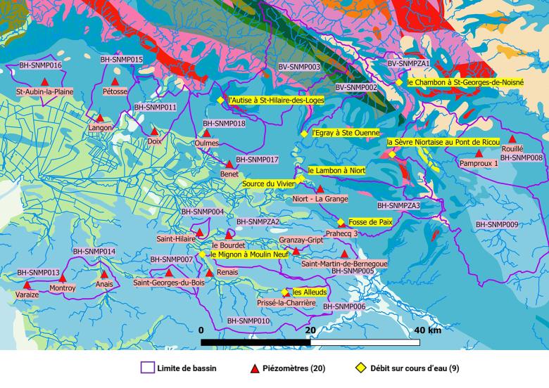
A simplified geological map showing the basins and monitoring points (20 piezometers and 9 flow measurement stations) which were modelled using GARDENIA.
© BRGM
The need
In order to update the SAGE (water management plan) for the Sèvre Niortaise Marais Poitevin area, the Interdepartmental Institution of the Sèvre Niortaise Basin (IIBSN) decided to carry out a "Hydrology, Environments, Uses, Climate" (HMUC) study, as recommended by the Loire Bretagne SDAGE (Blueprint for Water Development and Management). The "Hydrology" component of the study was carried out by BRGM. The objectives were the following:
- to reconstruct the "natural" hydrological regimes (not influenced by anthropogenic actions) at different measuring stations;
- to assess the impact of climate change on certain catchment basins (with significant importance in terms of drinking water supply), which are representative of the type of situations encountered in the area concerned by the SAGE.
The results
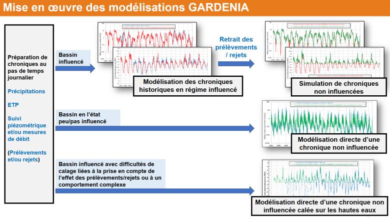
Based on sequences of meteorological data, BRGM used the GARDENIA model (Global Reservoir Model for the simulation of flows and aquifers) to simulate flow rates at the outlets of watercourses and/or the changes in piezometric levels, while taking into account the effects of withdrawals and discharges.
The model helped improve our understanding of how each basin functions. The studies notably underlined:
- the importance of having high-quality data about withdrawals (volumes, but also detailed information about distribution over time);
- the notable impact on the structures for monitoring changes in withdrawal patterns (abandonment or creation of structures, commissioning of replacement reservoirs);
- the role of the piezometers on the edges of rivers or marshes which, although they are useful in terms of characterising flow reversals or when flows dry up, do not provide a representative picture of the state of aquifer recharge;
- the impact of climate change on decreasing aquifer levels and river flows and the date at which the lowest water levels are reached.

Principles concerning the implementation of GARDENIA modelling - Extract from the presentation of the results of the study to the steering committee on 14 September 2021.
© BRGM
Using the results
After completing the simulation studies and analysing the results, a summary sheet was produced for each of the basins concerned. The results provide a reference base for the overall studies being conducted by the IIBSN. They notably show the maximum quantities of water that the catchment basins can provide without any withdrawals, and the volumes that can be withdraw in relation to this.
The partners
- Institution Interdépartementale du Bassin de la Sèvre Niortaise (IIBSN [Interdepartmental Institution of the Sèvre Niortaise Basin])
- Etablissement Public du Marais Poitevin (EPMP [Public Establishment of the Poitevin Marsh area])
- Agence de l’Eau Loire-Bretagne (Loire-Brittany Water Agency)


