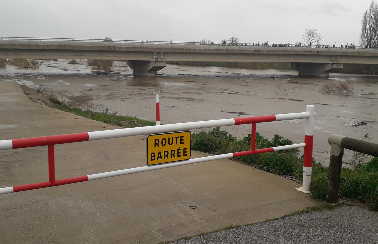
Water level of the Agly under the RD900 departmental road on 22 January 2020 at 2pm.
© Syndicat Mixte du Bassin Versant de l’Arly (SMBVA)
The need
For many years, the forecasters at the Méditerranée Ouest Flood Forecasting Department (SPC Med Ouest), in charge of the regulated section of the Agly, have been facing difficulties in forecasting floods. This is due to the large Corbières karst in the Agly catchment area, which has a major effect on the flow rate of the river. Depending on how full it is, it can either attenuate floods (high storage capacity) or, on the contrary, amplify them due to very rapid underground circulation downstream.
Accordingly, the aim of this project, carried out in partnership with the Syndicat Mixte du Bassin Versant de l'Agly (SMBVA), was to create a tool that can take the filling of the karst aquifer into account in order to determine the required alert level during flood periods at the Rivesaltes station (surface area of the Agly catchment area at Rivesaltes of the order of 1000 km²).

During the project, the model and the tool were tested in real time during storm Gloria (20-22 January 2020), which caused extensive damage in the area. The forecasts provided by the chart and the model the day before the event proved to be in line with the field observations (red alert). This real-time forecasting was very useful during this crisis period and improved our forecasting to the maximum, particularly in carrying out the monitoring procedures on the Agly sea embankments. Since this "extreme" weather event, the tool has been consulted systematically and we are satisfied with the way it has begun to be used.
The results
To meet this need, following characterisation of the hydrogeological functioning of the Agly catchment area in relation to the Corbières karst, a semi-distributed numerical model with an hourly time step was produced. With the input of rainfall data, it simulates the flow rates in the Agly at four points in the catchment area and the filling level of the karst. The model has been calibrated over a period of ten years and validated on the basis of these last few years. It has proved suitable for flow forecasting, helped particularly by accurate simulation of the level in the karst.
Subsequently, in forecasting mode it provided the data required to compile a chart showing cumulative rainfall and rainfall intensity against flow rate. This chart can easily be used in real time to work out the alert level from the initial level of the karst (continuously monitored Estagel piezometer, CD66 network, BSS code: 10903X0034/PZSTGL) and the predicted rainfall (forecast provided by MétéoFrance).

Vigicrue site during storm Gloria (20 to 22 January 2020) / "Rainfall-Flow Rate" chart for the Agly at Rivesaltes (2020).
© BRGM
Using the results
The structure of the model has been provided to the SPC so that it can be integrated into the real-time SPC simulation tools at a later stage. The SPC currently uses the chart in real time and retrieves the piezometer data daily to determine the alert level on the section. Similarly, the SMBVA uses the tool, particularly during crisis unit periods, to ensure safety for people and property.
The partners
- Syndicat Mixte du Bassin Versant de l'Agly
- Occitania Region
- Pyrénées-Orientales Department
- Europe (ERDF)


