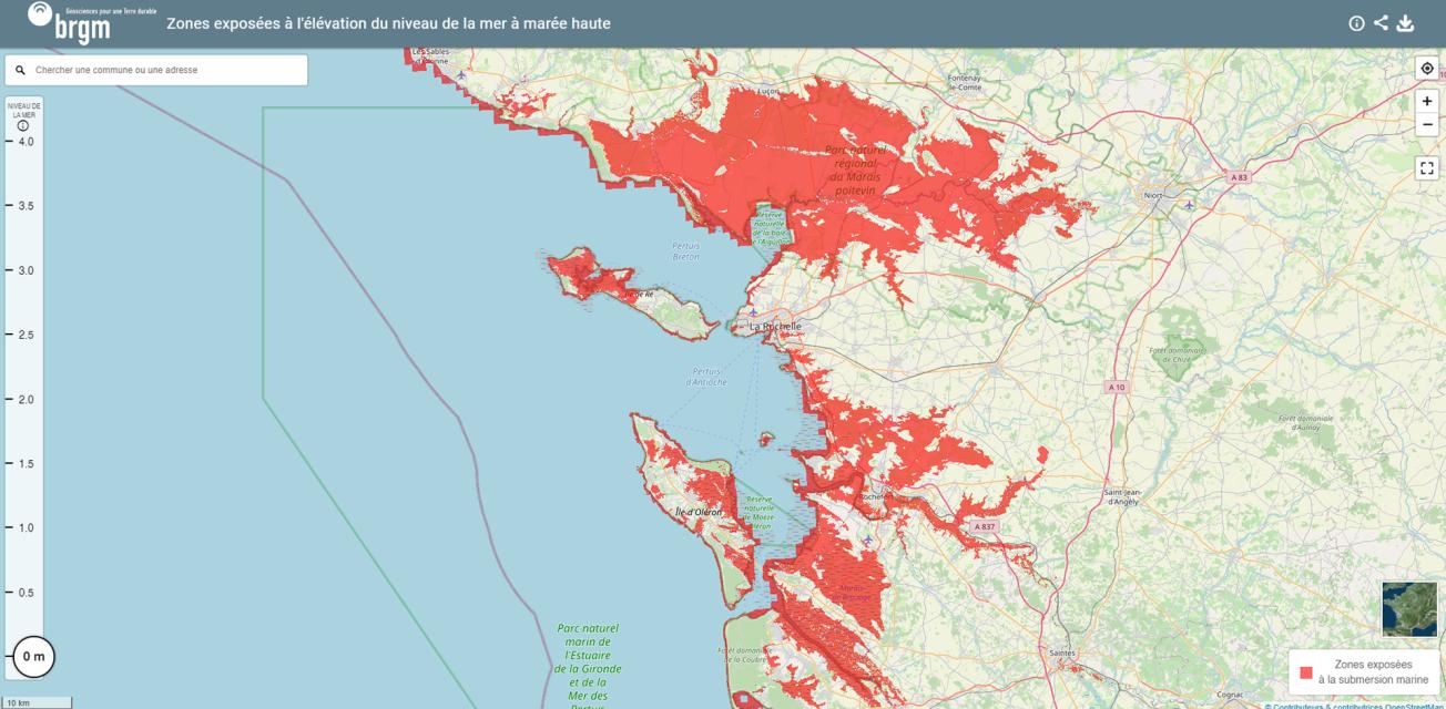
Interactive map of low-lying areas exposed to rising sea levels, published online by BRGM.
© BRGM
Challenges and needs
Rising sea levels are one of the consequence of global warming caused by greenhouse gas emissions from human activities. As pointed out in the 2021 IPCC report, sea levels will continue to rise into the 21st century and beyond. Even if the goals of the 2015 Paris Climate Agreements are met, sea levels will rise by at least 0.30 - 0.60m by 2100, and will continue to rise for centuries to come. The coastal flooding that will result from this rise is therefore a major concern for Europe, as many infrastructures are located close to shorelines or in low-lying areas.
To adapt to these changes, a number of climate services have been set up, including DRIAS in France, which has developed two coastal demonstrators, including the interactive map of low-lying areas exposed to rising sea levels published online by BRGM. This type of coastal demonstrator has been successful in raising awareness of global warming and the need for mitigation by limiting greenhouse gas emissions. However, what is currently lacking is a coastal climate service providing the necessary information to enable authorities to adapt to rising sea levels.

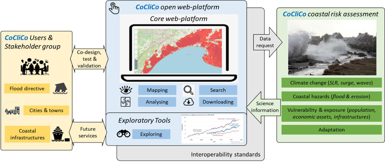
Conceptual diagram of the coastal climate service CoCliCo.
© CoCliCo
Expected results
Launched on 1 September 2021 for a period of four years, CoCliCo (Coastal Climate Core Services) is a European Union project for research and innovation, coordinated by BRGM and co-funded by Horizon 2020. Its purpose is to inform decision-making on coastal risks and adaptation, by providing an open web platform to explore dominant risk factors, by adapting techniques of visualisation and analysis to local decision-making contexts, and combining relevant layers of geospatial information.
Through this platform, users will be able to view, download and analyse multiple decision-oriented coastal-risk scenarios on different spatial scales, using more accurate local data where necessary.
Role of BRGM and its partners
To meet the challenge of developing the platform, the CoCliCo project has brought together European organisations and researchers with proven track records in assessing coastal risks and the impact of rising sea levels, as well as in adaptation, research and cutting-edge technologies for the management of interoperable geospatial data management, decision sciences and risk communication.
For example, BRGM provides expertise in the implementation of infrastructures for managing geospatial information for the assessment of erosion and coastal-flooding hazards against a backdrop of rising sea levels , together with risk assessment.
When the project comes to an end, the services offered by CoCliCo should become part of the Copernicus marine service, through the contribution of its partner Mercator Ocean. The aim is to keep the open character of the platform to allow project partners and third parties to use it for local needs.


