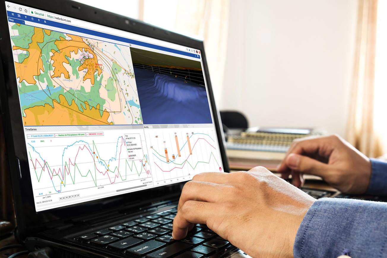
Using the Web-RDS platform to monitor a gas storage facility.
© BRGM
Energy companies routinely store gas in underground reservoirs known as “gas aquifers”, which then become gigantic natural tanks for injecting and extracting gases for energy needs. An example is the natural gas storage site located between the municipalities of Lussagnet and Izaute in south-west France.
This underground reservoir, operated by TEREGA TIGF (Transport et Infrastructures Gaz France), is a geological layer of sand and water lying some 500 metres below the surface. The reservoir “rock” is several dozen metres thick and forms a dome covered by a layer of impermeable clay that prevents gas leakage. The natural gas, when compressed and injected through wells, forces the water out from the sand layer. It is also extracted from the same wells, so that the water then flows back naturally into the sand.
This kind of storage is a good solution to ensure secure supplies for the area, while absorbing variations in demand and peaks in consumption.
A geosurveillance platform
For risk prevention and environmental protection purposes, it is essential to check the integrity of natural reservoirs used for underground storage as they respond to the annual natural gas injection and extraction cycles. Surveillance is also essential to avoid leaks, which would cause losses for the operator, but especially to prevent any degradation of the storage conditions that could raise risks to health or the environment.
This was the reason for the development of an innovative and collaborative approach, combining observation satellites and Web developments to analyse and consult data. The result is a web-based geo-surveillance platform for underground gas storage in a gas aquifer, called the Web-RDS (Web-Reservoir-Deformation-Seismicity). This innovative project, financed by Geostock-Entrepose (an engineering group specialising in underground storage) under a CITEPH programme (consultations for technological innovation in the field of energy), involved Magnitude (a company in the BHGE Group specialising in microseismic monitoring), TEREGA (formerly TIGF, the storage site operator), TRE-ALTAMIRA (a company specialising in radar interferometry), INT (a developer of data display solutions) and the BRGM.
As the BRGM scientists explain, during the study period from October 2014 to April 2017, “our aims with our partners at the Lussagnet and Izaute site were to demonstrate the feasibility of a tool designed to characterise the performance of a reservoir, describe its integrity, periodically assess risks and identify the conditions in which anomalous behaviour may appear”.

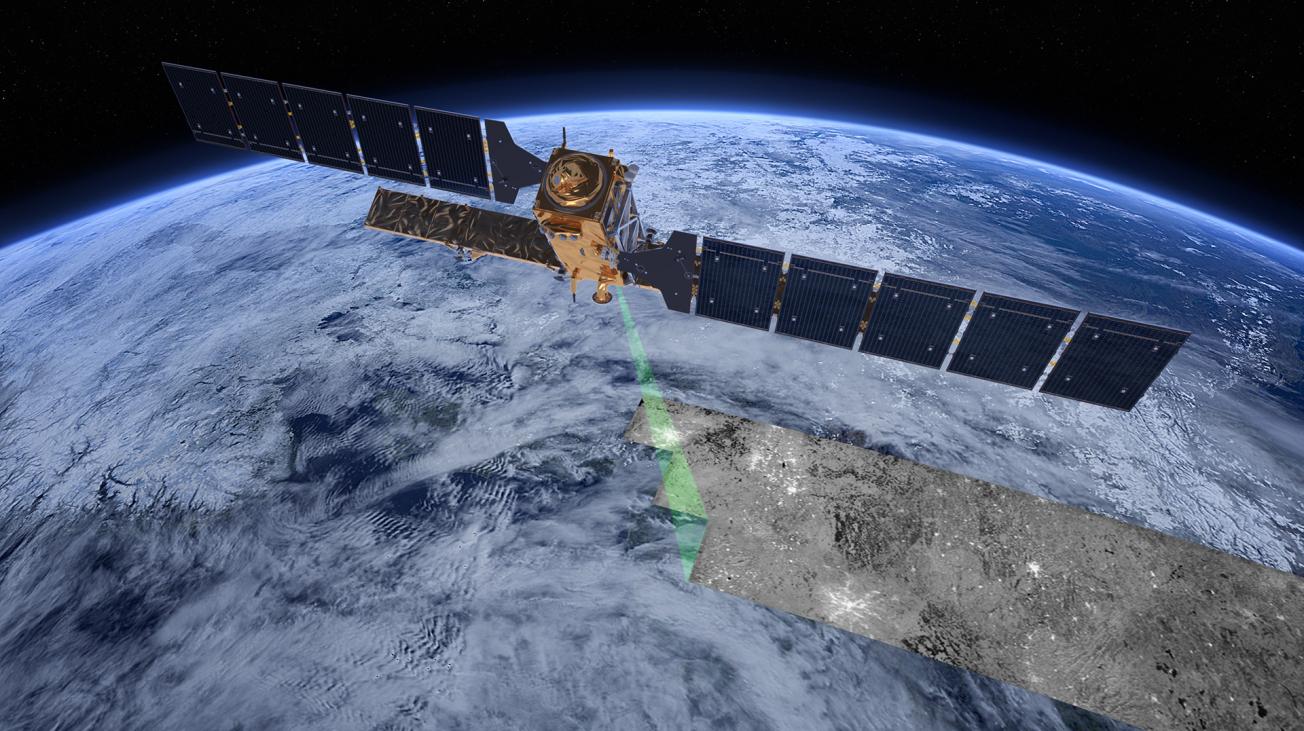
Two European Sentinel 1A/1B satellites measure surface deformations in high resolution over time and space.
© ESA/ATG medialab
Surface deformations ranging from 5 to 10 mm
In practice, the work conducted by the project researchers involved integrating sets of disparate and very heterogeneous surveillance data into a single, open-access Web platform to be used by different players for monitoring, alerting and decision-making purposes: time series acquired by the two Sentinel-1 satellites operated by the European Space Agency (ESA), nano-seismic events, geological information, operational site data, piezometric levels at different depths, etc.
A technique for aggregating, formatting and presenting the information has been developed so that the platform can group together all information concerning the behaviour of the soil and subsoil in response to storage and extraction operations: surface deformation, induced nano-seismicity, geological data and data on operations such as pressure at the bottom of the injection and surveillance wells around the zone.
The new tool was tested over two and half years and the results have demonstrated its efficiency: the very slight seasonal surface deformation observed at Lussagnet and Izaute after gas injection and extraction ranged from 5 to 10 mm, which conforms to the model predictions.
Analysing deformations in detail is a complex process. What are the possible causes of deformation? Is clay soil shrinking and swelling occurring on the surface at the same time as operations at depth? The research team is pursuing its studies, which are essential to better interpretations of surface movements in geological storage zones.


