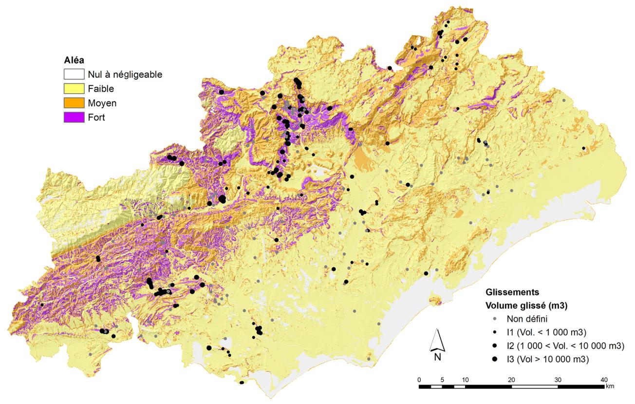
Landslide hazard map.
© BRGM
The needs
The lack of uninterrupted and consistent knowledge of the susceptibility to ground movements in the Hérault départment is an obstacle to preventive action and communication about natural risks and to the proper consideration of these phenomena in public policies on land use. In order to remedy this, the Hérault DDTM asked BRGM to map the department's ground movement hazard.
The results
The analysis methods depend on the type of phenomenon considered and are based on event-based knowledge. In this respect, an inventory of land movements has been compiled in the department. In the end, 805 events were recorded and described. On the basis of these data, the types of ground movement in the area have been identified, which is a basic prerequisite for hazard mapping.
Hazards were then mapped for each phenomenon, on the basis of event data, regional geological knowledge and mapping tools (landslide rupture, propagation of rockfalls on slopes, etc.). Based on field visits and cartographic processing (GIS), the approaches applied are adapted to the available data:
- quantitative analysis based on evidence theory, which is favoured for landslide phenomena;
- pseudo-quantitative approach for rockfalls, based on expert geological knowledge of the grouping of facies with similar behaviour and on statistical data for identifying rupture criteria and their spatial location;
- pseudo-quantitative approach (scoring method), for cavity collapses, based on knowledge of the cavities and associated movements in the past.
The factors integrated include the geology (lithology, stratigraphy and structural context), morphology and land use (land gradient, slope profiles, presence of rocky areas). The intensity of the phenomena is taken into account in the analyses. The "calculated" hazard takes account of the likely occurrence of a reference phenomenon, described by its intensity in particular. The analysis carried out for landslides is more advanced, as several reference scenarios are put forward and subsequently combined to represent the hazard.

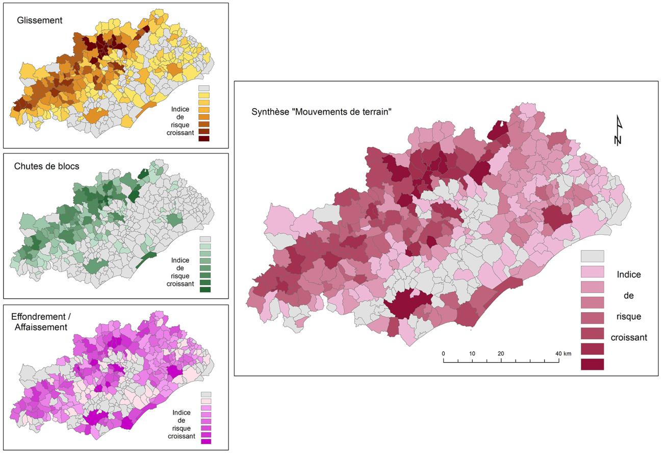
Summary by municipality of the ground movement hazard in the Hérault department.
© BRGM - B. Colas
Using the results
The maps for the various phenomena are on a scale of 1:50,000, which is suitable for providing information for preventive action on a municipal scale. Finally, a preliminary risk analysis is proposed by spatially correlating built-up areas and the identified hazard zones. The results are summarised on a municipal level for each phenomenon and then for all the phenomena taken into consideration. The risk can be ranked on the basis of this analysis at the departmental level and risk areas can be identified. In the long term, this type of approach should serve as a basis for the production of maps on a larger scale to ensure that municipalities receive adequate information.
The partners
- Hérault DDTM


