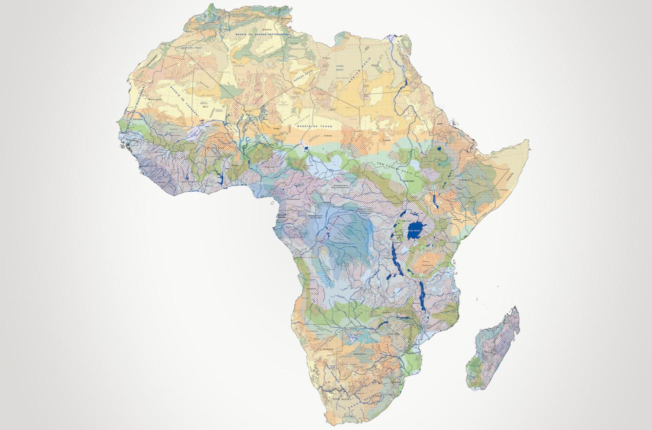
Hydrogeological map of Africa to 1/10 M showing estimated groundwater recharge, from less than 5 mm/year (in yellow) to more than 500 mm/year (in blue).
© BRGM.
Only ten years ago, no digital hydrogeological maps of Africa existed. An initial digital map to the scale of 1:10,000,000, backed up by a Geographic Information System (GIS) was produced in 2003-2005 through “SIG Afrique”, a geological information network involving eleven African countries and the BRGM. In 2008, after a validation workshop with several international experts, the map was published with funding from the French Ministry of Foreign Affairs.
Knowing the aquifer potential of major geological structures in the African continent
As a true hydrogeological map, rather than a map of water resources, it was built up by combining two categories of information (geological data and water recharge indicators) to locate and estimate the scale of water resources in outcropping geological formations. Based on the geology, it therefore identifies reservoirs that are (potentially) aquiferous to a greater or lesser degree, depending on their porosity and climatic zone.
Eleven hydrogeological units were identified and differentiated by their lithostratigraphy, and the recharge zones outlined. The map also shows the boundaries of the major sedimentary basins containing multilayer aquifer systems, deep aquifers with resources that are not, or only minimally, renewable, flow directions from deep captive aquifers, and the main hydrographic basins.

