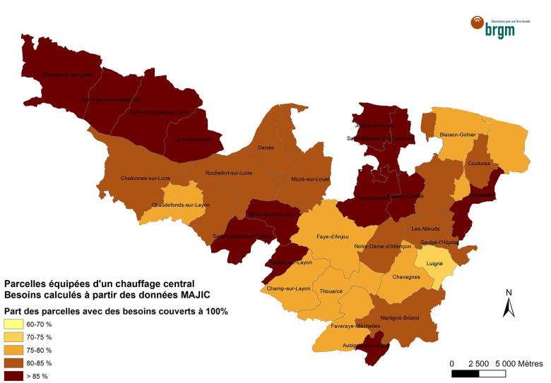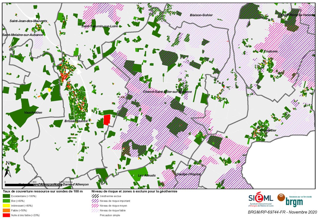
Example of exporting the GIS tool to Charcé-Saint-Ellier-sur-Aubance (49). Atlas of geothermal potential on vertical geothermal probes to a depth of 100 m.
© BRGM
The need
The CCLLA asked the Syndicat intercommunal d’énergies of Maine-et-Loire (SIÉML) and BRGM to study the geothermal energy potential of its territory, especially as a natural resource that can be used for the thermal comfort of buildings or for heating and/or cooling applications in industrial or agricultural processes, either directly or through the use of heat pumps.
The results
The geothermal potential was mapped at the plot scale by innovative cross-referencing of the thermal needs of the buildings above ground with the geothermal resources available in the subsurface: the thermal needs were coupled with thermal simulations specific to the different near-surface geothermal configurations, i.e. vertical geothermal probes (in a vertical geothermal system or VGS), groundwater doublets, and flooded former mine galleries.
For the VGSs, a calculation method was specially developed to estimate, at the plot level, the amount of energy that could be supplied by a heat pump on a permanent basis, taking into account the land available for drilling, the thermal properties of the ground and the amount of heat needed by the building.
The amount of energy that could potentially be extracted from the flooded galleries, in the form of heat production (without air conditioning), was estimated on the basis of the modelling carried out for the study, giving a total potential of 3.8 GWh/year.
The results of the study show that 100% of the needs are covered by near-surface geothermal energy in more than 70% of the region’s plots when the buildings are equipped with a central heating system, and even more than 85% in certain municipalities, thus covering 53% of the region's energy needs (246 GWh/year).
Using the results
A GIS planning tool was developed as part of this project. It allows better use of the subsurface in the context of the energy transition, by precisely quantifying the potential contribution of near-surface geothermal energy in relation to the energy needs of the region. In addition, this GIS, which is interoperable with other resources, can evolve and be enriched, and it can be reproduced in other regions.
This BRGM work was very useful to us because it provides us with accurate data at the plot level and not gridded mean data, and thus constitutes a very practical tool that can be easily used by our energy experts when advising municipalities. The results proved to be very interesting and will help us inform elected officials and technicians in the regions and build a roadmap towards the use of renewable heat.

