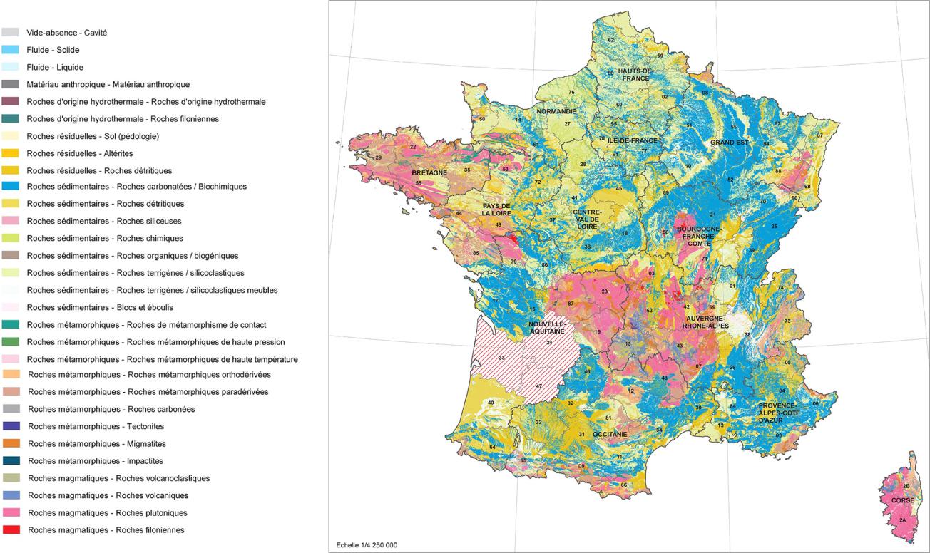
Harmonised lithological map of metropolitan France (levels 1 and 2) at 1:50,000, version 0 (2019).
© BRGM
The need
The lithological map, at a scale of 1:50,000, meets the needs expressed by geologists and, more generally, geoscientists, for homogeneous and strategic information describing the nature of the rock, for use in different thematic applications.
The results
The information available at the level of the départements through so-called "harmonised" geological maps at a scale of 1:50,000, which contain continuous and synthetic lithological information and are already available for most départements in related databases, served as a basis for the work done:
- The work undertaken frees the data from the concept of stratigraphic age: the existing "age" maps are converted into information on the geological and geochemical nature of the rocks, representing the main lithology within a polygon;
- Existing lithological information is preserved but codified according to hierarchical classes, based on a comprehensive,shared lexicon,representing the building block of a vast geological data information system;
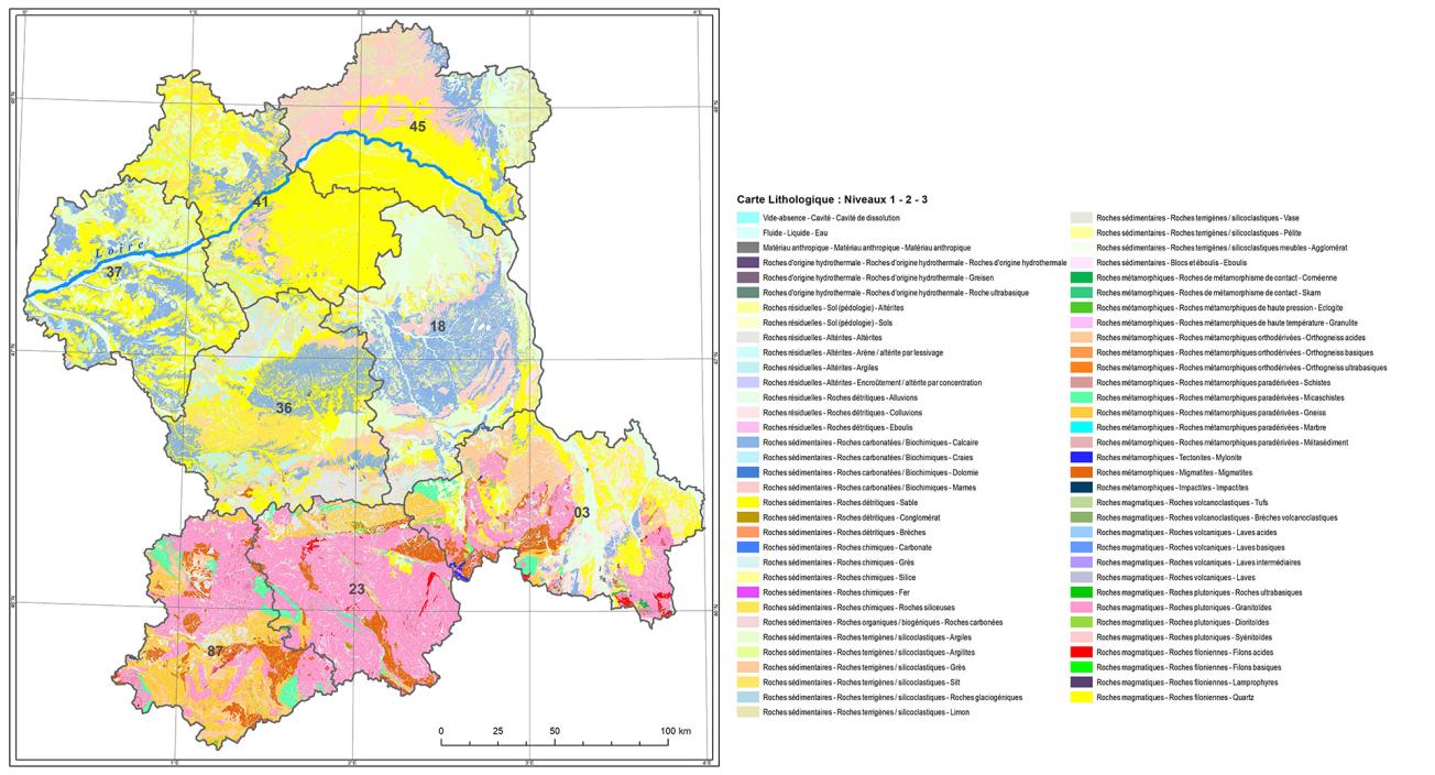
- The initial information is broken down into 3 stages or "levels", which constitute a classification or hierarchy: more than 150 lithological codes are now classified according to 6 level-1 codes, 29 level-2 codes and 113 level-3 codes; and a qualifier preserving the full level of detail of the original information. As an example, a mapped geological formation will be qualified as follows: sedimentary rock (level 1) / terrigenous or siliciclastic rock (level 2) / clays (level 3) / carbonate-bearing rock (qualifiier);
- A specific, structured legend has been created to visually represent the lithological nomenclature (version 0), thus providing a visual hierarchy and a meaningful cartographic rendering;
- The hierarchical database layout allows specific queries according to user needs.
This version 0, which can be improved, was produced at the end of 2019 and will be completed with the finalisation of the geological and lithological harmonisation of the Dordogne, Gironde and Lot-et-Garonne départements, on a scale of 1:50,000, underway in 2020.
Using the results
The improvement of subsurface knowledge, associated with data architecture provides more homogeneous and strategic information at the regional and local levels. Feeding the data into databases facilitates its use both via standardised cartographic documents and for more specialist uses, depending on the different needs encountered: knowledge of water resources, geotechnical characterisation for risk assessment, research into materials for sustainable resource management, etc.
This new product, delivered in the widely used scale of 1:50,000, is version 0, which can be improved. Some questions still remain to be addressed: how to manage map boundaries, how to represent secondary rock types (e.g. continental or coastal deposits, with numerous lateral facies variations), how to take into account evolving geological concepts, etc.
These data, like all geological data on the subsurface, will be made openly available on the InfoTerre portal.

Harmonised lithological map of the Centre region (levels 1, 2 and 3) at 1:50,000, version 0 (2019).
© BRGM


