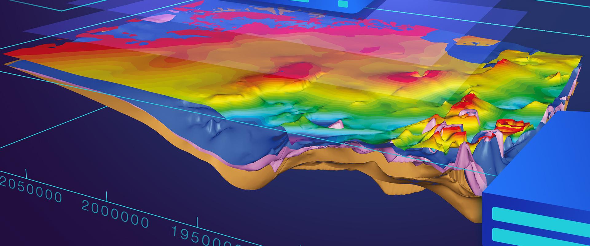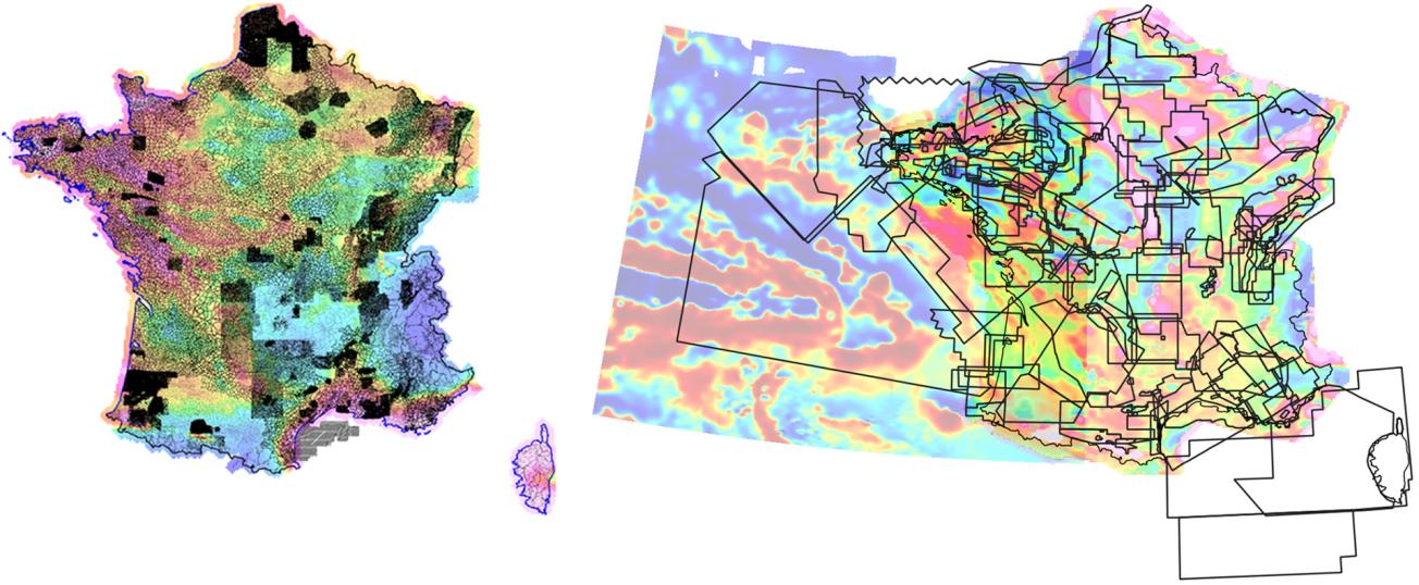
Left: French gravimetric data bank: location of the 430,000 gravimetric stations. Right: Aeromagnetic data base of France: areas covered by the 146 campaigns in mainland France.
© BRGM
The need
There is a specific BRGM project for updating and maintaining geophysical and aero-geophysical databases. The banked data are widely disseminated and used to support many public policy, research or commercial projects.
The results
BRGM currently has the following 4 geophysical databases:
- The French gravimetric bank, which includes more than 430,000 stations, all located in mainland France;
- The aeromagnetic database, which comprises more than 150 campaigns spread over mainland France and the French overseas departments and territories;
- The aero-gamma-spectrometric database, which covers 12 campaigns on the mainland;
- The helicopter-borne electromagnetic database, with data from about ten surveys, mainly located in the French overseas departments and territories.
It should be noted that most of the geophysical databases to date concern airborne methods. The creation of a database to host geophysical data acquired on the ground could be a future objective. No matter how the data are acquired, they are regularly used for applications related to geological knowledge, hydrogeology, knowledge of materials, geothermal energy or even risks.
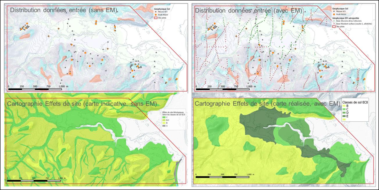
Distribution of input data and maps of lithological site effects around Dembeni, Mayotte (2021).
© BRGM
Using the results
In 2021, the first phase of the Mayotte local seismic hazard mapping project took place. It consisted in setting up a working methodology and studying the feasibility of revising the local seismic hazard map (lithological and topographical site effects and liquefaction hazards).
To do this, the BRGM teams worked together, using the geophysical databases:
- processing and interpretation of aero-electromagnetic (AEM) data;
- carrying out additional geophysical measurements on the ground at the test sites;
- interpreting pre-existing and geophysical data acquired for the project on the ground, and in particular a final interpretation combining all data into a site effects map of the 3 pilot areas.
The project started with an inventory of ground-acquired geophysical data that could be used for the project for Mayotte, concomitantly with a reprocessing of the AEM data in the base in order to obtain the most accurate results. AEM data for mapping lithological site effects has been used to provide 2D or even 3D information on the geometry and/or nature of the target interfaces and to geolocate the information, thus making the mapping of lithological site effects more reliable.

