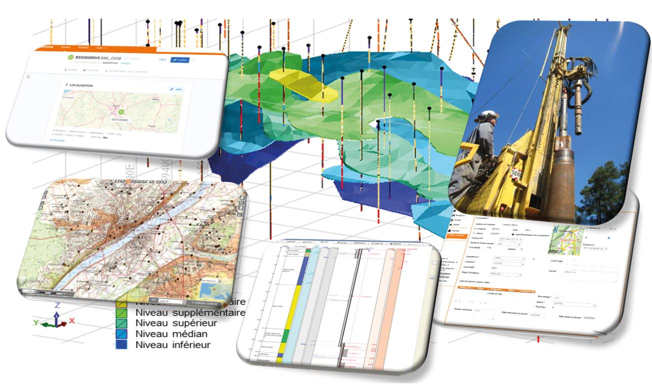
Subsurface Database (BSS), with its input and data-display screens, used to help create models.
© BRGM
The need
These geoscientific and environmental data include the geological and technical descriptions of underground structures (boreholes, probes, wells or excavations, etc.) in France (mainland France and overseas territories), which are listed and saved in the Subsurface Database (BSS), a national database, created in 1941 and permanently updated since 1959.
The information concerning each structure (whether subject to an administrative declaration process or not) is compiled in files that are archived by each BRGM Regional Division, concerning the area under their responsibility. At the same time, the data are computerised (in the case of basic data, such as the location of the structure, its purpose, its use, its condition, its beneficiaries, etc.) or digitised (in the case of supplementary data, such as geological or technical sections, hydrogeological or geotechnical information or the localisation map) to ensure that all the files are accessible to the public via BRGM's InfoTerre portal.
The results
The BSS currently contains more than 890,000 files with over three million digitised documents. More than 300,000 people logged in to the InfoTerre viewer in 2020, resulting in the download of more than 2,100 sets of departmental data. Moreover, partnership agreements have also been signed with public organisations and private companies, which provide significant amounts of data to enrich the database (Orano, VNF, FONDASOL, etc.).
At the same time, various other projects, thematic databases and information systems (IS) have been added to complement the geological and technical data already collected. Examples include: the "water" BSS, which is intended to monitor changes in the quality and quantity of groundwater; a website for declaring minimal impact geothermal energy projects online; and the deployment of a one-stop online platform for declaring underground works in certain regions (DUPLOS project).
The BSS is constantly evolving. Several projects will be launched in 2021, including:
- the standardisation of modern lexical terms, in order to ensure consistency among all the interoperable registers put in place by BRGM;
- the implementation of a geotechnical information system to better describe and store information on soil and rock mechanics for civil engineering works;
- the preliminary design of a "Quality BSS" making it possible to qualify works and thereby only retain those whose data are scientifically valuable.
Finally, the data entry and data-storage interface – currently operated via a protected internet connection – will be reviewed and modernised in order to better meet the needs of data managers, and notably specialists in particular thematic fields (geologists, hydrogeologists, geotechnicians, etc.) who are likely to directly select or improve the information already collected.
Using the results
Information from the BSS is used in most geoscience studies in France. The main areas in which BSS data are applied are:
- spatial planning, the environment, site searches and infrastructure routes;
- exploration, exploitation and protection of resources (water, materials, geothermal energy, etc.);
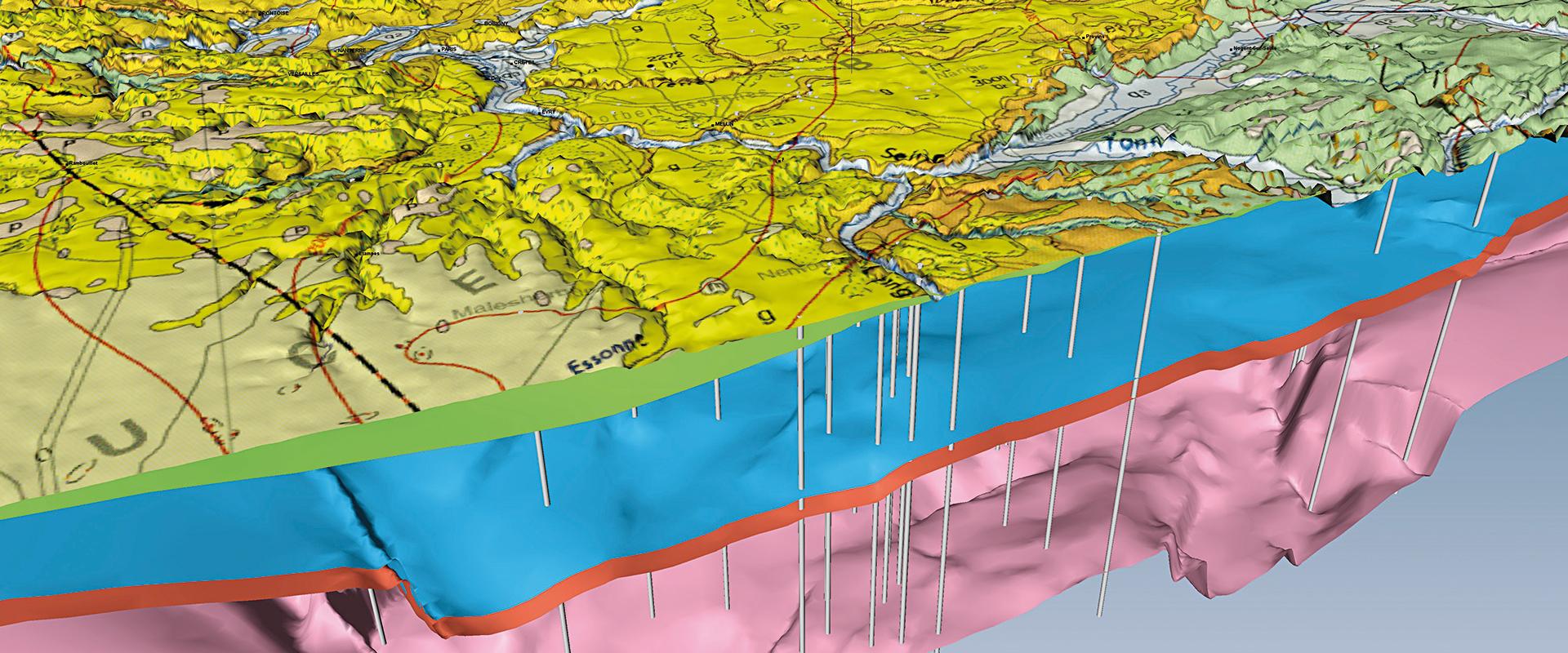
- placing thematic data in their geological context (maps, 2D or 3D models).
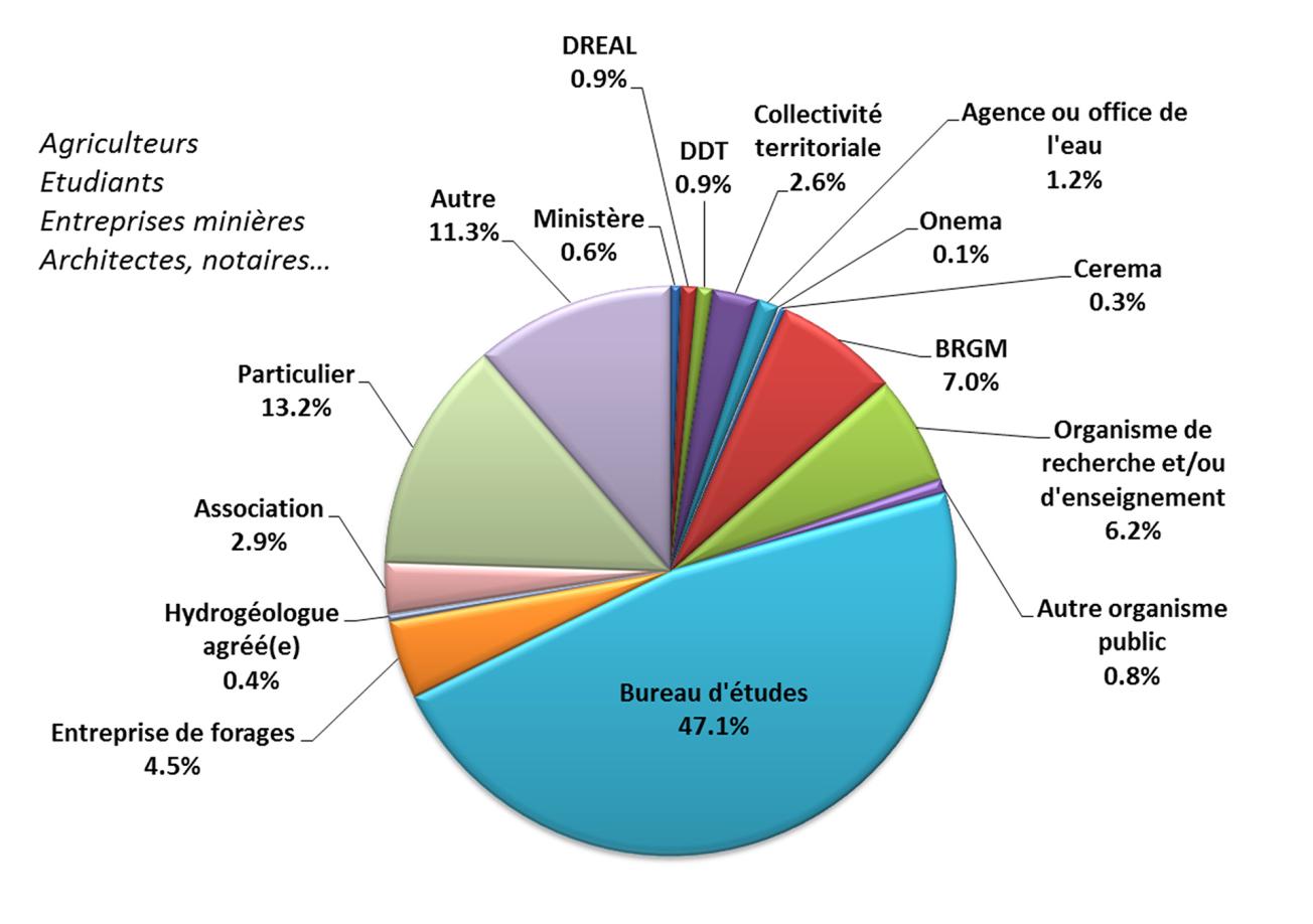
A 2016 survey analysed the breakdown of the different BSS-user profiles and the type of data they used in their professional or personal activities. The percentages were as follows:

Breakdown of the different types of BSS users (2016).
© BRGM


