The need
Before undertaking geothermal projects, the players in the sector, local authorities and project initiators, need information to enable them to identify the sectors of interest and potential targets for new deep geothermal projects. The objective of the project led by BRGM, in line with the work done by BRGM and ADEME to use information on the subsurface for the development of geothermal energy in France and to support the exploration of new deep aquifers, is mainly to promote the use of existing data on low-temperature, deep geothermal resources in mainland France. This will in turn encourage the development of projects and the initiation of applications for authorisation to explore or exploit the resources.
The results
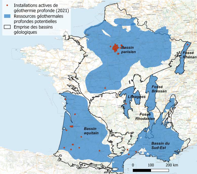
The survey collected data on deep formations and aquifers where the low temperature geothermal resource is more or less known and could potentially be developed. These are formations with temperatures above 30°C and at a depth of several hundred metres. The cartographic data collected come from research work carried out by BRGM or its partners. They are derived from geological modelling and synthesis, thermo-hydrodynamic studies and interpolation of point data (boreholes, seismic lines) on the scale of the region and geological basins throughout mainland France (Paris Basin, Aquitaine Basin, South-East Basin, Rhine, Rhone, Bresse and Limagnes grabens).
Using the results
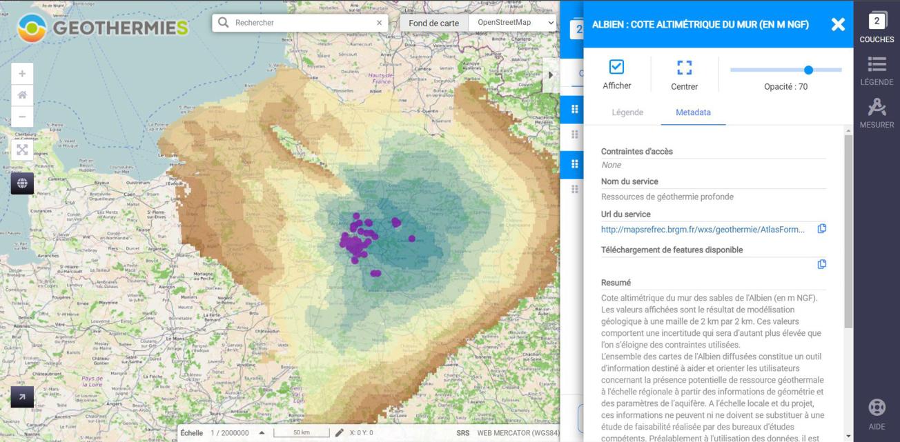
The information collected is intended to be made available to a wide public (in particular geothermal professionals and local authorities) on the map section of the main website on geothermal energy via web services that can be used directly in this section or by means of GIS software. The maps also contain metadata. Since the first quarter of 2022, information on the formations and aquifers targeted for deep geothermal energy in the Paris Basin, the Aquitaine Basin and the South-East Basin has been accessible via the map section. Ultimately, other data will be made available on the site (relating to other basins or acquired via data processing for the production of new maps such as the theoretical potential of formations).

Example of the layers published on the Geothermies website
© BRGM
Public reports
-
Electrical resistivity tomography applied to the installation of boreholes for drinking water on ten sites in Mayotte. Final report
-
Mayotte groundwater prospection and exploitation programme. 6th drilling campaign in Mayotte. Proposals for the location of boreholes. Final report
-
Techno-economic study of exploration methods that can be implemented to reduce the geological hazards of deep geothermal operations in France - Final report
-
GTH REPORT: Assessment of the deep geothermal energy sector for heat production over the period 2007–2018- Final report
-
SYBASE project - System for the recording and monitoring of low-enthalpy geothermal operations in mainland France. Final report


