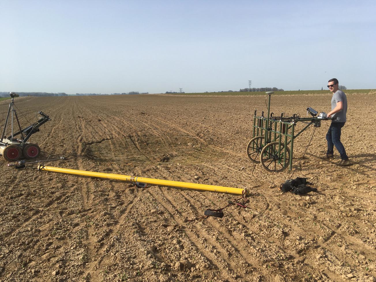
Electromagnetic, magnetic and geological radar equipment for detecting marlpits (Goderville, 2021)
© BRGM - J.-C. Gourry
The need
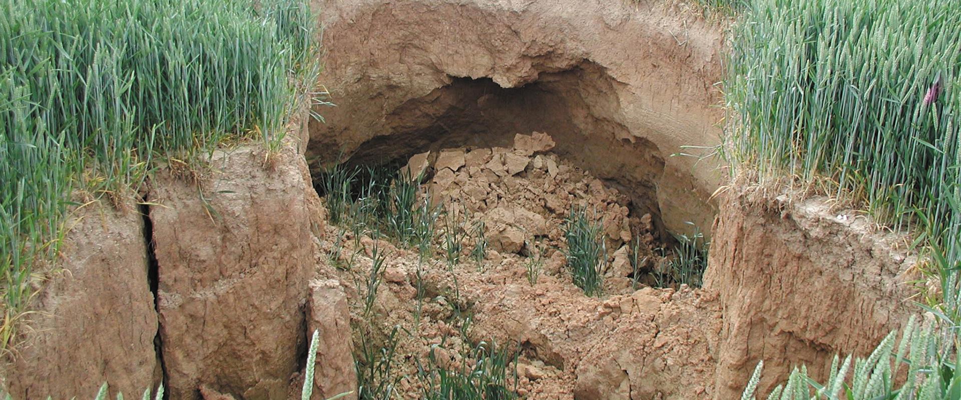
Between 100,000 and 120,000 marl pits have been dug in Normandy over the past two centuries, in order to extract chalk for improving agricultural land. Most of these marlpits have been forgotten and the shafts sealed off without leaving any trace on the landscape. As a result, only 10% have been precisely located. These pits still represent a risk, with cave-ins occurring regularly. Further, in cases where a pit has been declared but not precisely located (the so-called Napoleonic plots), any local land developments are held up until such a time as the pit is found. The only approved reconnaissance techniques are mechanical stripping and soil analyses, both of which are costly and provide only random results, depending on the size of the area to be covered.

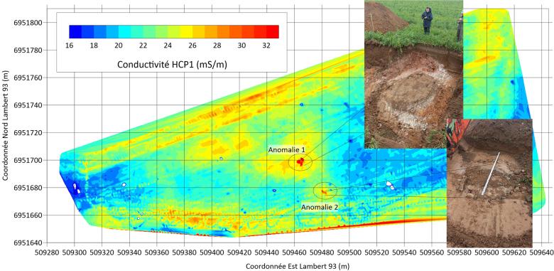
“Horizontal Coplanar" apparent conductivity map, T/R spacing of 1m, on one of the sites in Goderville (76), and photos of stripping operations on the two conductivity anomalies identified (Goderville, 2021)
© BRGM - J.-C. Gourry
The results
The combination of geophysical methods implemented by BRGM scans the subsoil to a depth of about 4m. In relation to the relatively homogeneous surrounding environment, the soil plugging the pit creates a local anomaly in the measurement of the geophysical signal. Once identified and positioned, each anomaly can be checked after stripping the first metre of soil.
The two geophysical tools used are a low-frequency electromagnetic system and geological radar. Both were tested on three agricultural plots of several hectares. After soil stripping, the three geophysical anomalies identified during the project were validated. One of these marlpits was not known to the national land planning authorities.
Using the results
The new geophysical tools developed can cover between 5 and 10 ha daily. After processing, any significant geophysical anomalies are checked by soil stripping. The size and volume of the marlpit are then established by sinking boreholes into the shaft.
In the near future, these tools will make it possible to improve and accelerate inventories of marlpits in Normandy in order to limit the areas at risk, and to enable spatial planning.
The partners
- Direction Départementale des Territoires et de la Mer de la Seine-Maritime (DDTM76)
- Conseil Départemental de la Seine-Maritime (CD 76)
- Normandy Chamber of Agriculture


