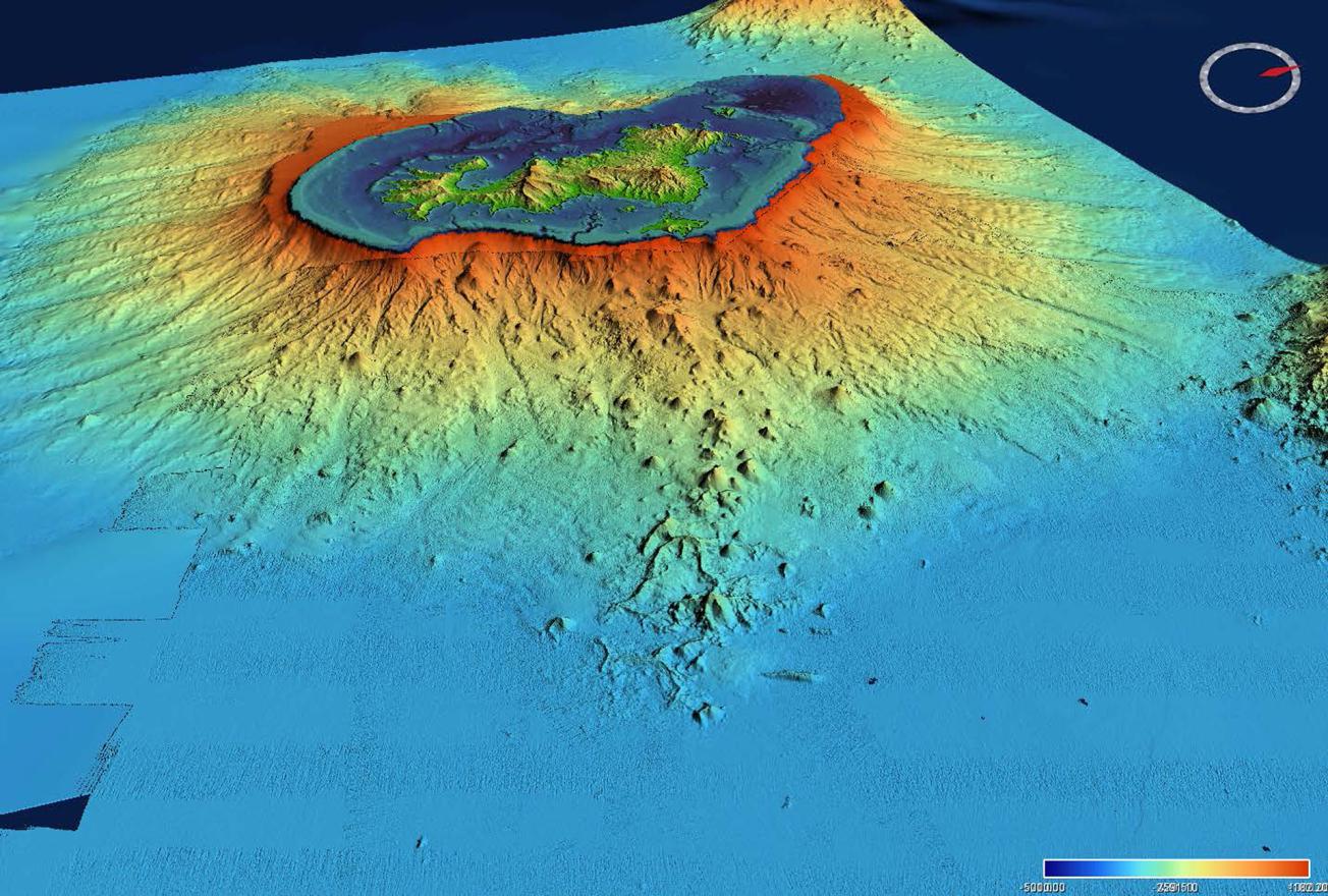
Submarine reliefs off the coast of Mayotte, recorded as part of the oceanographic missions carried out around the birth of a new underwater volcano (Mayotte, 2019).
© Campagne MAYOBS2
The second oceanographic campaign from 11 to 17 June 2019 involved scientists from the IPGP, IPGS, BRGM and Ifremer.
Since 10 May 2018, over 1800 tremors of magnitude 3.5 and more have been recorded around Mayotte, one of which was the strongest ever recorded in the Comoros zone.
During the MAYOBS1 observation campaign conducted from 6 to 18 May 2018 offshore from Mayotte, the scientific teams discovered that an undersea volcano was forming some 50 km away from the island at a depth of 3 500 m. This discovery has helped to understand the causes of the seismic activity observed in the last year.
A new zone of undersea volcanic activity identified to the south of the active volcano
The second campaign was conducted in June to continue data acquisition following the recent MAYOBS1 discoveries, in order to detect any changes in the undersea relief.
This involved the redeployment of undersea seismographs and taking new bathymetric and reflectivity measurements. These data were supplemented by rock samples and observations of fluid outflows from the volcano and earthquake swarm zones.

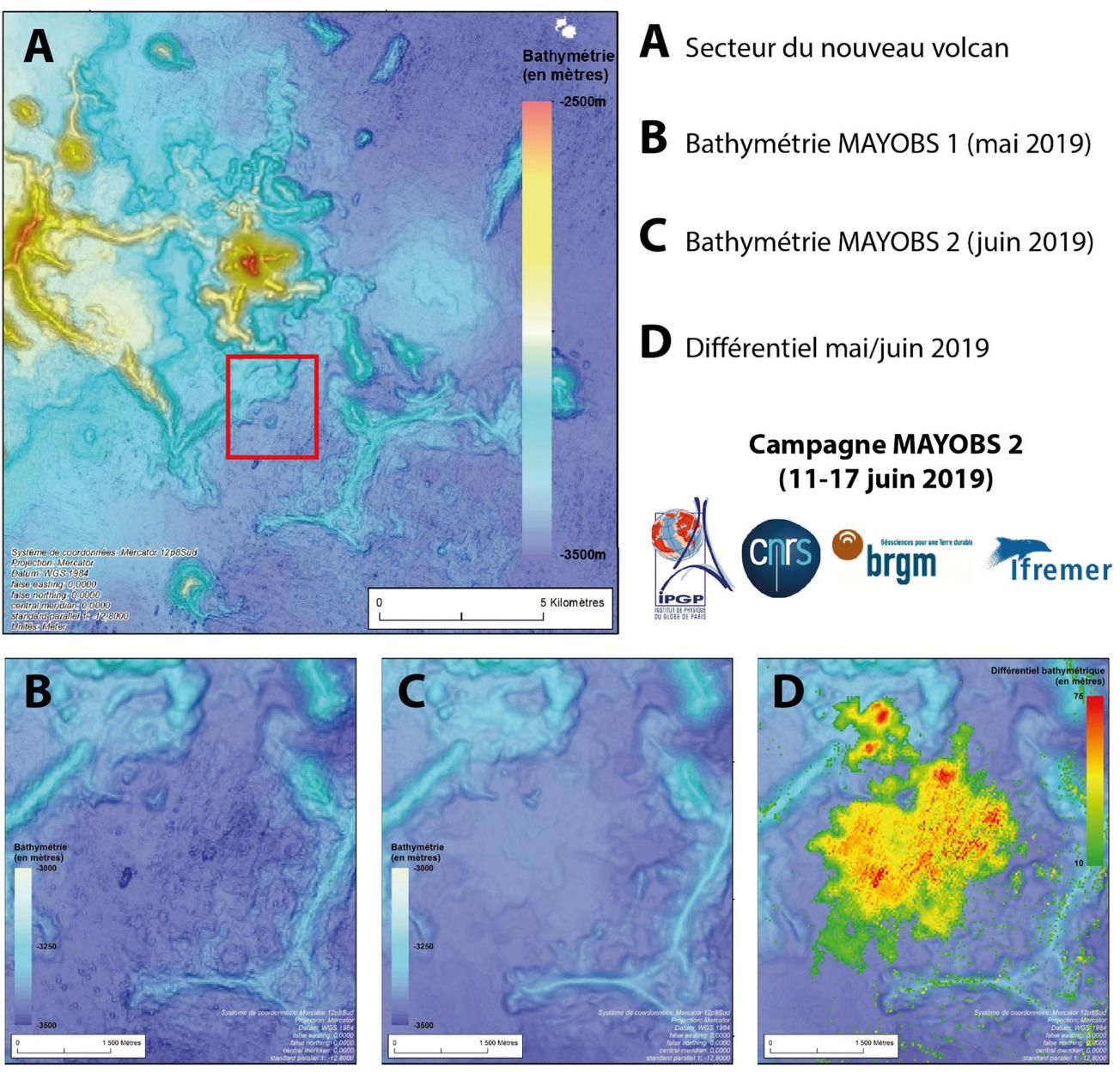
The volcano sector and bathymetric measurements from the MAYOBS1 and MAYOBS 2 campaigns.
© Campagne MAYOBS2
The bathymetric measurements taken above the new volcano showed that its size had not changed since the MAYOBS1 campaign one month earlier, while a new relief was identified to the south of the volcano. This new zone of volcanic activity extends over more than 8 km² and varies in height from 25 to 75 metres (figures A, B, C and D above).
The new measurements, in both the main swarm zone and the volcano zone, have confirmed the presence of plumes that are visible in the water columns but do not reach the surface.


