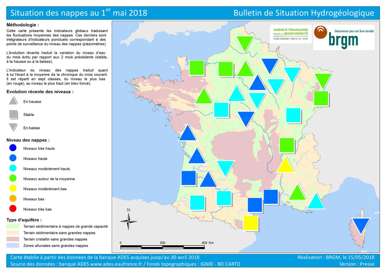
Map of water table levels in France on 1 May 2018.
© BRGM
Water table levels on 1 May 2018 were uneven across regions.
Almost two thirds (60%) of all groundwater tables were at moderately high to very high levels while less than a quarter (21%) were at moderately low to very low levels. One fifth (19%) were at average levels. This confirms the significant incidence of the rainfall at the beginning of the year, and that winter recharge was substantial. Except for a few areas, it can be noted that the rains early in the year were significant in terms of their effect on aquifer recharge across a large portion of the country.
Trends in water table levels
The general trend as regards the change in the water table levels reflects the approaching end of the winter recharge phase. With only 41% of the levels still rising, we are now at the stage where the vast majority of the points monitored are tending to stabilise. The number of points showing a downward trend is increasing significantly (39%) compared with the previous month (25% at the end of March). This situation reflects the transition between the high-water period and the gradual drop of levels announcing the low-water period. The end of the winter recharge period now seems to have arrived.
The groundwater level status on 1 May 2018 reflects the transition between the high-water period and the low-water period to come.


