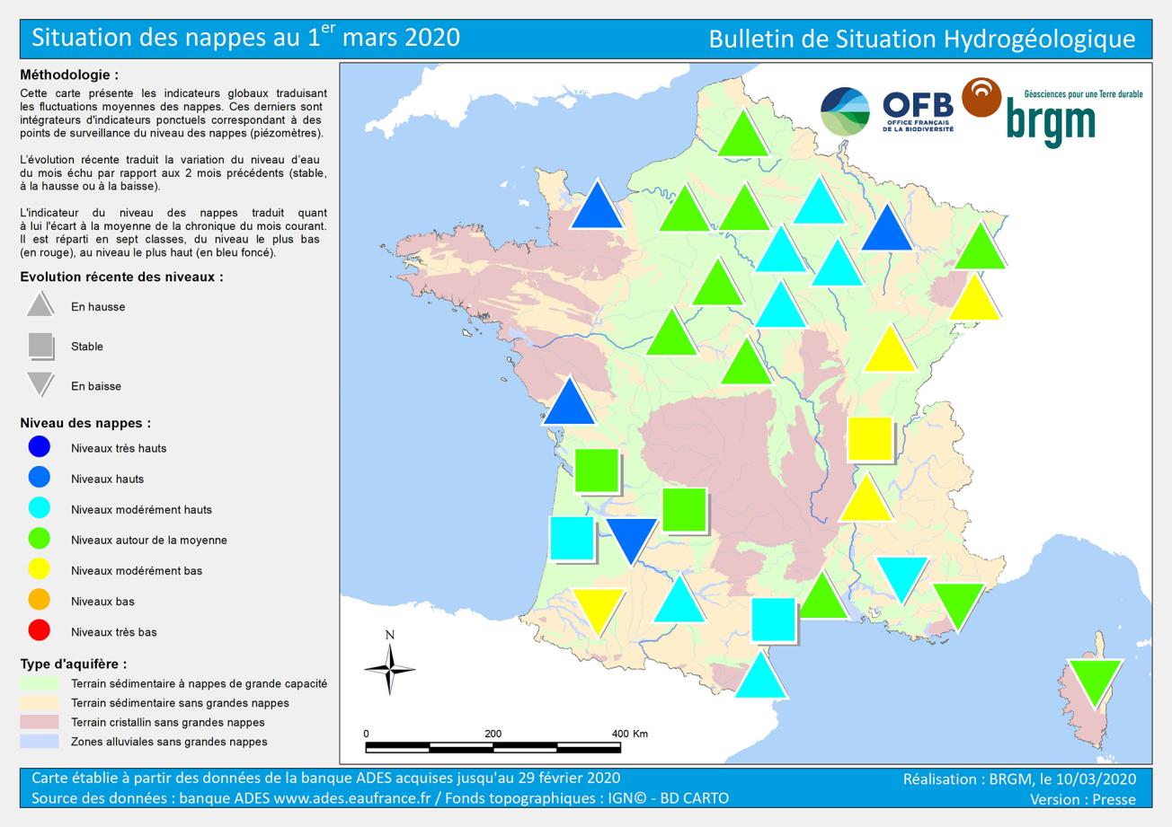
Example of a map of the water-table situation.
© BRGM
One of the consequences of global warming in France is that intense droughts are becoming more frequent in the summer. At the start of every month, a National Hydrogeological Situation Bulletin presents the monthly changes in groundwater levels for continental France in the form of maps.
The state of groundwater tables
BRGM provides details about the state of the groundwater tables, covering the main hydrogeological systems, with indicators representing the level of groundwater present below our feet.
For the month of July 2020, the surveys indicated that the level of the groundwater was high overall, thanks to heavy rainfall during the autumn and winter of 2019-2020. Nevertheless, the state of the reserves in the Rhône valley (Rhône-Saône) and the Alsace plain has become increasingly worrying over the last few winters, due to a lack of rain, which has not enabled the reserves to be sufficiently replenished. At the same time, the limestone basins of Lorraine and Berry (Centre-Val de Loire) are suffering from the dry weather of the last few weeks.
The water reserves below our feet
Out of the 6,500 aquifers in France, around 200 are of regional importance, with a surface area of between 1,000 and 100,000 km2. The largest is the Craie aquifer in the Paris Basin, which stretches from Normandy and the Hauts-de-France to the Centre-Val de Loire region. The smallest aquifers are located in the granite massifs of Brittany and Auvergne and are only a few dozen square kilometres in size.
The various aquifers behave very differently during droughts or periods of heavy rainfall. Notably, the amount of rainwater that filters down through the soil to reach the aquifers depends on the permeability of the soil.


