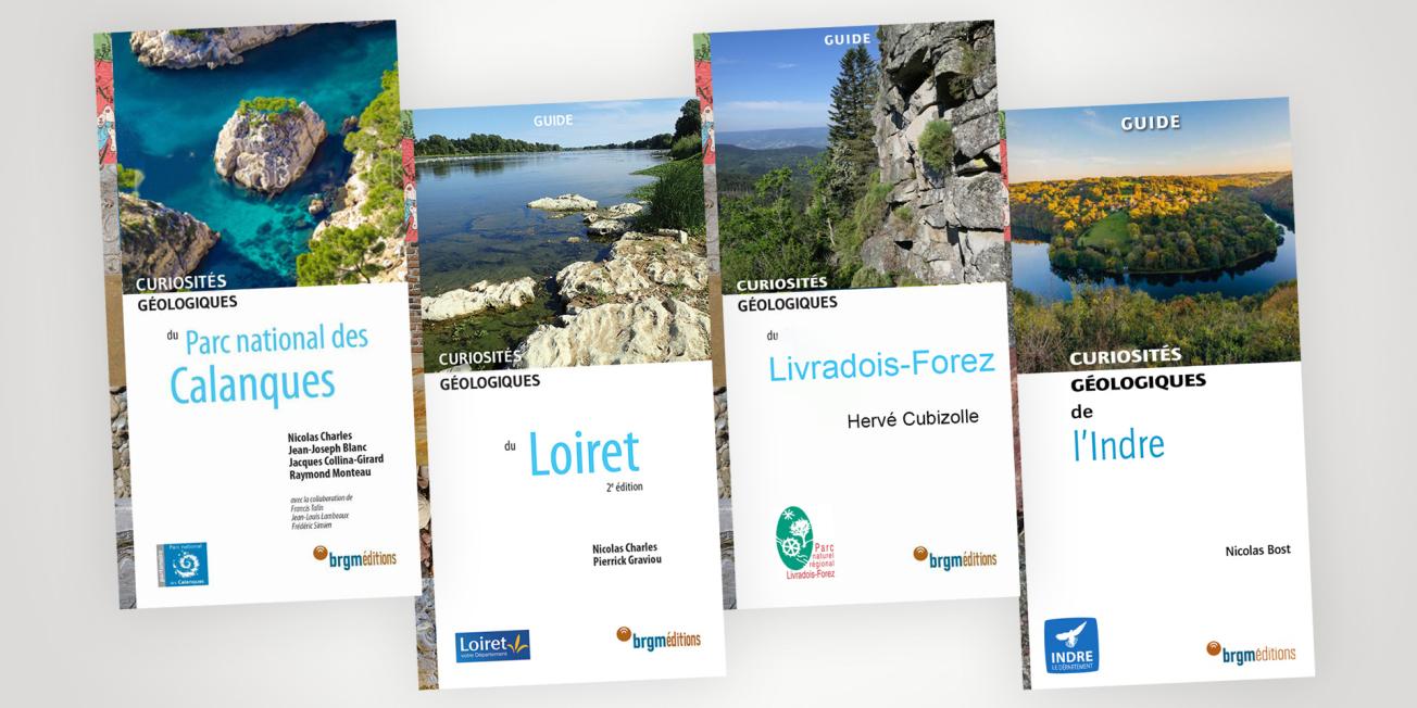
Covers of the geological curiosity guidebooks of the Editions du BRGM.
© BRGM
Curiosités géologiques, a collection of 30 guidebooks
These guidebooks complete the geological curiosities collection which makes the geology of different French regions accessible to a wide audience.
The Éditions du BRGM aim to make a complex field of research accessible to the general public by explaining the processes of rock formation over geological time periods, illustrated by examples from the field. The books also include trails and circuits for discovering plants, wildlife, architecture and culture in general. All these different aspects are linked to specific local environments, which are often shaped by the history and nature of the subsurface.
Rediscover the geological curiosities of the Loiret
Transcription
GEOLOGICAL CURIOSITIES GUIDEBOOK
THE LOIRET
The Geological Curiosities of the Loiret is a book about this department's ancient past. Geology is not an immediate science and is often relatively unknown. This book presents, for example, the three major types of rocks, which must be presented, the Loiret's geological history, and the relationship between humans and the region's subsoil, for in the Loiret, just like all over the planet, humans exploit the natural resources from the subsoil. The history of the Loiret's subsoil began about 200 million years ago with the arrival of the sea from the east. It not only flooded the department of the Loiret but also the entire region, the Paris Basin. The sea remained for approximately 100 million years with some fluctuations, coming and going until roughly 90 million years ago. During this period of time, sediments were deposited on the bed of these various seas. These sediments were packed down, creating the rocks we see today. The guide presents, for example, the flinty chalk and limestone deposit sites in the eastern region, near Château-Renard. It has a wide variety of curiosities. More recently, after the sea withdrew, it was replaced by a marshy region with many lakes. This resulted in Beauce's limestone deposits. This lacustrine limestone can be found throughout the region, in the old quarries near Bâcon, for example, in Saint Pryvé Saint Mesmain, and in the Loire riverbed, in the summer, when water levels are very low. It is lacustrine limestone in which you can find fossils of small freshwater snails and even turtles. You can also find sand and clay from more recent ages that flowed in from the Massif Central, carried by torrents that ravaged everything in their path, including local fauna, which, at the time, was mainly made up of rhinoceroses and crocodiles, for it was a hot climate. We're standing in the floral gardens of Orléans-La-Source. The spring is aptly named because it is the source of the Loiret river, after which the department was named. It is a very unique spring. It all begins upriver from Orléans, near Jargeau, where, in the summer, when the Loire river is very low, water flows into great holes. The water runs for about 15 kilometres in an underground network of small subterranean rivers, and resurges here, forming this karst spring, called the Bouillon. This field guide regroups about 20 different sites, which you can visit with family and friends. You'll explore the ever-mysterious past and extend your tour of Val-de-Loire's cultural heritage sites.
ORDER THE GUIDEBOOK ONLINE FROM BRGM EDITIONS
Following the success of the first edition, Éditions du BRGM is offering a new version of the guidebook on the geological curiosities of the Loiret. It takes into account the latest scientific advances, such as the knowledge acquired about the formation processes of the Essonne valley sandstones. It also presents the new Muséum d’Orléans pour la Biodiversité et l’Environnement (MOBE) and focuses on the major floods of 2016.
The Loiret department has natural regions with very different geological contexts. The Beauce, Sologne, Gâtinais and Val de Loire have a variety of agricultural and built environments that are closely related to the diversity of the rocks that make up the subsurface of the Loire département.
After a presentation of the geological history, the close links between stones and people and the different environments, the book details 20 particularly interesting sites: the blue waters of Tavers, the swallow holes of the Loire at Jargeau, the source of the Loiret and the Dragon's Cave.
Curiosités géologiques de la Corrèze [Geological curiosities of Corrèze], by Nicolas Charles and Pierrick Graviou. 118 pages, 19 euros
Discover the Livradois-Forez Regional Nature Park through its geology
Transcription
GEOLOGICAL CURIOSITIES GUIDEBOOK
LIVRADOIS-FOREZ
This geological curiosities guidebook focuses on Livradois-Forez, exploring the little-known region of the Massif Central for a broad range of readers. While Livradois-Forez may not offer spectacular sites like the volcanoes in Auvergne, this region does have a lot of charm and has a lot to offer from a geological standpoint thanks to its geological history. What will the reader find in this book? First, a chapter on the nature and origins of the rocks, taking a closer look at local rocks, a section on local and regional geological history, a third section on surface-level formations and soils, which are important for vegetation and agriculture, and finally, a chapter on biodiversity. This region is not subjected to intense human pressure, thus providing a well-preserved environment for some wonderful nature observation. Another great aspect of this book is that it provides the reader with 22 geologically-themed nature walks. It describes 22 different sites. It's a great way to discover the region through its geology and geological history. Happy excursions to you all.
ORDER THE GUIDEBOOK ONLINE FROM BRGM EDITIONS
Consisting of the remains of 350 to 300 million year old mountains, the Livradois massif and the Forez mountains have a wealth of varied landscapes. This diversity is due to the geology, which combines rocks of very different natures and origins: old granite-gneiss basement, sedimentary formations of basins, volcanic reliefs and recent peat bogs.
The difference in elevation of the landscapes also contributes to this variety, from the vast alluvial plains of the Loire to high mountain pastures and forest slopes. This somewhat unknown region has a great wealth of flora and fauna. This sparsely populated area, located far from major urban and industrial centres, offers remarkable biodiversity.
This guidebook invites you to discover 22 sites representing the diversity of the geological environments: glacial cirques, granite boulder fields, volcanic organ formations, peat bogs, millstones, and rare rock combinations (nepheline-basanite-melilite). The guidebook also describes the uses to which these rocks have been put, to make megaliths, castles, churches, priories and traditional rural buildings.
Curiosités géologiques du Livradois-Forez (Geological curiosities of the Livradois-Forez) by Hervé Cubizolle. 118 pages, 19 euros
Geological trail in the Calanques National Park
Transcription
GEOLOGICAL CURIOSITIES GUIDEBOOK CALANQUES NATIONAL PARK
This is a guidebook for geological curiosities in Calanques National Park in which you'll discover 24 geological sites. One of the top sites is Cap Canaille, the highest sea cliff of France at 400 m. Geologists will find a former shallow interior sea with reefs. Another less known site in the national park is Mont Rose. Here, you'll find early traces of living organisms that literally created the rock, called stromatolites. Stromatolites had an important role in the history of our planet for they are thought to have created oxygen on Earth. The Bec de l'Aigle in La Ciotat is made up of brown rock called puddingstone. Puddingstone is evidence of ancient deltas that collected erosion products along the sea banks from a continent that no longer exists today because Corsica and Sardinia drifted away from Provence. The other specificity of this book is that it makes the connection between biodiversity and geodiversity for they make up this natural heritage. There are some remarkable examples in Calanques National Park. Because of global warming and cooling, the sea level varied greatly resulting in the creation of caves that were used in prehistoric times and that today are below dozens of meters of water. It has a very specific form of fauna. Today, we're discovering new species, such as a shrimp whose existence was unknown until recently. This is linked to the inflow of fresh water, for in this limestone massif, a lot of water flows underground, dissolving the limestone. In geology, this is called a karst. This is why, in certain areas, salt water and fresh water meet, leading to a profusion of biodiversity.
ORDER THE GUIDEBOOK ONLINE FROM BRGM EDITIONS
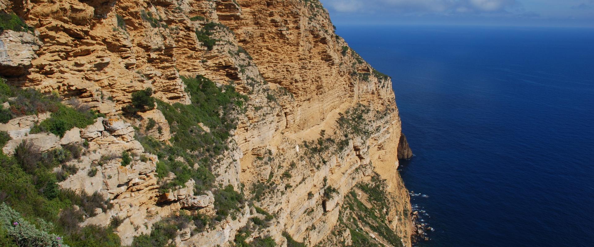
With their vertiginous white cliffs, turquoise waters, bright green Aleppo pines and the rust colour of the highest cliffs in France, the incomparable landscapes of the Calanques National Park are world famous. Located close to Marseille, the second largest urban area in France, this protected natural area owes its uniqueness to the ubiquity of the abrupt rocky relief on and under the surface of the Mediterranean. The relief offers a wide variety of natural environments which allow a rich diversity of plants and animals to flourish in habitats that are intimately linked to the different rocky substrates. This coastal ensemble illustrates the important changes in sea level in relation to climate change over geological time.
The subsurface is also the source of valuable resources that the inhabitants were able to exploit very early. Although the emblematic Cassis stone has been exported to many countries, it has also been used for a less well-known purpose. Together with sea salt, it was the raw material for soda ash, which, when mixed with oil, produces Savon de Marseille (Marseille soap).
After a presentation of the geological history and the close links between stones and humans, the guidebook describes 24 remarkable sites, all accessible on foot: the Sormiou anticline, the Sugiton belvedere, the Cassis rock, the red sandstone of Cap Canaille, the tafonis of Figuerolles, etc.
Curiosités géologiques du Parc national des Calanque [Geological curiosities of the Calanques National Park] by Nicolas Charles, Jean-Joseph Blanc, Jacques Collina-Girard and Raymond Monteau. 128 pages, 19 euros
A new guide to the geology of the Indre
Transcription
GEOLOGICAL CURIOSITIES GUIDEBOOK
THE INDRE RIVER
On this map, the Indre river is located right below the Paris Basin, bordering the Massif Central, two extremely diverse geological regions. One of the top iconic sites known to geologists and mineralogists is the Chaillac baryte and fluorite mining site. The Rossignol Vein, one of the top veins in France, has extraordinary resources. All collectors own a pyromorphite rock from Chaillac. Another interesting site for its mineral resources is Luçay-le-Mâle for its flint. Napoleon's armies consumed millions. They're all over Europe. It's a great site. You'll also want to explore some natural sites like the ponds of Brenne. The largest, the Mer Rouge, is well worth the trip.
ORDER THE GUIDEBOOK ONLINE FROM BRGM EDITIONS
The Indre département is located between two major geological areas: the Paris Basin, the cradle of French geology, and the Massif Central, which comprises the remains of a very old mountain range covered in places by much more recent volcanic products. The subsurface of the department contains very different rocks which largely explains the diversity of the Indre landscapes: green bocages (mixed fields with hedges, pasture-land and woodland), cereal plains and numerous ponds. Between Brenne, Berry and Boischaut, the Indre has very varied landscapes.
This guidebook on geological curiosities presents 20 remarkable sites to enable users to discover the Indre in a different way. Granitic tors, dolmens or menhirs on the Aigurande plateau, the large cereal plains of Levroux, iron, fluorite and barite mined for centuries, are all linked to the region's rich past. This memory is recorded in the rocks of the Indre, resulting from a complex evolution over nearly 500 million years.
Curiosités géologiques de la Corrèze (Geological curiosities of Indre) by Nicolas Bost. 118 pages, 19 euros
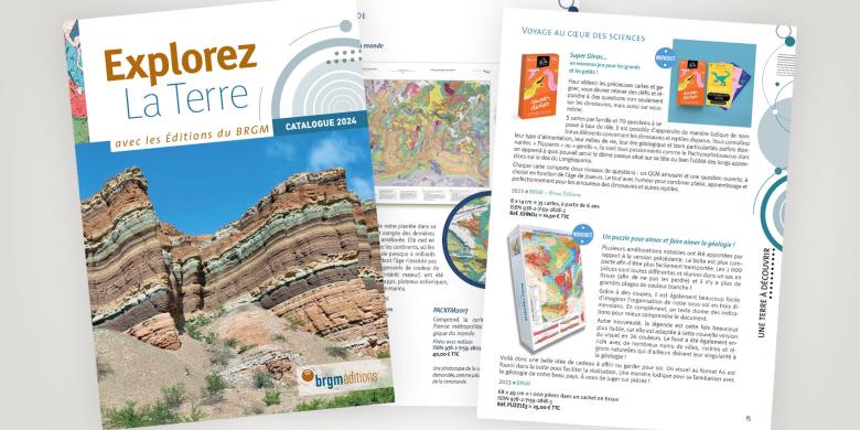
New catalogue from Éditions du BRGM
The new Éditions du BRGM catalogue is now available. It includes geological maps, introductions to the Earth sciences, discovery of the geological heritage, scientific books and books for the general public, and the journal Geosciences; overall, it offers a vast choice of themes and geography to all types of audience, from the general public to the scientific community, including professionals and teachers.


