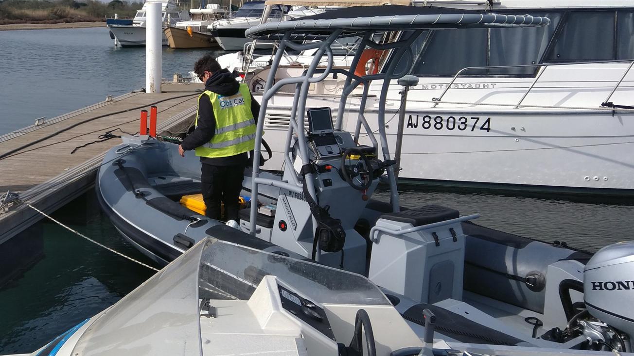
A BRGM semi-rigid boat equipped with a single-beam echo sounder and a Differential GPS (DGPS) for bathymetric acquisition along the Catalan coast
© BRGM
ObsCat (Observatory of the Catalan sandy coast) and OCA (Observatory of the Aquitaine coast), two coastline observatories in which BRGM is a stakeholder, started their coastline monitoring campaigns at the end of March 2021.
Catalan coast: a LiDAR topographic survey of 44 kilometres of sandy beaches

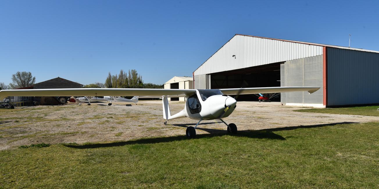
The ULM used for the LiDAR topographic survey.
© BRGM

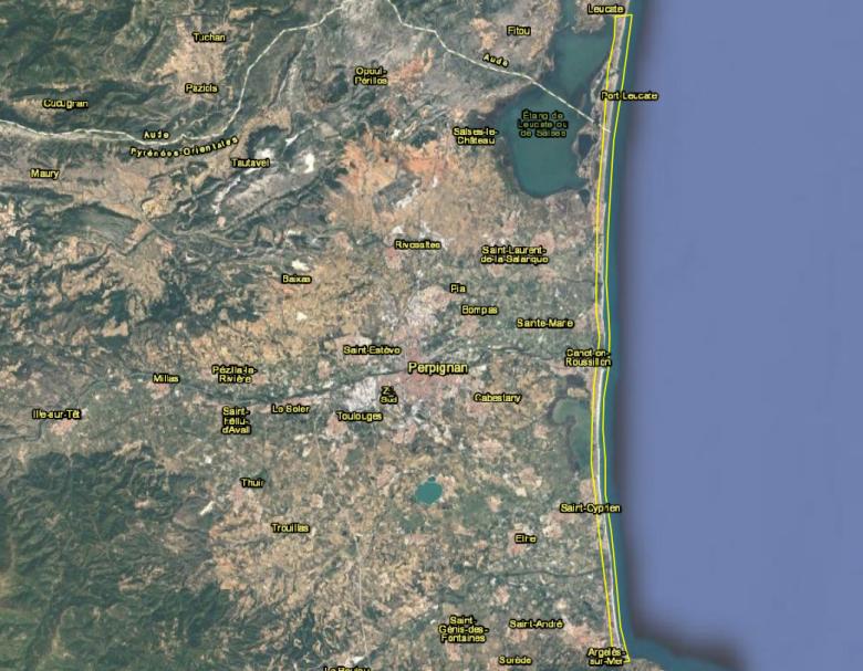
Topographic LiDAR survey of the ObsCat acquisition campaign of 24 March 2021, between Cap Leucate (north) and Le Racou (south).
© BRGM
As part of its seasonal data acquisition campaign for the spring of 2021, on 24 March ObsCat carried out a topographic LiDAR survey of the 44 kilometres of sandy beaches of the sediment cell it monitors, between Cap Leucate (Aude) and Le Racou in Argelès-sur-Mer (Pyrénées-Orientales).
BRGM, ObsCat’s technical and institutional partner, in charge of the observatory’s seasonal data acquisition and interpretation, commissioned the company Global Geomatic France (GGF) to provide this service.
This is the third LiDAR survey carried out by the Observatory (May and September 2020 and March 2021). This latest survey marks the first time an operational flight of this magnitude has been made for a LiDAR carried by a microlight. With this flight configuration, this type of survey becomes a fast, reliable and easily deployable means of measurement, even over a large area, and at a lower cost than by other more traditional airborne means (helicopters in particular). It enables the restitution of continuous and precise orthophotography of the whole area covered (4 to 6 cm/pixel).
Concomitantly with this topographic survey, a BRGM Occitanie team has been carrying out bathymetric surveys that complement the LiDAR topographic survey since 23 March, with nadir sounding over the 17 ObsCat seasonal monitoring sites, between Leucate Plage and Le Racou in Argelès-sur-Mer.
These data make it possible to monitor the morphological and sedimentary evolution of the Catalan sandy coastline, thus providing valuable information for coastline management to the communities of communes (federations of municipalities) of Albères Côte Vermeille Illibéris, Sud Roussillon, Perpignan Méditerranée Métropole and the commune of Leucate. This seasonal data acquisition component is financed by these local authorities as well as BRGM, the Water Agency and the Occitanie Region/FEDER.

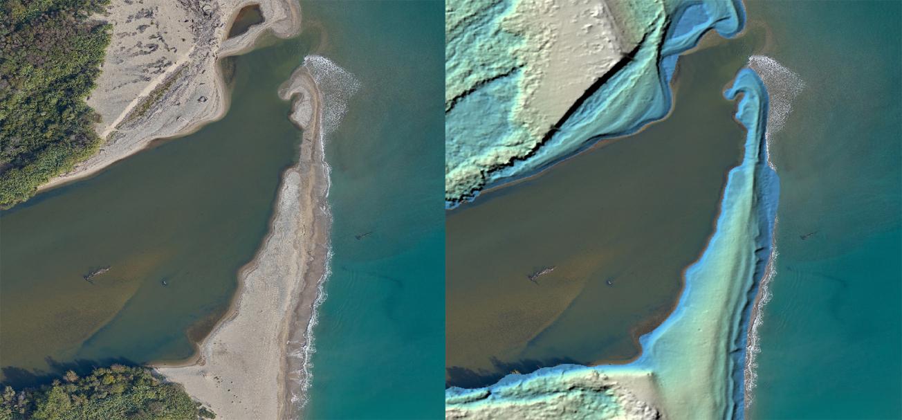
Example of orthophotographic (left) and topographic (right) restitution of the mouth of the Tech river (66).
© BRGM
Aquitaine coastline: annual post-winter monitoring of 300 kilometres of coastline
Since 29 March, the Observatoire de la Côte Aquitaine (OCA), of which BRGM is a technical partner, has been carrying out annual post-winter monitoring of 300 kilometres of the Aquitaine coastline; the survey will continue to the beginning of June.
Since 1998, and with optimised techniques since 2002, these Differential GPS field surveys (with centimetre accuracy) have been carried out every year in the spring after winter storms. The aim is to understand the dynamics of the coastline, on several time scales, and to predict its future evolution, while taking into account the impacts of climate change. The acquisition and analysis of the data collected during the field campaign thus enables:
- quantification of the evolution of the coastline and its variability along the Aquitaine coast, particularly in relation to the developed coastal sectors;
- a better understanding of the rhythms of evolution on different time scales (event-driven, seasonal, inter-annual, multi-annual and secular);
- and a better characterisation of the coastline retreat hazard on the Aquitaine coastline, in relation to the effects of climate change.
Sandy coast: 2020 campaign data now available
In 2019, the OCA launched the interactive Transect Graphs tool, which provides access to all the data acquired during the spring measurement campaigns since 2008. The DGPS campaign and the 2020 LiDAR surveys on the Aquitaine sandy coast are now available.
In the field with the teams of the Aquitaine Coast Observatory on 4 sites in Aquitaine
BRGM: coastal risk experts
In the context of climate change, BRGM is actively involved in understanding and managing coastal risks. It conducts research and expert studies on the changing coastline (coastal erosion) and marine submersion of coastal areas due to hydro-meteorological factors (storms and cyclones) or induced by tsunamis.
BRGM provides innovative approaches and tools for risk prevention and for the sustainable development of coastal areas. It is also involved in monitoring the coastline through coastal observatories in mainland France and overseas.
BRGM is a member of the National Network of Coastline Observatories
BRGM is involved in implementing the national strategy for integrated coastline management adopted by France in 2012 and is a member of the National Network of Coastline Observatories, established as a pool of observatories responsible for acquiring coastline data at the local level. Purpose: to encourage long-term sharing and dissemination of data and knowledge on changes in the coastline.


