About the author
A doctor of geology, Nicolas Charles is a geologist at BRGM, the French National Geological Survey. He is involved in numerous geological mapping and mineral resource projects in France and abroad. Since 2016 he has been coordinating a European geoscience training project in Africa (PanAfGeo) aimed at strengthening partnerships between European and African geological surveys. He is the author of numerous scientific outreach publications on the French geological heritage and also runs conferences on geology and mineral resources.

From stone to rose, from magma to chaos
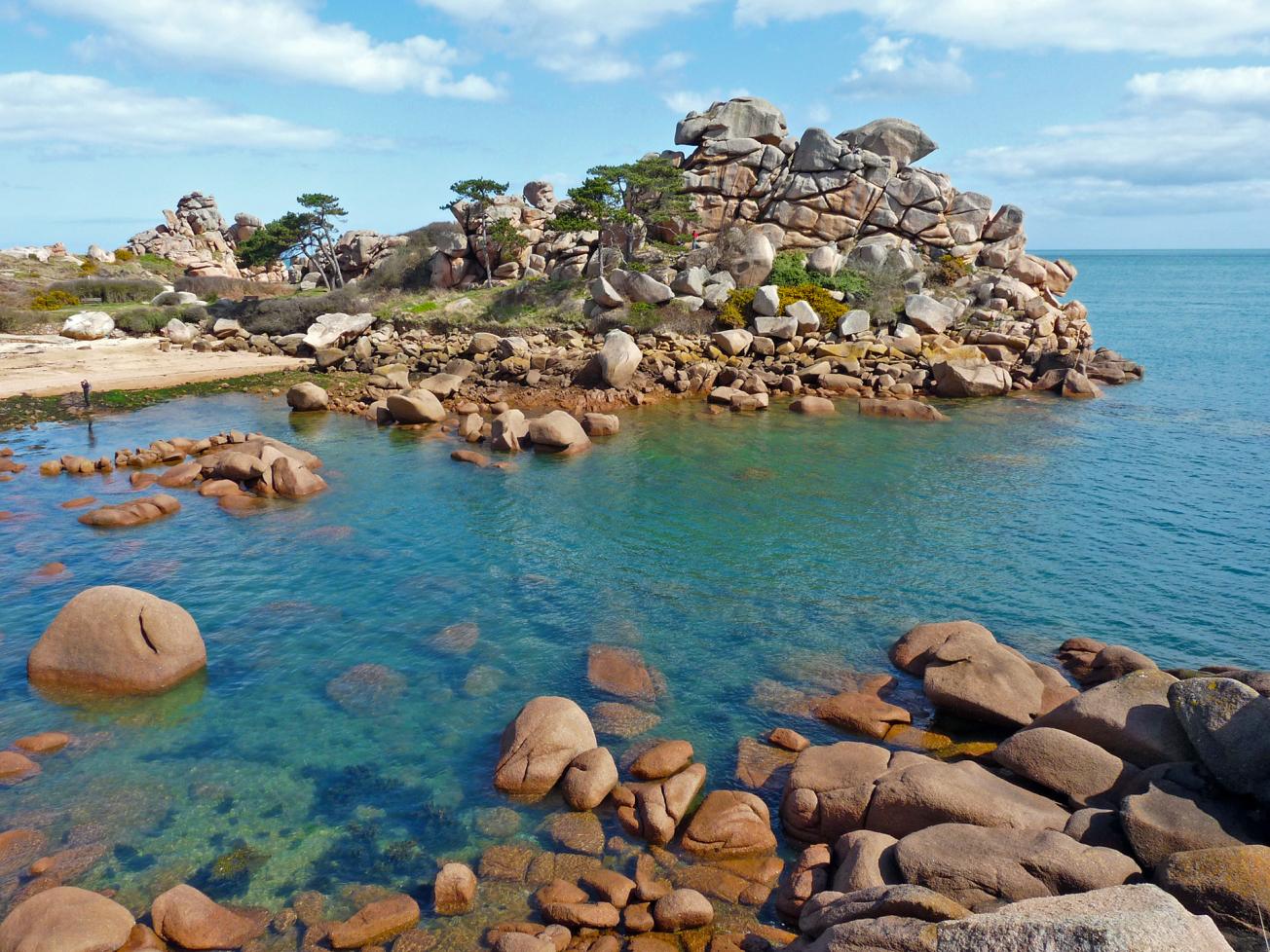
Chaos du Château on the Pink Granite Coast in Pors-Rolland, Perros-Guirec.
© BRGM - Nicolas Charles
Breton pink granite is a magmatic rock formed by the crystallisation of a magma a few kilometres underground some 300 million years ago. Like all granitic rocks, it is made up of different minerals crystallised with each other and without any space between the grains. Quartz is grey and translucent, biotite is black and lamellar and feldspar is milky white, or tinted pink as here by iron oxides, which gives this Breton granite its famous colour.

The Bec de l'Aigle (Eagle’s Beak), witness to a vanished landmass between Corsica and Provence
Humans like to give cloud shapes familiar names, as they do to mountains. At La Ciotat, near the famous Calanques of Marseille, an evocative shape stands out on the horizon: the Bec de l'Aigle. This rocky headland is an emblem of this part of the coast of Provence, clearly reminiscent of the profile of an eagle's head.
This rock spur juts out into the Mediterranean, displaying brown rock with large pebbles that geologists call "puddingstone". This rock was formed about 90 million years ago. It bears witness to a vanished landmass, a distant cousin of Corsica and Sardinia.
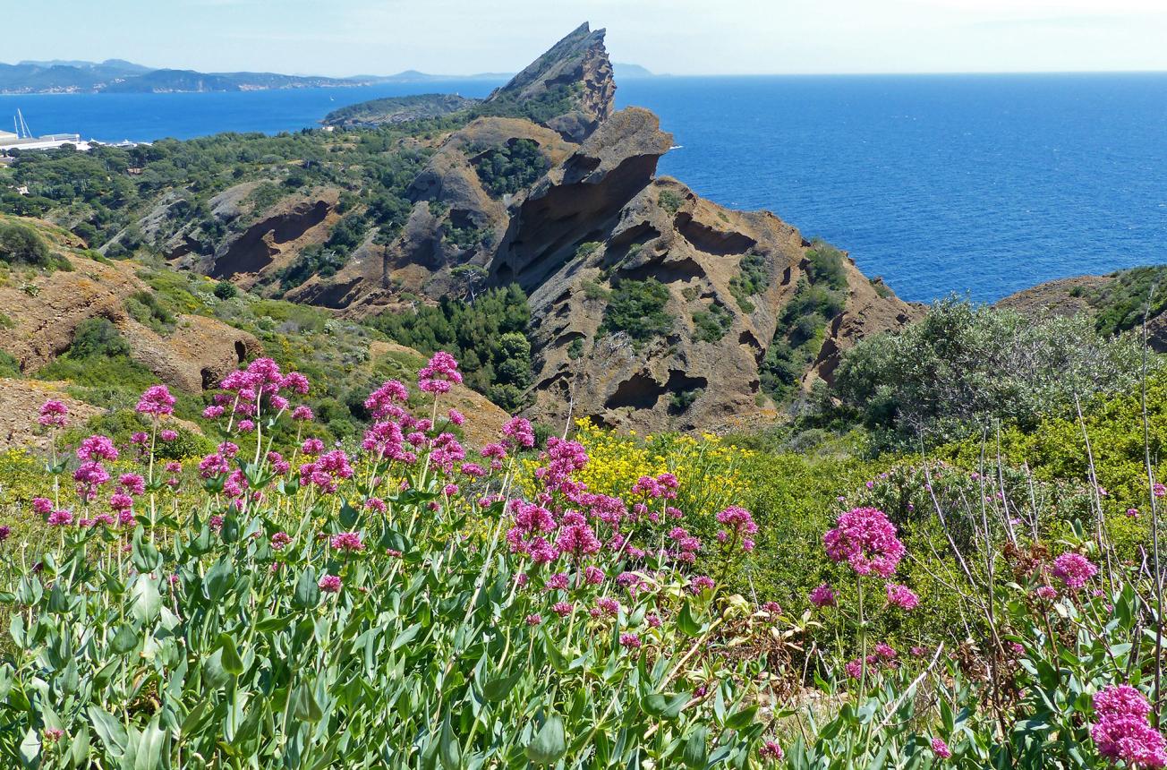
The Bec de l'Aigle, La Ciotat.
© BRGM - Nicolas Charles
At that time long ago, the region of La Ciotat was located on the edge of a landmass facing Provence and considered to have been linked to Corsica and Sardinia. This landmass eroded and the sand, gravel and pebbles transported by the rivers accumulated in deltas at the base of this emergent land. These accumulated sediments include the contemporary Bec de l'Aigle puddingstone. The disappearance of this "Atlantis", separated from Provence by a small inland sea, is linked to the formation of the Mediterranean Sea, ensuing from the counter-clockwise rotation of Corsica.

Between land and sea, the history of a Charente estuary
Between land and sea, an unusual succession of geometrical shapes emerges in France's leading oyster farming region. Seen from the air, marshes, dykes, clearings, channels and villages appear intermingled along the Seudre estuary in Charente-Maritime. This coastal river is about 65 kilometres long and ends its course in the Atlantic Ocean between Marennes and La Tremblade. The fresh water flows from its source at Saint-Genis-de-Saintonge to Saujon, a spa town where the salt water marks the beginning of the estuary.
The banks are made up of former salt marshes that were developed as early as the 7th century. Today, they are mostly abandoned or converted into salt meadows and oyster beds where the famous "Fine de Claire", the Marennes-Oléron oyster, matures.
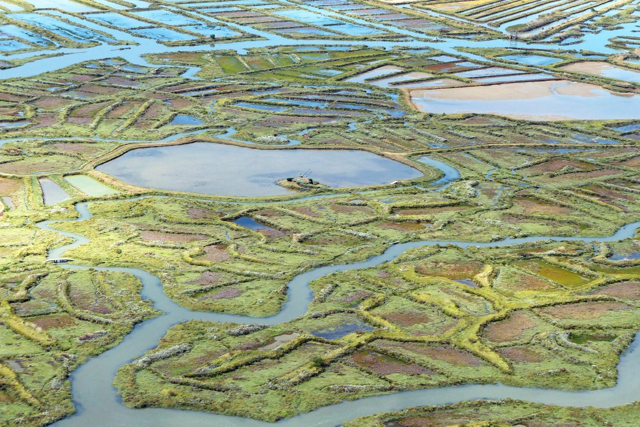
Seudre Estuary, Charente-Maritime. Marais gâts (former salt marshes).
© BRGM - Nicolas Charles
This landscape of coastal marshes, where fresh and salt water meet, has developed over a topographic basin guided by faults running north-west to south-east. These subsoil fractures originated from the formation of the Pyrenees about 40 million years ago.
The estuary, on the other hand, was formed much more recently in geological time, dating from the Quaternary. During this period, the sea level varied substantially: about 20,000 years ago, the ocean surface was a hundred-odd metres lower, resulting in the rivers digging their beds deeper and forming actual canyons in places where the future estuaries of the Charente (Gironde, Charente, Seudre) would be. Subsequently, the rivers carried and deposited sediments, particularly prized by the Médoc wine growers. Between 12,000 and 8,000 years ago, the sea level rose again. The ocean flooded the valleys, forming vast gulfs where fluvio-marine sediments were deposited, now forming the base of the coastal marshes and known locally as "bri".

Rock in a wineglass - Pouilly-Fuissé at Solutré
In the Mâconnais district, this "petrified ship", as Alphonse de Lamartine liked to call it, dominates the Pouilly-Fuissé vineyards.
It was here, in 1872, that the Solutrean style was identified, an Upper Palaeolithic culture that extended from 22,000 to 17,000 years before the contemporary era. The Solutreans were masters in the art of flint knapping, particularly the "laurel leaf", a characteristic shape from this period.
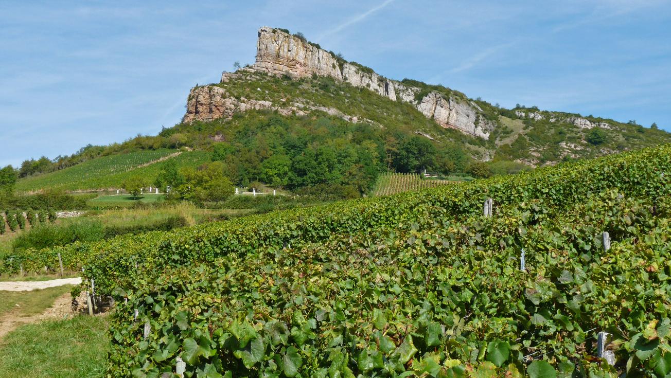
Roche de Solutré (493 m) composed of old limestone from the Jurassic period, Saône-et-Loire.
© BRGM - Nicolas Charles
Since the Middle Ages, winegrowers have progressively and precisely demarcated and named their vineyard plots, thus establishing so-called "climat” wine growing locations. These are nothing to do with the weather! They are characteristic of the Burgundy region. According to the UNESCO definition, each climat has specific geological, hydrometric and exposure characteristics. The produce from each climat is turned separately into wine from a single grape variety. The wine thus produced takes the name of the climat from which it originates. Near the Roche de Solutré, we refer to the climats of "Vers la Roche", "La Levée", "À la Cotonne", etc.

La Fournaise, a giant world-renowned volcanic hot spot on Reunion Island
For geologists, the Earth is a living being which they observe and study. Its breath is all the more palpable when it comes to volcanoes, those giants of fire that amaze young and old alike and compel you to feel the forces of nature.
As such, Reunion Island is an exceptional area of biodiversity and geodiversity, classified as a UNESCO World Heritage Site. Two volcanoes make up this island in the Indian Ocean: the Piton des Neiges (3070 m), which has been dormant for 12,000 years, and the Piton de la Fournaise (2621 m), which has been active for about 450,000 years. In fact, it is one of the most active in the world. Geologists describe them as shield volcanoes because of their round, flat profile with slopes of about 15°.
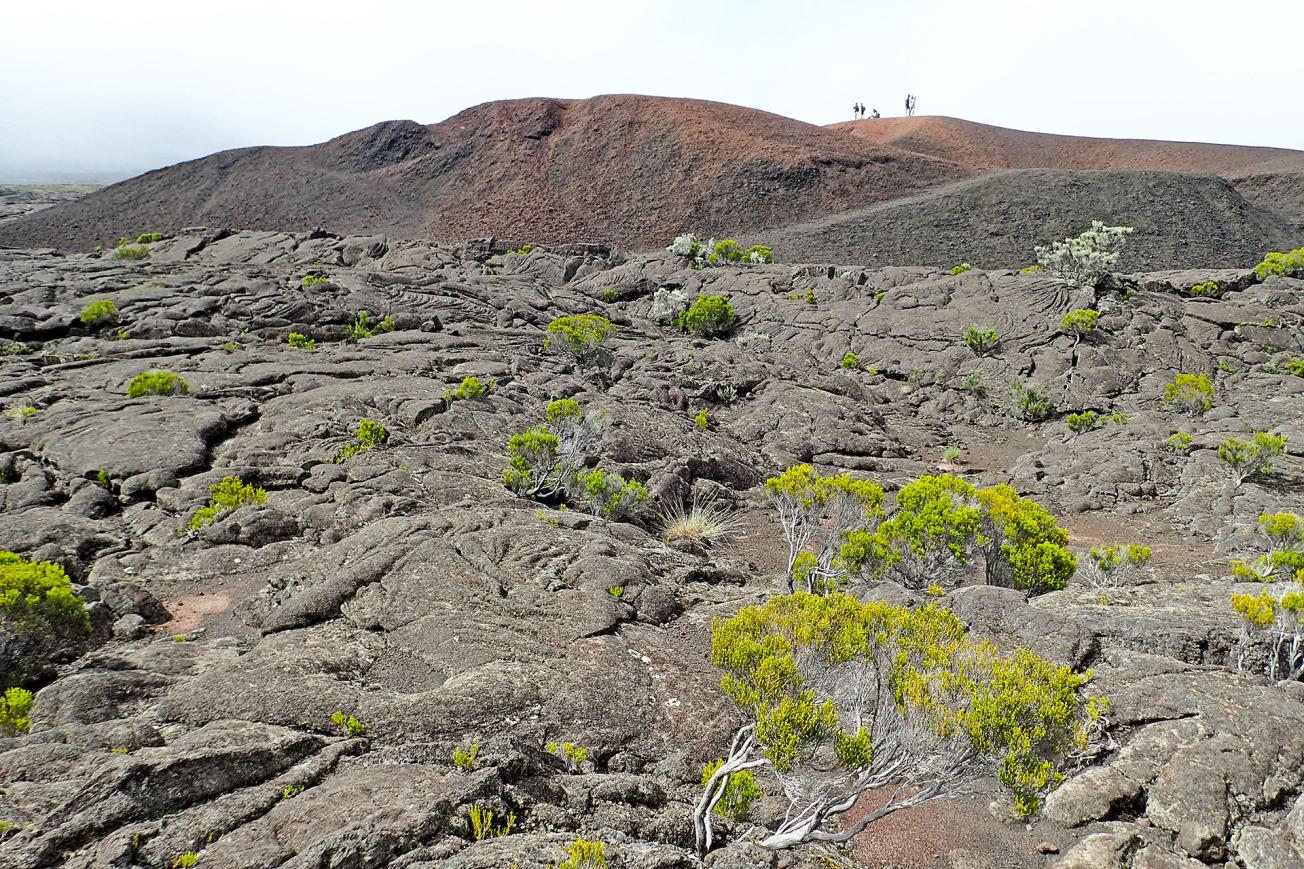
Piton de la Fournaise, Reunion Island. Enclos Fouqué lava field (18th century) and the Formica Léo cone (3000 to 4500 years old).
© BRGM - Nicolas Charles
The volcanoes on Reunion Island are linked to a hot spot, an anomalous thermal area originating straight from the mantle. This "blowtorch” is almost immobile on the geological time scale and is also thought to be the origin of the Maldives, the Chagos archipelago, Rodrigues Island, Mauritius and the Deccan Traps in India. The arrival of magma on the surface of the earth's crust gave rise to Reunion Island between 5 and 9 million years ago, with the island only emerging from the sea around 3 million years ago as the submarine lava flows piled up.

