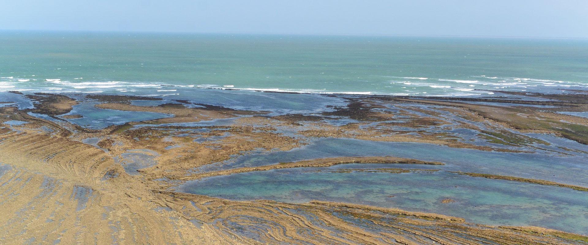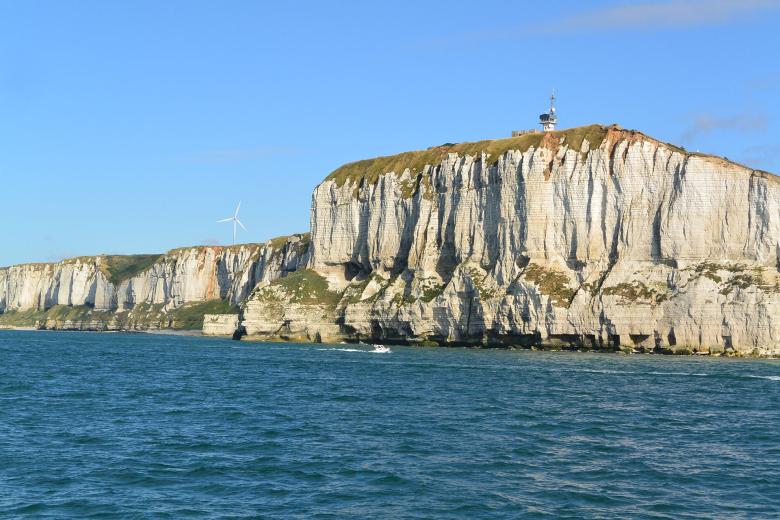
Layout of geological formations on land, which are the same as the formations at sea (Fécamp Cliff, Manche département).
© BRGM - Isabelle Thinon
Your challenges and needs
Whether carrying out preliminary studies of an area, or detailed surveys of a site, it is crucial for offshore project developers and stakeholders to have a thorough understanding of the subsurface and any associated geological risks. This knowledge of the subsurface of the sea-floor enables you to:
- Determine the geometry, depth and characteristics of geological formations and structures (faults) in the subsurface.
- Acquire information about certain geological structures that extend between land and sea (potential reservoirs, active faults, similar areas on land, etc.).
- Determine the associated natural risks: seismology, instabilities, karst formations, volcanic activity, tsunamis, etc.
- Identify and assess the potential mineral resources, such as sand stocks (marine aggregates).
- Characterise the nature of the seabed in more detail, for the purpose of studies aimed at protecting marine habitats or the coastline, for example.
- Determine the most appropriate marine exploration methods and strategies (geophysics, geology).
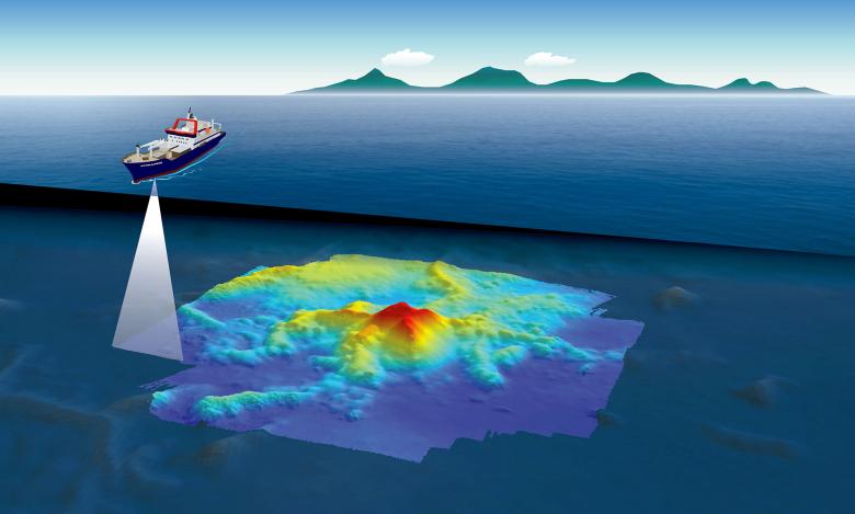
Working on board the vessel Marion Dufresne, a team of scientists (from BRGM, CNRS, IFREMER and IPGP) deployed ocean-bottom seismometers (OBS) and studied the seabed off the coast of Mayotte following a series of earthquakes. They discovered a new underwater volcano (Mayotte, May 2019).
© BRGM - Fabien Paquet
Our added value
BRGM has been involved in studying offshore subsurface geology since 1963. Today, drawing on this extensive experience, it provides a range of services to optimise the development and implementation of your offshore projects:
- Provision of a wide range of geophysical data (seismic reflection, sonar, magnetism, gravimetry, etc.) and geological maps covering the entire French coastline. BRGM's services can cover the acquisition, processing and/or interpretation of geophysical data. Moreover, our teams can assist you in acquiring and analysing offshore geological samples (sediment cores, rocks), while also drawing on our in-depth knowledge of regional geological formations on land (analogues).
- Expert geological and geophysical knowledge of the French maritime territory and its land-sea continuum. Often referred to as "marine geology", this type of expertise actually covers all underwater areas: oceans, seas, lakes and inland seas. Thanks to its extensive knowledge of regional marine geology, BRGM can adapt to different geological contexts: sedimentary basins/continental margins, bedrock (orogens), superficial formations (loose sediments).
- Expertise in geological mapping and 3D modelling of the seabed to help understand the subsurface and potential uses (resources, storage, etc.). This means the project can be appropriately adjusted from a technical point of view, and optimised from an economic point of view.
- Tailor-made support: desktop study, drafting of the terms of reference (ToR), project implementation and monitoring, geological studies on various scales (regional, local or site-specific) and assessment of any related natural risks, third-party expert assessments, quality assessment of third-party deliverables.
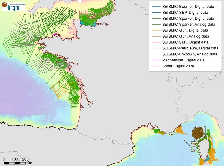
Data: existing offshore seismic reflection profiles (version 2018) along the French coast and Corsica.
© BRGM
Tools and platforms
- Marine databases and cartographic summaries: Sea Subsurface data Base (BSS mer), containing marine geology survey data, established according to the French Mining Code, managed by BRGM. BRGM geophysical database. InfoTerre portal with maps and surveys, European Seadatanet portal.
- Sampling: rock core drill, grab bucket.
- Geophysical acquisition and processing: Boomer (very-high resolution seismic reflection), Sparker (very-high resolution seismic reflection), Sonar.
- Software used (processing and interpretation): Seismic Unix, Delph (© Ixblue), Isis sonar, Geographix/Gverse, Sonar scope (© Ifremer), Globe (© Ifremer), Arcgis/Qgi, GeoModeller (© BRGM).
- Laboratories: thin sections, granulometry, core library, geochemistry laboratory.
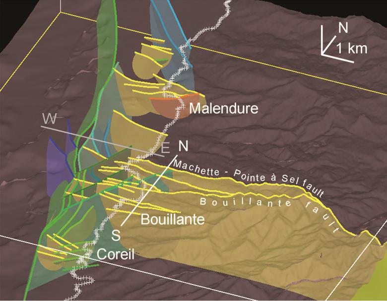
3D land-sea model built from the interpretation of seismic profiles and geological data on land (Bouillante cluster, Guadeloupe).
© BRGM - Calcagno et al. (2013)
A few references
- Acquisition of geophysical data on the coastlines of metropolitan France, French Guiana, the French West Indies, Réunion Island, Mayotte/Comoros and New Caledonia.
- Publication of data in scientific journals, reports and geological maps.
- Geological mapping of the subsurface: Thinon et al. (2008); 1:250,000-scale geological map of the continental margin, Lorient section (Southern Brittany). Eds. BRGM; Thinon et al. (2010); 1:25,000-scale map of the continental margins of Corsica. Eds. BRGM https://doi.org/10.18144/0__df04f43c-e644-4c52-9345-f218e037bac2; Paquet et al., (2016) geological map of the Seine Bay – Pays de Caux based on the 1:1,000,000-scale map of Chantraine et al. (2003).
- Summary maps:
- GEOPAL project: land-sea maps showing the nature of loose sediments, the thickness of loose sediments and the morphology of the bedrock (hard rock) along the Pays de la Loire coastline. BRGM report/RP-62383-FR
- EMODnet project 1 to 5 (2009-2023): contribution to harmonising and disseminating geoscientific data and products (including coastal and marine data) on a European level - EGDI portal: Marine geology - EGDI (europe-geology.eu)
- Surveys of the seabed for the purpose of exploiting mineral resources or for coastline development and protection plans, on behalf of the French government authorities and water management agencies. Examples: Guennoc et al. (2008, BRGM/RP-56579-FR); Stepanian & Thinon (2014, BRGM/RP-64158-FR).
- Projects aimed at improving geological knowledge (geological map, geological log of boreholes, natural risks, etc.) for the purpose of developing offshore wind-farm sites along the Mediterranean, Atlantic and Channel coasts, on behalf of industrial companies and French government authorities. Restricted or confidential reports (2007-2023).
- Projects to improve geological knowledge of the subsurface in order to assess energy (geothermal) or storage (CO2) potential in the Mediterranean basin, New Caledonia and Guadeloupe, on behalf of industrial companies, French government authorities and French regional councils (Grataloup et al., 2012, BRGM/RP-64302-FR; Thinon, 2013, BRGM/RP-61545-FR).
- The Mayotte Volcanological and Seismological Monitoring Network (REVOSIMA doi:10.18715/MAYOTTE.REVOSIMA): joint responsibility for monitoring the seismo-volcanic crisis in Mayotte (BRGM, IPGP) on behalf of the French government.
To find out more
References
Solutions


