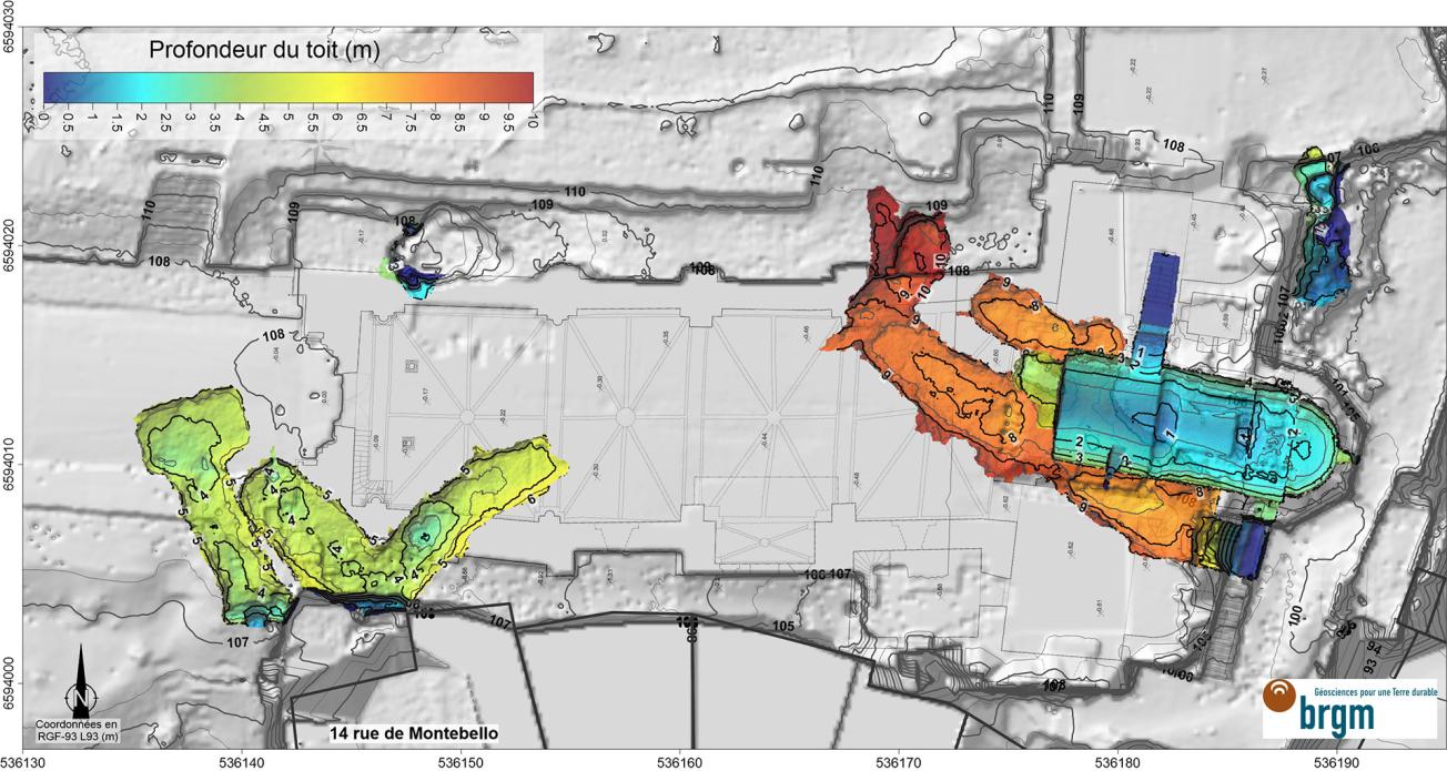
Depth of the roof of the cavities visited, based on the results of the mobile laser scanner survey (Montmorillon, 2021)
© BRGM
The need
A drainage trench was dug along the north wall of the Notre-Dame church in Montmorillon (Vienne département) in spring 2018, as part of a project aimed at consolidating the structure. Following heavy rainfall, a sinkhole appeared at the bottom of the trench, threatening the integrity of the northern wall of the building. Despite various investigations, no clear cavity could be identified, due to the complexity of the site. Consequently, the Montmorillon town council asked BRGM to carry out a specific investigation campaign to identify any cavities under the church.

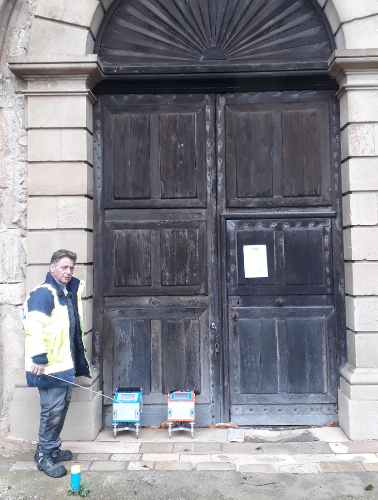
The two gravimeters used for the on-site measurements (front entrance to the church in Montmorillon)
© BRGM - T. Jacob
The results
BRGM conducted a microgravimetric measurement campaign (comprising 306 stations) to identify any variations in gravity that could be detected from the surface in and around the Notre-Dame church, in order to identify any anomalies linked to underground cavities (variations in the masses measured in the subsurface). At the same time, a survey was carried out using a mobile laser scanner. This provided a 3D geometric picture of the site and its known cavities. The 3D laser scanner survey enabled the teams to precisely identify:
- the structure of the church, which is a massive stone building that influences gravity;
- the known and accessible cavities on the site, including the crypt which generates a marked gravimetric anomaly;
- the abrupt (steep) topography of the site, which could produce false anomalies or even conceal the anomalies sought, if not taken into account.
This 3D survey therefore enabled the teams to make the necessary corrections to the gravimetry analyses, in order to obtain a map of gravity anomalies linked to potentially unknown cavities.
Using the results
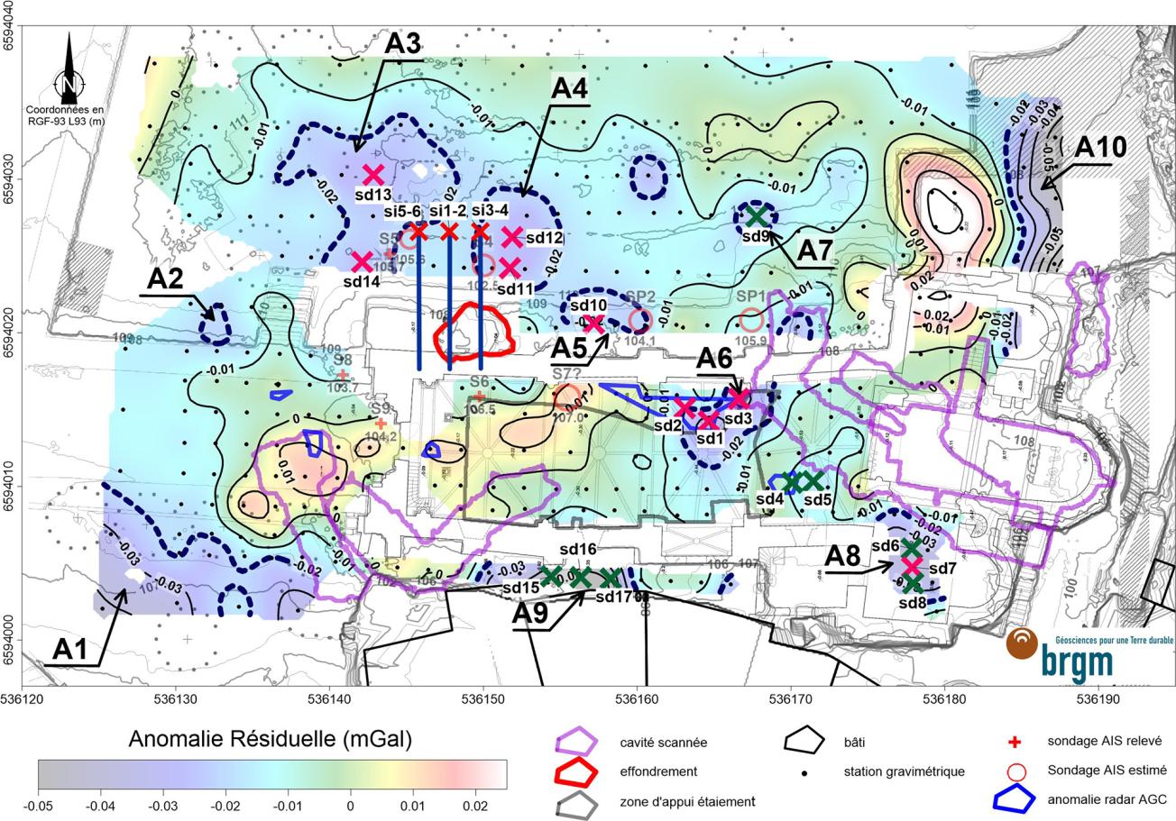
Ultimately, the investigations identified ten negative or "slight" gravimetric anomalies, which BRGM recommended checking further in order to find any cavities, through seventeen destructive vertical reconnaissance boreholes up to an altitude of 98 m NGF (Nivellement Général de la France, equivalent to mean sea level (MSL), nine of which are categorised as being Priority 1. The drilling of three inclined boreholes was also recommended to determine the presence of residual voids under the collapsed zone.
On 21 December 2021, the town council held a public meeting to present a summary of the work and studies carried out on Notre-Dame church since 2018. In 2022, BRGM is continuing to support the municipality (now through project management assistance) to carry out the drilling of destructive test boreholes, along with SONAR or LIDAR measurements if a cavity is actually detected.

Map showing the location of the recommended exploratory drilling on the residual anomaly (Montmorillon, 2021)
© BRGM


