Impact of soil erosion on the urban network in Mayotte - LESELAM.
© BRGM - Grégoire Dectot
Context and challenges
Soil erosion in Mayotte is caused by the impacts of heavy tropical rainfall on unprotected soils:
- in cities and building sites, along road embankments and bare earth roads and in parks and gardens with insufficient plant cover,
- in agricultural areas, fields on medium to steeply sloping ground and fields managed as monocrops without plant cover or mulch,
- in natural areas, forest plots, clear-cut or burned to make way for crops, and badlands (padzas), etc.
High human pressure tends to accelerate soil erosion, for example through poorly regulated urban sprawl, deforestation, the shift from extensive farming (typical multi-crop Mayotte-style gardens) to monocultures that leave soils unprotected. Erosion is exacerbated in the rainy season and poses a serious threat to Mayotte's lagoon, one of the most beautiful in the world.
The LESELAM project was designed to better understand, prevent and remedy these soil erosion challenges in Mayotte.
The LESELAM project’s main objective is to produce the necessary knowledge to address the questions raised by those directly concerned on the ground: What are the main sources of erosion and to what extent do they worsen siltation in the lagoon? How efficient are the remedial measures proposed?
The need
The terrestrial component of the Erosion Roadmap to which the LESELAM project is linked has the following objectives:
- understanding and quantifying erosion processes,
- identifying priority risk areas for the implementation of protective measures,
- prevention and remediation, both in terms of communication and learning, and the use of incentives and regulations.
In order to meet this need, an observatory was set up for three catchment areas representative of Mayotte (natural, agricultural and urban components), with continuous monitoring of rainfall, runoff and erosion. The aim is to quantify erosion, understand the transfer processes, and analyse these processes at different scales, from the plot to the catchment area. A network of plots with runoff and erosion monitoring was set up in forests, on padzas, on slopes, in urban gardens and in agricultural areas, with the aim of not only measuring the impact of different types of land use, but also testing anti-erosion and soil conservation measures.
Achievements of the first two project phases
The LESELAM project included two initial work phases:
- LESELAM 1 (2015–2017), with BRGM, CIRAD, IRSTEA, Les Naturalistes de Mayotte and CAPAM as partners.
- LESELAM 2 (2018–2020), led by BRGM and Les Naturalistes de Mayotte, with subcontractor support from the University of Tours, KERMAP, CAPAM, AGRIKAGNA and ADINM.
Achievements of these two phases included:
- the establishment of an Erosion observatory in three catchment areas, as a basis for assessing erosion throughout the island. The monitoring carried out within the framework of the observatory enabled the calibration of the Watersed erosion model (Landemaine, 2016), which was a prerequisite for modelling sediment exports over all of Mayotte’s catchment areas, implemented for the 2018 benchmark year. After five rainy seasons, the LESELAM observatory has shown a level of erosion that is:
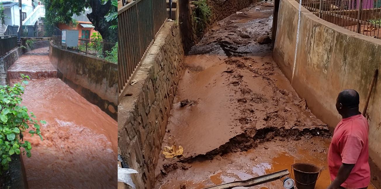
- very high and very dependent on new construction in urban areas, where these do not comply with good practice, in particular the management of embankments during construction on slopes (>10°);
- potentially high in agricultural areas on plots managed as cassava/banana monocultures on sloping soils with weeding, a practice that is increasing to the detriment of the traditional Mahore gardens;
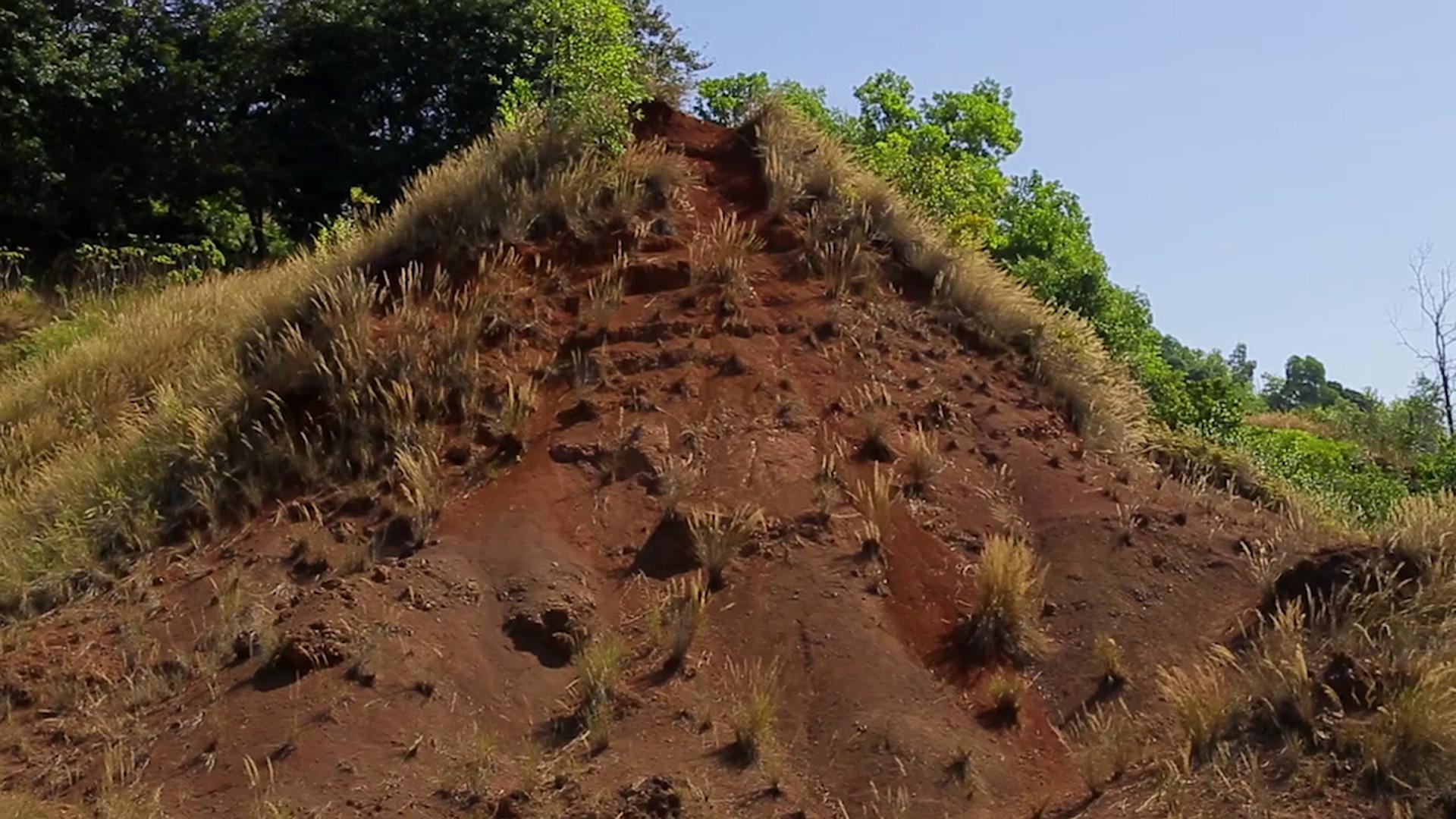
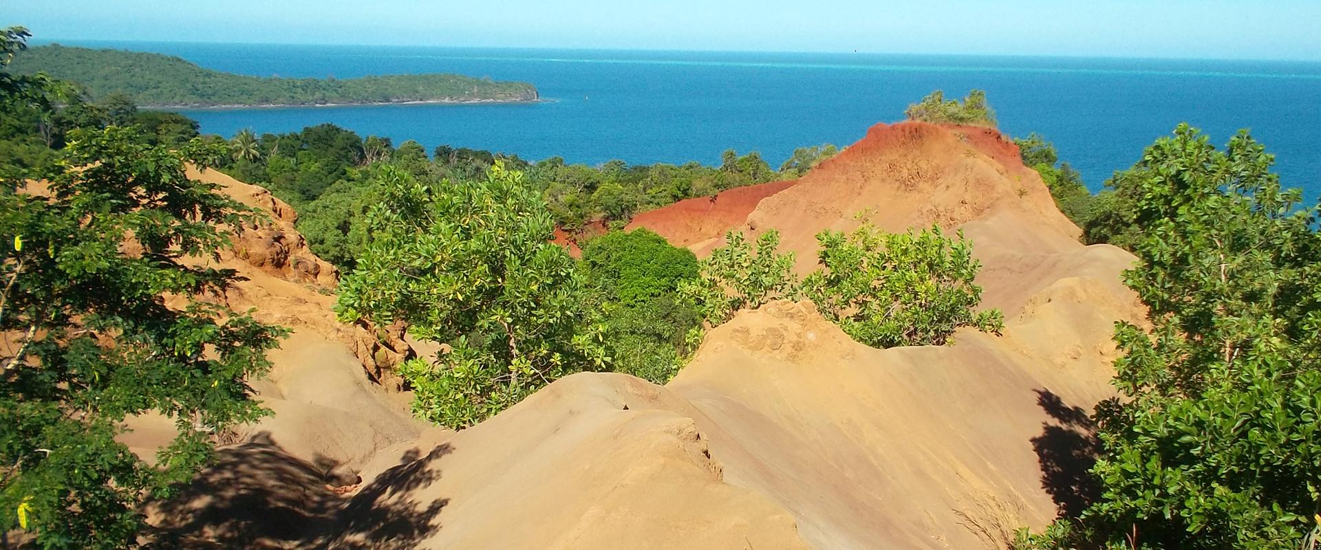
- low to negligible in natural forest areas, but high to very high on padzas, which however only account for a marginal part of the surface of Mayotte.
- the production of three Good Practice Guidebooks (Agriculture, Urban and Ravine).
- work to raise awareness among the population and farmers (films, interventions in schools and associations, etc.).
- a prospective analysis with the setting up of workshops to discuss several possible scenarios for 2035. The scenarios elaborated through this collaborative approach enabled the production of prospective land-use maps and, finally, quantification of the impact of the scenarios on terrigenous exports to the lagoon in terms of erosion. Based on feedback from the LESELAM observatory and this prospective work, a “strategic” memorandum intended for decision-makers, including government departments, has been finalised with the aim of setting priorities for action to deal with erosion in Mayotte.
Combating soil erosion in Mayotte
Transcription
FIGHTING SOIL EROSION AND THE SILTATION OF THE LAGOON IN MAYOTTE MAYOTTE REGIONAL OFFICE
AN EXCEPTIONAL LAGOON
Mayotte's lagoon was listed a marine natural park in 2010. Its exceptional biodiversity makes it one of the planet's most remarkable lagoons. But this biodiversity is threatened due to siltation of sediments from Mayotte's natural, agricultural and urban areas. Mayotte has known big changes throughout its history, mainly agricultural, with major shifts in crop production particularly regarding ylang-ylang and sugar cane crops. But since the '90s, it has seen other kinds of big changes related to its exceptional demography, which has impacted naturally fragile environments. This fragility is based on the island's morphology, with its prevalent sloping surfaces, its tropical climate and intense rains, and its fragile and erodible soil.
THE LESELAM PROJECT
In 2012, the DEAL in Mayotte established a strategy for erosion to try to contain the issue of erosion and siltation in the lagoon. The LESELAM project to fight soil erosion and siltation in the lagoon comes within the scope of this plan, for its objective is to evaluate the inflow of sediments from Mayotte's drainage basin and to accompany individuals and professionals by implementing better conduct to contain this problem. The LESELAM project falls in line with the ENVALAG and SEDILAG projects, which are led by the university centre and Mayotte Marine Natural Park. They all share a common goal: to raise awareness and to develop tools that will hopefully slow down, in the long run, the siltation of the lagoon.
UNDERSTANDING EROSION IN MAYOTTE
In order to understand how erosion occurs in Mayotte, an observatory was set up in late 2015 as phase one of the LESELAM project. To best represent the island's various environments, three different zones were selected. The first, located on Mtsamboro Hill, is 17 hectares. It represents coastal environments, with steep slopes and dense urbanisation. In Mtsamboro, run-off waters are concentrated in the main gully and flow onto the beach across from the Choazil Islands. The second zone is in Dzoumogne, above the drinking water reservoir along the Oua Bandrani stream. It measures 343 hectares and is representative of environments that have both agricultural land and natural forest areas. Here, there are also a few padzas. Finally, the third zone in Salim Bé is located further south. It combines all three components: natural, agricultural and urban.
WHAT MEASURING TOOLS HAVE BEEN ESTABLISHED?
In Salim Bé, the stream right behind me, measuring tools were set up to measure the water level and water flow. We also measure its turbidity, or the level of suspended matter. We've also set up several rain gauges along the drainage basin, both upstream and downstream, for an accurate measurement of the area's precipitation. 15 to 20 mm of rainfall will result in stormwater runoff that converges along river systems and gullies. This cloudy water is a reddish-orange colour, which is characteristic in Mayotte, and which flows into the lagoon. When the water level rises, our automatic samplers collect water samples from the swollen river. They're analysed in a laboratory to determine the concentration of suspended particles. This is then compared to the turbidity measured on site. Since the end of 2015, we have collected data on erosion, rainfall, and run-off for three drainage basins: Salim Bé, Mtsamboro, and Dzoumogne. They provide interesting data on coastal erosion in tropical environments.
WHAT ARE THE OBTAINED RESULTS?
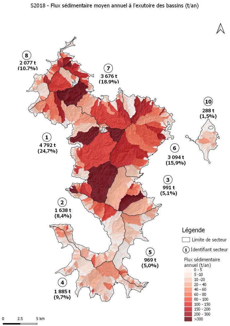
Mtsamboro's basin went from an erosion rate of 1 ton per hectare per year in 2016 to over 16 tons in the last year. The main cause is the advent of self-built infrastructures in periurban areas. Dzoumogne basin's level of erosion is much lower than Mtsamboro's, due to land use being predominantly natural and agricultural and because of its moderate slopes. However, we have seen a clear evolution between 2016 and 2020. The erosion rate was zero over the first two years and has now reached 0.5 to 1 ton per hectare per year. Mayotte's traditional forests, which provide full land-cover, are being replaced by cassava and banana fields on medium-to-steep slopes. Salim Bé's drainage basin has medium level of erosion at 1.5 to 4 tons per hectare per year due to its intermediate characteristics between Mtsamboro and Dzoumogne. The data collected by LESELAM's observatory allows us to calibrate a watershed erosion model over the three basins, which was applied to all of Mayotte's basins to produce a map of sedimentation flux in the lagoon from all of the island's drainage basins. Mapping helps us prioritize the basins by contribution to the lagoon, identify the more erosive basins, and prioritize measures of erosion control, both in urban and agricultural environments.
WHAT SOLUTIONS FOR CONSTRUCTION SITES EXIST?
At LESELAM's observatory, we have established case-control embankments to measure erosion from the building phase to the final phase. Our measurements went from 300 tons per hectare to 110 tons per hectare the first year and from 50 tons per hectare to 10 tons per hectare the following years after plant preservation measures had been established. We also studied various construction sites on the island where we found a lack of slope stabilization and a lack of consideration towards the fight against erosion in both the conception and completion phases. These measures have allowed us to create a guide for good urban conduct. This guide offers simple measures that are adapted to Mayotte thanks to 10 data sheets that mainly address revegetation, protection of building sites, recommendations for each phase, and monitoring to ensure proper construction practice in Mayotte.
EVOLVING AGRICULTURAL PRACTICES
Along with our partners, we established a Wischmeier system that is made up of two segments: one case-study section and one improved section. In the case-study section, we left the crops in place without changing the way things are done on local farms. In the improved section, we introduced certain practices such as adding pineapple hedgerows, mulch, and cover crops. We tracked the evolution to see, in the rainy season, what forms of erosion we'd find. In the last two rainy seasons, the plots in which we maintained traditional farming methods, methods you might find on any farm, typically with monocultures of cassava and bananas, we measured 30 to 40 tons per hectare of sediments. And plots that had pineapple hedgerows and mulch had less than 1 ton per hectare. This proves the efficiency of these methods. People in Mayotte used to have farms with multiple crops on one plot, which held the soil together. But today, they practice monoculture, planting only one type of crop per plantation. This causes a lot of erosion on the plots. Today, people farm wherever they can, even on slopes. This also leads to a lot of erosion.
WHAT ABOUT SELF-BUILD HOUSING?
"Self-build" is the construction of one's individual home. You are both the contractor and the developer. There are no regulation laws for self-building. However, it is important to respect construction and housing codes and to undertake the necessary steps. To fight against erosion in a self-build project, you may, for example, avoid making terraces during the rainy seasons, protect mounds of earth with tarps, and limit this mound of earth's exposure to the elements. We strongly recommend building an evacuation system for collecting run-off water from plantations and roofs.
GULLIES AND STREAMS: FRAGILE ZONES
Gullies and streams play an important role in erosion. They carry sediments to the lagoon. One must not build a home next to a gully and protect these areas with plant cover. A best-practice guidebook was developed to inform you with the proper conduct to protect these areas.
WHAT OF THE STUDENTS OF MAYOTTE?
In order to teach students about ending erosion, educational resources are made available to teachers on the academy's website. It is also a way of working with digital tools and local data. The data collected for this educational project is the result of a beautiful collaboration between BRGM, particularly members of BRGM who participated in LESELAM, and the island's educational community. This exchange between the scientific and educational communities made this data accessible to a wider population. Students may access this digital data and add to it their local environment. This is one of the themes taught in Year 12: erosion and human activity. Students don't always make the connection with erosion, so it is up to the teachers to raise these questions about the reasons behind this heavy erosion in Mayotte and its consequences. Our students see this erosion but have trouble understanding the causes and consequences of this erosion. One of the main difficulties is being able to project into the future and to see the indirect long-term consequences of erosion on the island of Mayotte, whether in terms of subsistence or agricultural resources. Having quantitative data, for example, allows them to better understand this important phenomenon on the island of Mayotte. It is necessary for students and future generations to become aware of this issue to change our methods and preserve our island.
WHAT NEXT FOR THE LESELAM PROJECT?
LESELAM's observatory will continue monitoring run-off and erosion for the next three rainy seasons as part of phase 3 of the LESELAM project. The conservation techniques that were tested during LESELAM 2 will be deployed on larger-scale sites such as Doujani's periurban site or Mro Mouhou's agricultural site. The goal is for the population, primary schoolers, high schoolers, like those at Coconi Agricultural School, farmers, villagers, or community technicians, to start using these methods themselves so that erosion is no longer inevitable on the island of Mayotte and to limit, as much as possible, the siltation of the lagoon.
Use
The LESELAM project links a scientific tool, i.e., a monitoring observatory, the modelling tools developed at BRGM (Watersed) and socio-economic analyses in a prospective work intended to make recommendations for decision-makers who have to introduce measures and regulations to prevent the silting up of the Mayotte lagoon.
In addition, the scientific data acquired by the LESELAM observatory are made available, after processing and validation, in particular to the flood prevention departments of the DEAL (Department of the Environment, Planning and Housing), Météo-France, and the Rectorat.

Thanks to this study we can quantify the phenomenon. On this basis, we are going to communicate better with people to try and get them to change the most harmful practices, for example, to stop leaving the soil bare and to develop mulching and polyculture. The guidebooks that have been developed are very useful and will help us to do this. They need to be disseminated as widely as possible because almost all the inhabitants of Mayotte are concerned.
LESELAM 3 (2021–2023)
A third project phase is under way, involving BRGM, Les Naturalistes de Mayotte, EPFAM and CEA as partners.
As well as the continuation of the LESELAM Observatory, LESELAM 3 will use the data and knowledge acquired to address water-use issues and resulting water conflict in the Dzoumogné basin, share practices in both urban (Doujani) and agricultural (Mro Mohou) areas, and fulfil communication needs at the general (media) or educational level (schools).

Erosion in urban (left), agricultural (middle) and natural (right) areas.
© BRGM
To find out more
-
Access the LESELAM project website
-
What kind of agriculture for Mayotte in 2035? - Assessment of a participatory foresight exercise - LESELAM 2 project
-
LESELAM project (Lutte contre l’Erosion des Sols et l’Envasement du LAgon à Mayotte) [Action against soil erosion and lagoon siltation in Mayotte]. Progress Report No.1 - December 2015
-
LESELAM project (Lutte contre l’Erosion des Sols et l’Envasement du LAgon à Mayotte) [Action against soil erosion and lagoon siltation in Mayotte]. Progress Report No. 2
-
LESELAM project (Lutte contre l’Erosion des Sols et l’Envasement du LAgon à Mayotte) [Action against soil erosion and lagoon siltation in Mayotte]. Progress Report No. 3
-
Hydro-sedimentary monitoring and soil erosion modelling in Mayotte - LESELAM 2 project - Final report


