Mayotte’s spectacular population growth, development needs and demand for new resources and for risk management led to the launch of the GEOMAYOTTE Project to map the geological substructure of the island to 1:25,000.
A particular feature of this operation was the airborne geophysical survey carried out thanks to support from local partners (SGAER1; DEAL2; SIEAM3, Regional Council, BRGM, etc.) and was co-financed in equal amounts by the State and BRGM. GEOMAYOTTE is part of the French Geological Reference Platform for France (RGF) programme.
Coupling natural magnetic field and electromagnetic measurements
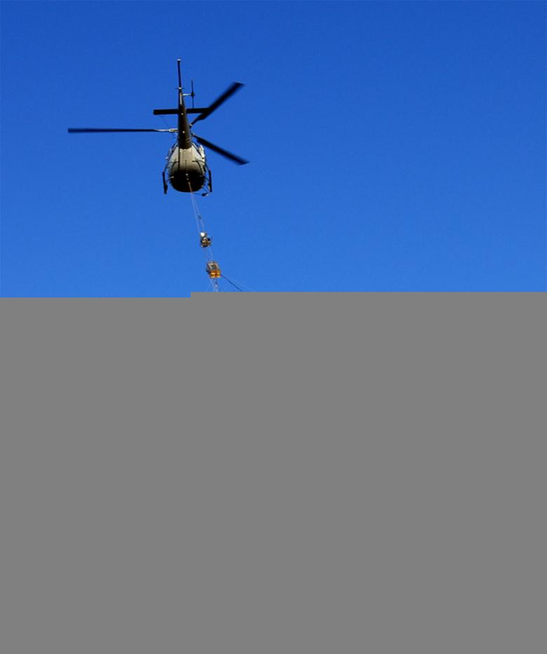
For the first time in overseas France, a helicopter carrying remote sensing instruments capable of identifying the nature of the subsurface overflew the whole of the island of Mayotte during a month-long campaign. The geophysical survey data are now generating a new 3-D rock resistivity map.
The system comprises a 15 m diameter loop moving by helicopter at a height of 40 m above the ground. This is a transmission/ reception survey instrument: the loop transmits an electromagnetic wave that induces a ground response which is then measured by the device. The induced current depends on variations in subsurface electrical resistivity. This socalled electromagnetic method uses the resistivity of rocks to distinguish between massive, compact and resistant rocks and altered, argillaceous rocks soaked or saturated in seawater or freshwater, which are better electrical conductors.
The airborne system also has a magnetometer to measure local natural magnetic field variations induced by the mineral characteristics of certain rocks present in the ground. This method is currently used in geology for mapping rocks to depths of up to several kilometres.
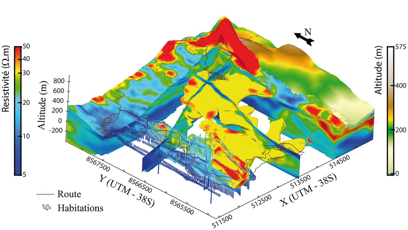
Resistivity model of the island of Mayotte (right) and 3D characterisation of a potentially water-bearing (yellow mass) volcanic flow system (left), built up with electromagnetic data from a heliborne survey.
© BRGM - Jacques Deparis
A 3D model : a depth of 200 meters
All of the data were processed and analysed by BRGM and the University of Aarhus in Denmark, which is working with SKYTEM, the designer of the airborne system. Through several ongoing hydrogeological projects on risks and materials on the island, the team demonstrated the reliability of the geological model at a depth of 200m.
The geophysical data were used to draw up a geological map of the island’s volcanic and surface formations. This was a major contribution to the mapping of volcanic bodies under a thick regolith layer and to the characterisation of the nature and thickness of the island’s surface formations.

