Very high-resolution seismic acquisition campaign on the Guadeloupean island shelf (Guadeloupe, 2021)
© BRGM
The need
The low sandy coasts around Guadeloupe are particularly vulnerable to erosion. It is estimated that approximately one third of the beaches in Guadeloupe show an erosion trend over the period 1950-2013. Beach nourishment reinforces the natural protective role of beaches as barriers against extreme events. This type of management has the particular advantage of not disturbing the hydro-sedimentary dynamics, while preserving the attractiveness of the sites and maintaining the ecological functions associated with these vulnerable environments. However, one of the limitations on implementing this management method concerns the identification of sediment stocks from which sand can be taken.

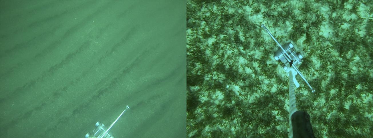
Examples of underwater photography of the island shelf (Guadeloupe, 2021)
© BRGM
The results
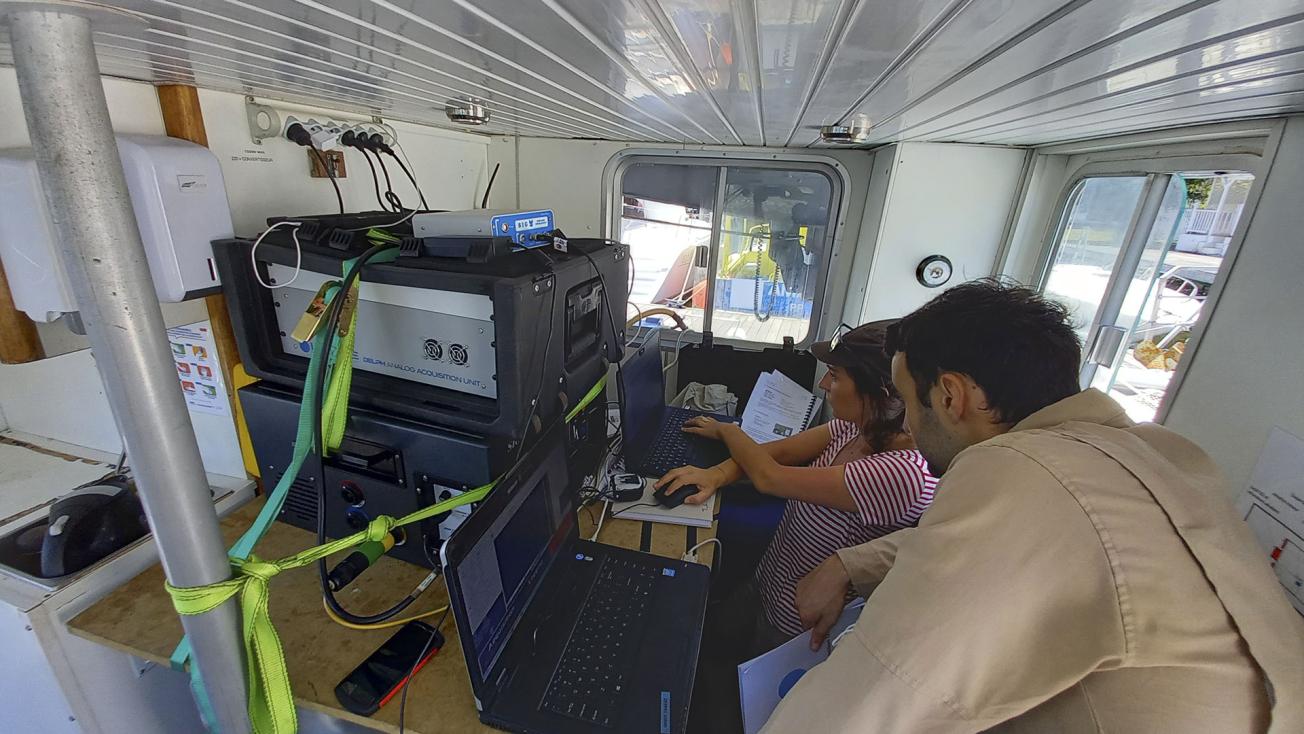
The BRGM study is a synthesis of what we know about the surface formations of the island shelf as well as an analysis of the vulnerability and accessibility of sandy deposits on a regional scale. A marine seismic campaign was also carried out in May 2021 with the aim of better characterising the geometry and nature of the sandy formations to the south of Grande-Terre and to the east of Basse-Terre. During this campaign, 69 very high-resolution seismic profiles (covering a stretch of about 100 km) were acquired, from the coastline to depths of 40 m, and about 100 sediment samples were collected by grab sampler.
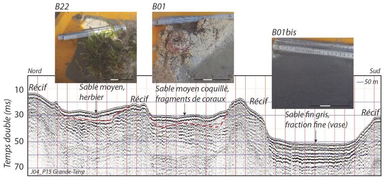
The interpretation of the results reveals the disparity in the distribution of sandy sediments on the island shelf in terms of their type and geometry. Thus, a thin surface cover of coral sands has been identified south of Grande Terre, with local areas of accumulation of medium to coarse sands along the beds of old channels and finer sands in deeper depressions (between 30 and 40 m). In the Petit-Cul de Sac Marin sector, a significant sandy cover has been identified to the south of the commune (municipality) of Gosier. Finally, on the shelf located to the east of Basse-Terre, sediments of volcanic origin have been identified, more heterogeneous both in cover and in the nature of the sandy deposits.

Example of a transverse seismic profile representative of the south of Grande-Terre off Saint-François and an illustration of the successive accumulation zones and the heterogeneity of the deposits with a photograph of the associated sediments
© BRGM
Using the results
These results have extended our knowledge of the distribution of surface formations and, more broadly, the geology of the Guadeloupean island shelf. The nature and geometry of the sandy deposits were characterised on two sides of the island. All the data acquired during the study will be used to implement local coastline management strategies by identifying potentially favourable extraction areas for beach nourishment operations.
The partners
- Guadeloupe Direction de l'Environnement, de l'Aménagement et du Logement


