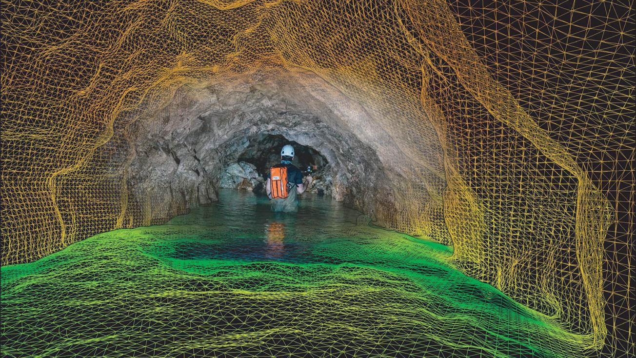
3D scan of an underground gallery (Haute-Vienne, 2018).
© BRGM - Silvain Yart
The French Geological Survey (BRGM) was created on 23 October 1959 by the merger of several French geological and mining institutes and is now one of the world’s leading institutes in the field of subsurface knowledge and technology. BRGM’s expertise meets identified needs, such as the characterisation of strategic metals at the request of French and European authorities, the development of geothermal energy and the modelling of underground space to prevent accidents due to natural or anthropogenic hazards. In the light of phenomena such as increasing population density or the development of new energies, the role of the subsurface could become increasingly relevant in the coming decades.
In 2019, the establishment changed its organisation to better anticipate new challenges. BRGM is now focussing on six major issues: groundwater management, geology and subsurface knowledge, the use of underground space in the context of energy transition, risks and spatial planning, mineral resources and the circular economy and digital data and services.
Development of its core professions to meet current and future challenges
As the French geological survey, it focuses on scientific research, support for shaping public policy and international cooperation. As one of the Carnot Institute’s, BRGM undertakes research under contract with industrial sectors and businesses of all sizes. Located in Orléans-La Source, BRGM’s headquarters house laboratories for making complete transversal analyses of the surface and subsurface. The teams at the technical centre provide support to the regional departments, which are frequently called upon by the authorities to manage risks. BRGM also has a vast international network, which makes it one of the world’s leading players in geological expertise. With its two subsidiaries, Iris Instruments and CFG, it also has its own resources for developing geophysical instruments and geothermal project management.
BRGM continues to expand its organisation for its core professions. Its laboratories are thus being enlarged to accommodate an original pilot hall for studying the transport of pollutants in the subsurface. In addition, France’s Geological Reference Programme aims to cover the entire national territory with a three-dimensional views of its subsurface to a depth of about 3 kilometres. Another project under development is the creation of a groundwater forecast system to predict the level of groundwater reserves 6 months ahead.
In 2018, BRGM employed 1061 people and its income amounted to 135.8 million euros.
A history that goes back a long way
BRGM is the result of two centuries of pioneering geological exploration and administrative developments. In the 18th century, as an increasing number of researchers in Europe discovered the characteristics of rocks and tried to understand how they were formed, the French medical doctor and mineralogist Jean-Etienne Guettard published A mineralogical survey and map of the type and location of terrain underlying France & England (1746). This was the first attempt at a geological map, a field that now accounts for a significant part of BRGM’s activity. In 1868, growing interest in understanding and mapping the subsurface led to the founding of the Service de la carte géologique de la France [French geological mapping service].
Concurrently, mineral prospecting was developing rapidly to provide the materials needed for the industrial revolution. In the 20th century, BRGM’s direct ancestors were established in mainland France and in the colonies. In 1959, they merged into the BRGM, the French geological survey organisation. In 1965, teams from different backgrounds gathered at the newly inaugurated technical and scientific centre at Orléans-La Source. It now houses more than 800 people. As an undisputed specialist in the discovery of metal deposits BRGM evolved in response to the expansions and crises of the mining sector, before selling most of its holdings from the 1990s onwards.
Its geological expertise was also called upon for the development of geothermal energy, major underground works such as the Channel Tunnel and the characterisation of ground movements. From the 2000s, it made a strategic shift by moving into issues related to the environment and risk prevention (soil pollution, groundwater modelling and management, climates change impact studies, management of former mining sites, etc.), while maintaining extensive geological and cartographic expertise.


