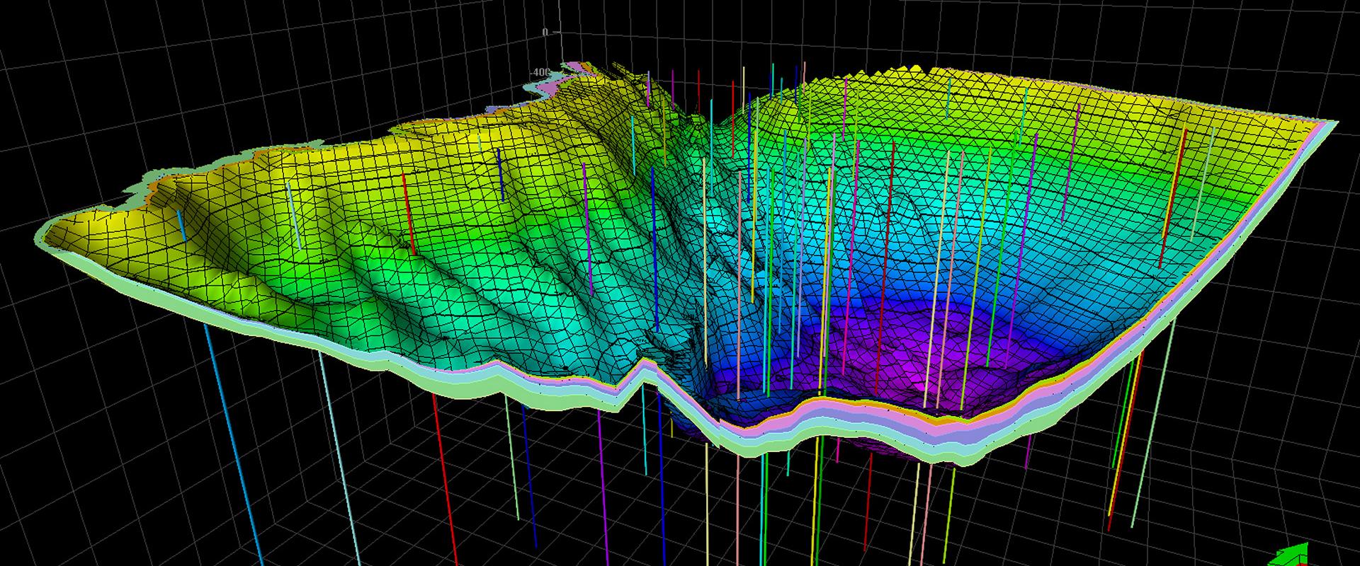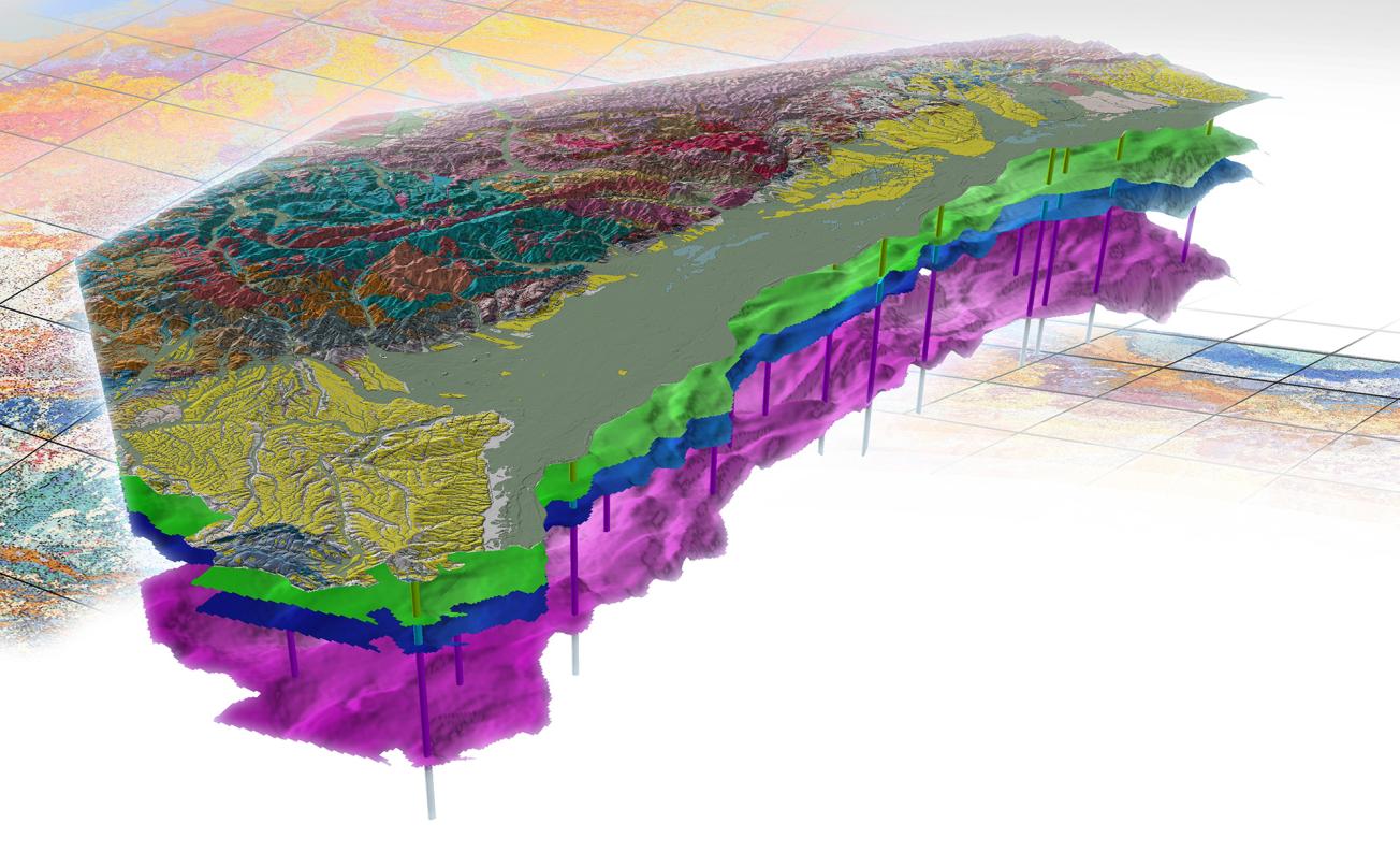
3D view to the north-west across the Alsace plain and the Vosges Range.
© BRGM - D. Rambourg
The French Geological Reference Platform (RGF), designed by the BRGM, is a national programme for the acquisition and management of geological data that involves the entire French geosciences community (university laboratories, companies, etc.). The RGF programme is the BRGM’s number one priority for the coming decades.
A geological information system in 3D
Following on from the 1/50 000 geological map of France, the RGF takes two-dimensional scientific information to a new level of knowledge of France’s geology, on multiple scales and in three dimensions, moving on to the fourth dimension to show its evolution over time.
The RGF will incorporate and harmonise a vast amount of data on the subsurface in France, complementing the 1/50 000 geological map data and the subsoils databank (BSS). New geological and geophysical surveys are also planned to complete existing data.
The RGF data will be incorporated into a collaborative information system designed to exchange, circulate and access geoscientific knowledge.
An innovative research and decision-support tool to address major issues for society and the economy
The RGF is designed as a knowledge platform to support needs for information, decision-making and education. It is intended for use by professionals in planning, economic sectors, environmental management and education, as well as by civil society organisations and the general public.
The new knowledge on subsoils acquired through the RGF will support innovative responses to a wide range of issues facing our society: surface and subsurface planning, managing water and mineral resources, energy prospecting and storage, waste storage, risk prevention, protecting people and the environment, etc.
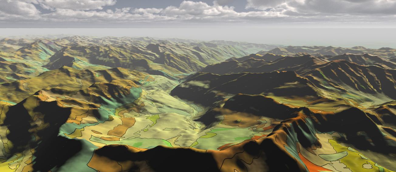
Extract from the RGF 1:50 000 geological map of the Pyrenees draped over a digital elevation model (Pyrenees, 2015).
© BRGM
A scientific challenge and an investment for the future
The French Geological Reference Platform is a major scientific and technical challenge that addresses the goals of the European “Inspire” Directive for the implementation of a Europe-wide infrastructure for geographic, environmental and geological information.
The issue is to characterise, understand and describe France’s subsoil over time, and to meet our needs for knowledge, uses and management of the subsoil. This is an important and ambitious scientific undertaking that demands input from the entire French geoscience community.
The aim is to establish an overall geological information system to build on and circulate knowledge among all interested users. It will further improve the efficiency of geological studies for the benefit of the State, local areas and businesses.
Regional work programmes
The RGF is a multi-annual programme that will be deployed in stages across France through regional work programmes.
An initial demonstrator was carried out in 2013 on the Vosges-Rhine Graben. It was used to finalise a coherent methodology for applying the RGF across the whole of France.
Several regional RGF work programme have followed, in the Pyrenees, the Alps and peripheral basins and the Paris Basin.

