The need
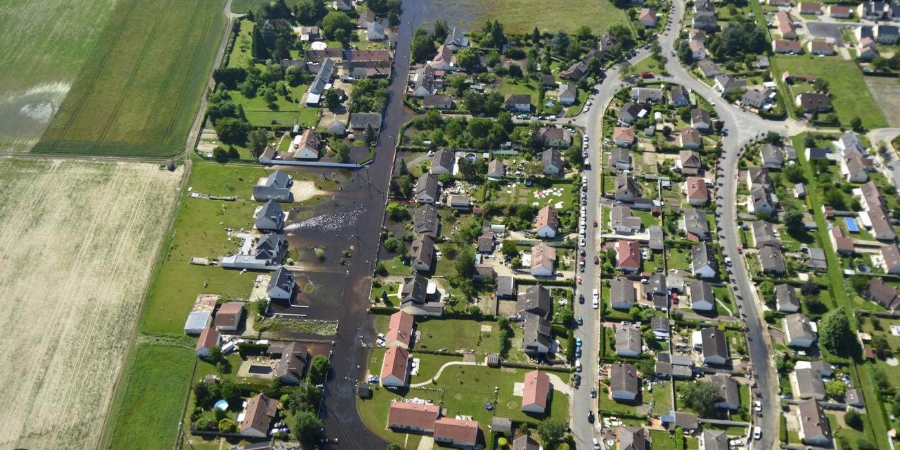
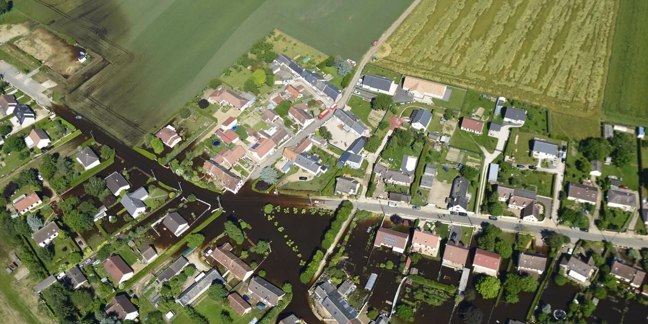
From 30 May 2016, the municipalities to the north of Orléans suffered exceptional flooding for more than a week, leading to road closures (including the A10 motorway) and extensive damage (including collapses). Following these events, the General Council for the Environment and Sustainable Development (CGEDD) recommended that a hydraulic and hydrogeological study of the catchment area be carried out in order to gain a better understanding of its hydrological functioning, particularly the role of its chasms, and to issue recommendations for its development. Under the direction of the local authorities (Orléans Metropolitan Area, Beauce Loirétaine Group of Municipalities, La Forêt Group of Municipalities), COFIROUTE and the Loiret DDT, two studies were initiated, one by BRGM for a physical study of the catchment area upstream of Cercottes and the other by CEREMA for hydraulic modelling of the flooding risk between Cercottes and Bricy.
Results
Situated on a sandy clay substratum, the Retrève is poorly known and its functioning poorly understood. Contrary to popular belief, its exceptional and infrequent overflows (two overflows as far as Gidy in the last 50 years) are not due to the karstic functioning of the Beauce aquifer, but to runoff from exceptional rainfall (the rainfall on 30 May 2016 was more intense than any expected once in a hundred years) on soil that was already waterlogged and not very permeable. This was shown by the BRGM study, which mapped the characteristics of the soils with regard to run-off and infiltration and estimated the flow rates of the river as it exits the Orléans forest, for different rainfall return periods. These flow rates also constitute the input data for the hydraulic model developed by CEREMA.
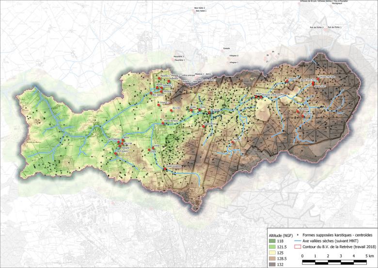
At the same time, given the role of the karst in the hydraulic functioning of the sector, BRGM carried out an innovative inventory of karstic phenomena, which are widespread in the Orléans Forest. By interpreting the LiDAR (digital terrain model with altimetric accuracy to within one metre), more than 800 karstic features were counted, nearly a hundred of which are chasms that have been checked out by speleologists.
Flooding in spring 2016
Using the results
On the basis of the results, CEREMA built a hydraulic model focusing on the reconditioning of crossing structures and the impact of any obstacles on the path of the floodwaters, and also to demonstrate the role of chasms that absorb water and mitigate the flooding. The conclusions of the study provide recommendations for the maintenance and monitoring of these chasms, which can be used as warning stations upstream of sensitive areas.
Partners
- Orléans Metropolitan Area, Beauce Loirétaine Group of Municipalities and La Forêt Group of Municipalities
- COFIROUTE
- DDT
Public reports
-
Hydraulic and hydrogeological study of the Retrève catchment area. 1: Inventory and analysis of karstic features. Final report
-
Hydraulic and hydrogeological study of the Retrève catchment area. 2: Surface lithology mapping. Final report
-
Hydraulic and hydrogeological study of the Retrève catchment area. 3: Underground drainage. Final report
-
Hydraulic and hydrogeological study of the Retrève catchment area. 4: Hydrology. Final report


