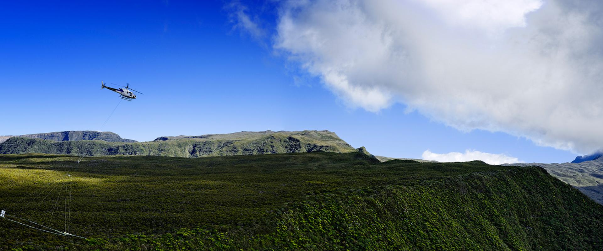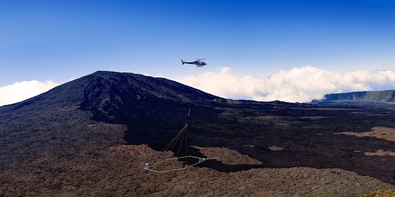
Heliborne geophysical survey of La Réunion.
© BRGM - René Carayol
Over the past decade and more, BRGM has developed expert capacity in acquiring and processing geophysical data (electromagnetic, magnetic and gamma-spectrometry data) using airborne tools.
Airborne geophysical imaging provides a continuous view of the surface and subsurface geology down to a depth of several hundred metres, from the regional to the local scale.
Depending on the sensors on board an aeroplane, helicopter or drone, several subsurface characteristics can be studied simultaneously at different depths and on different scales, quickly and despite forest cover or difficult access.
This is a valuable decision-making tool for raw material exploration, risk and land-use planning, assessment and management of groundwater resources or for underground energy extraction.
Fields of application
Mineral resource prospecting
- Mapping of basement kaolin potential by means of airborne gamma-ray spectrometry;
- Regional to national maps of favourable mining sites, produced by airborne magnetic and gamma-ray spectrometry;
- Assessment of the solid rock potential of particular areas by helicopter electromagnetic surveys;
- Geophysical reconnaissance by drone of mineral deposits or materials on the scale of a mine or quarry.
Geothermal and other energy, storage
- Geological characterisation of deep geothermal targets by gravimetric and aerial magnetic surveys;
- Support for geological exploration of hydrocarbon reservoirs.
Water resources
- Salt water intrusion imaging to assist in water resource management in coastal areas;
- 3D modelling of aquifers in basement, volcanic, sedimentary and karst contexts, etc.;
- Helicopter-borne electromagnetic surveys to assist in locating water boreholes.
Risk management and spatial planning
- Reassessing maps of ground movement hazards using data from helicopter-borne electromagnetic surveys;
- Decision-making assistance in the choice of storage sites for non-hazardous waste.
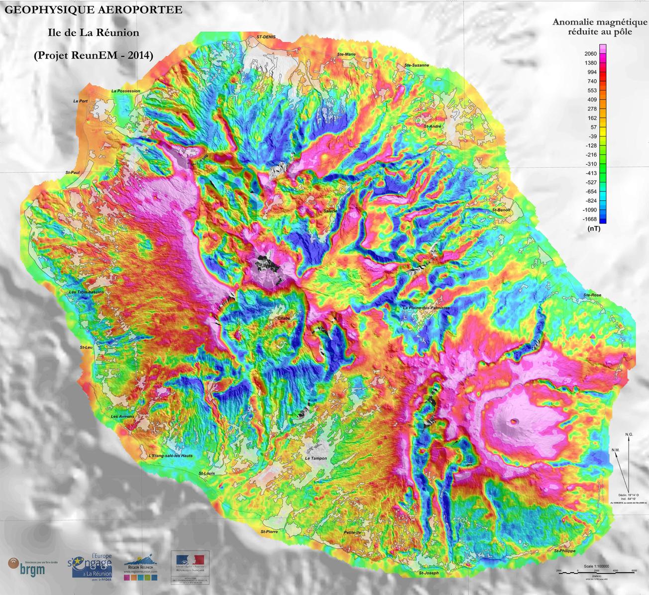
Magnetic Anomaly Map (Reunion Island, 2014).
© BRGM
Available resources
Technical resources
- Heavy airborne geophysical survey methods: technical control of acquisitions (subcontracted) to ensure the best choice of technique(s) and carrier according to the requirements:
- Gamma spectrometry surveys (natural U, K and Th radioactivity): cartographic interpretation – nature and physical-chemical properties of the parent rock, the regolith and the soils;
- Electromagnetic surveys (resistivity): 2D and 3D models of the top 300 metres of the subsurface;
- Magnetic surveys (Earth’s magnetic field): 2D and 3D modelling of the magnetic properties from the top few hundred metres to kilometres of the subsurface;
- Gravimetric surveys (terrestrial gravity field): 2D and 3D modelling of densities in the top few kilometres of the subsurface.
- Implementation of high-resolution magnetic surveys by drone, advanced processing and interpretation.
Digital Tools
- Software system for data processing, interpretation and modelling using Geosoft, Aarhus WB, 3D-Geomodeller and BRGM software.
Human resources
A team of 5 expert geophysicists for:
- Preparing and implementing airborne geophysical surveys;
- Production of geophysical parameter maps and models;
- 2D/3D interpretation of subsurface structures and geology.

