Corsica is the fourth largest island in the Mediterranean in terms of surface area (8,680 km2) and has a population of 330,000. Approximately 4.5 million tourists visit the island each year.
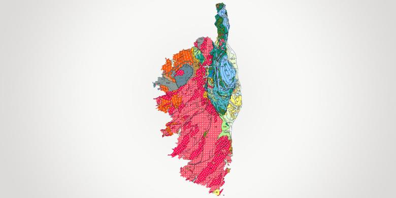
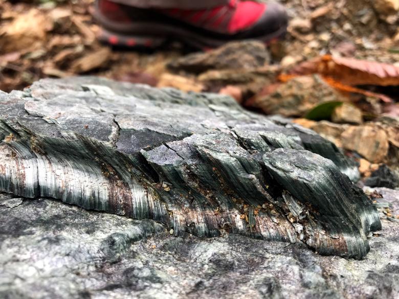
Corsica is a mountainous island with granite (Hercynian Corsica) and metamorphic (Alpine Corsica) bedrock, along with some sedimentary basins and alluvial formations. The ophiolitic formations of Alpine Corsica are rich in asbestos, representing a possible local health risk for the populations concerned. Groundwater is exploited primarily for drinking water, particularly in the case of the aquifers located in the alluvial formations of the coastline. The compartmentalised aquifers of the metamorphic and granite formations contain substantial water resources which form an important part of available groundwater supplies. The coastlines are subject to erosion and flooding, particularly along the eastern plain, and along the many small beaches and bays of the island. Coastal recession is moderate and associated primarily with storm events. Nevertheless, given the concentration of potential problems (which might affect housing and activities) along the coastline, regular monitoring is required, particularly in the context of climate change. Land movements (boulder falls, landslides and gully erosion) affect mountain areas and coastal cliffs, with an increased risk during the wildfires that may occur in Corsica. Established in Corsica since 1979, BRGM provides input for shaping public policies in these areas and more particularly in relation to coastal risks, environmental asbestos, groundwater resources and gravity risks.
Partners
- Local and regional authorities: Corsican authorities and offices, the OEC, the OEHC and the ODARC, groups of municipalities (CAB, CAPA), municipalities (Corte, Bastia, Galéria and others), municipal or inter-municipal services (Acqua Publica).
- Government departments, agencies and public institutions: Prefectures, DREAL, DDTM, DIRECCTE, Rhone-Mediterranean-Corsica Water Agency, OFB, ADEME, the Conservatoire du Littoral.
- Private, other: EDF, Centre de Recherche Viti-vinicole Insulaire.
Practical information
To find out more
What's new in Corsica?
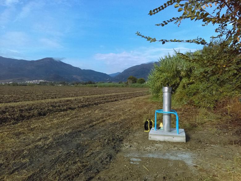
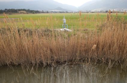
Creation of an artesian borehole equipped with instrumentation as part of the project to characterise the resources available in the Bevinco hydrosystem.
© BRGM - Marie Genevier
Groundwater management: management of resources
In Corsica, 50% of the drinking water supply comes from groundwater, captured mainly by drilling in the coastal alluvial aquifers.
The quantitative status of the groundwater is monitored by BRGM as part of a national agreement with the OFB biodiversity office or, more occasionally, to support water resource operators. This process relies on boreholes or piezometers, which are monitored as part of specific hydrogeological projects. BRGM also supports the Water Police and water resource managers, as well as developing hydrogeological models to find out more about available resources and ensure their sustainable management. A project was set up recently to update knowledge of available and usable groundwater resources in the Corsican basin, in order to provide solutions for rational resource management.
Geology and knowledge of the subsurface: data acquisition and distribution, support for stakeholders
Since 1979, BRGM has collected a wide range of data on Corsica's subsurface and made it available via the infoTerre portal. These data include geological maps of Corsica and of over 4,000 underground structures.
Recently, BRGM drew up the first 1:5,000 scale maps of environmental asbestos hazards in the municipalities of Haute-Corse (including the greater Bastia area and Corte). Similar maps will be drawn up over time for all the municipalities concerned in the Haute-Corse département. BRGM also conducts expert appraisals and preliminary project studies, the main objective of which is to identify the occurrence of asbestos, as recommended in the INRS guide. Training sessions are also conducted for our partners concerning environmental asbestos hazards. At the same time, BRGM is involved in updating predictive mapping of the radon exhalation potential in Corsica.
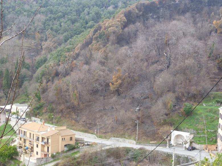
Increased risk of ground movement (after a fire) threatening a dwelling in Cervione.
© BRGM - Baptiste Vignerot
Risks and spatial planning
Prevention of geological hazards
In order to forestall the risks related to ground movements, BRGM may be called upon to conduct urgent spot diagnoses, as was the case on the popular GR20 trekking route in 2015, or after storm Fabien in 2019.
At the same time, BRGM is mapping ground movement risk prevention plans (PPRs) for regulatory purposes concerning the most exposed municipalities. Finally, BRGM is providing multidisciplinary expertise for complex studies, such as the study underway with INERIS and CEREMA on the stability of the pillar supporting part of the citadel of Bonifacio.
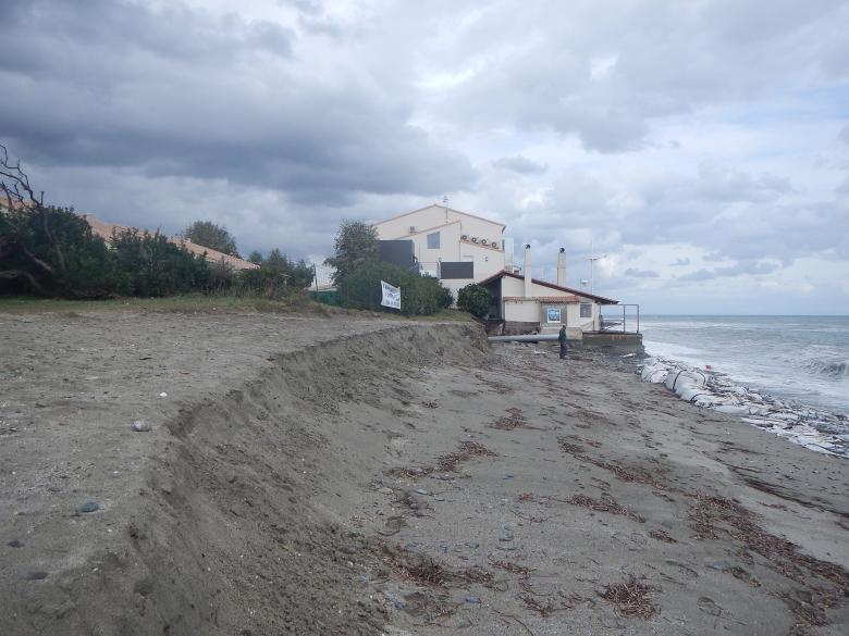
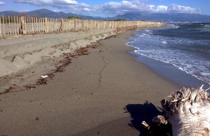
Retreating coastline (Moriani, municipality of San Nicolao) - the impact of storm Adrian of 29 October 2018.
© BRGM - Thibault Laigre
Prevention of geological hazards
As part of the Corsican coastal observation network (ROL), BRGM is conducting an annual campaign of topobathymetric measurements of the Corsican coastal area, and developing innovative approaches for better coastal management. Consequently, cameras were installed to monitor the beaches of Calvi, Moriani and Bastia as part of the European Maregot programme in 2017-2020.
BRGM is contributing its expertise to the definition of low-lying areas potentially exposed to coastal flooding in Corsica. Complementary dynamic approaches will be implemented on key sites such as the Gulf of Ajaccio.
BRGM set up and manages the ROL internet portal, for displaying and monitoring changes to the coastline.


