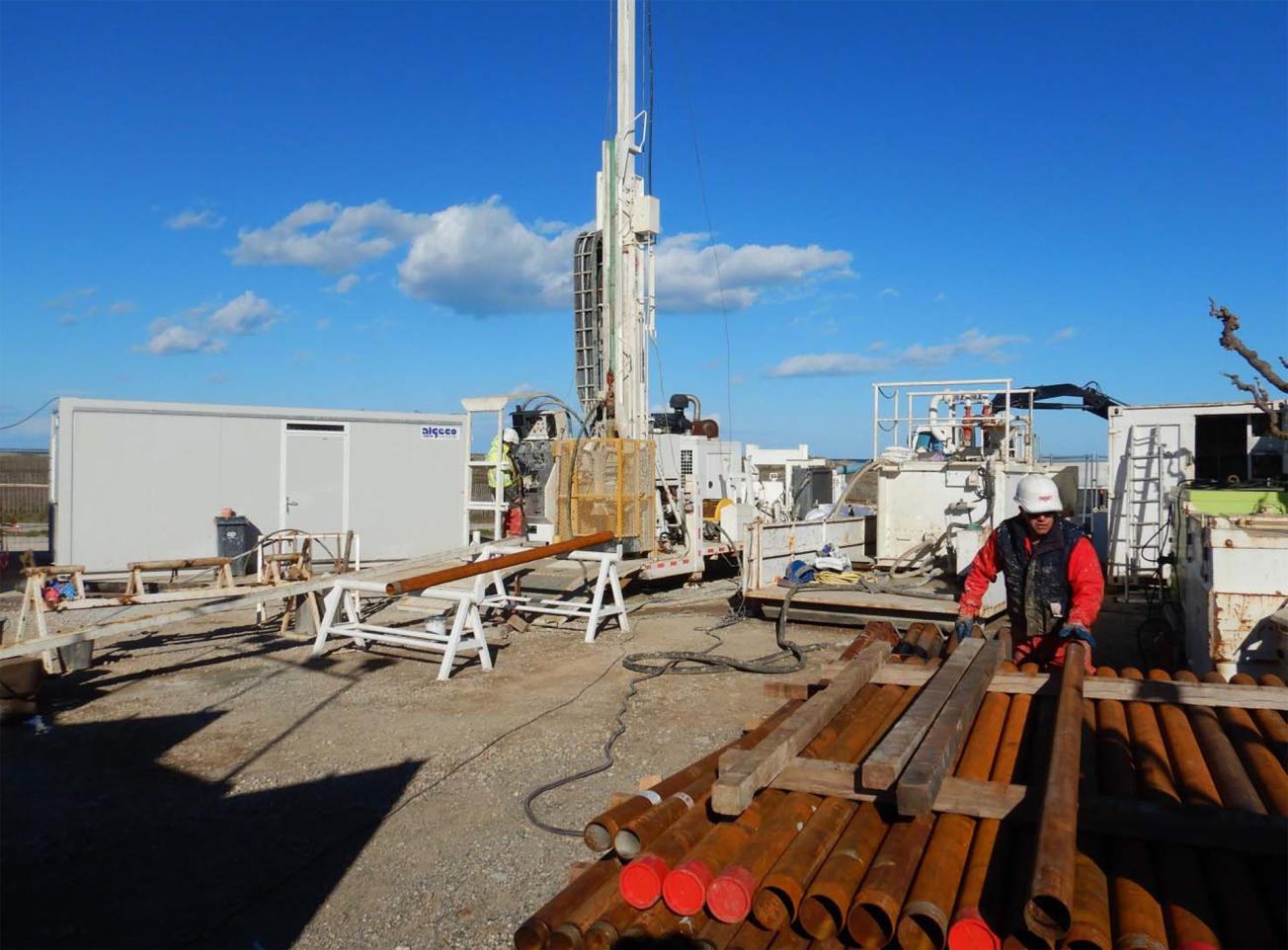
View of the borehole works on the Canet-en-Roussillon site.
© C. Duvail – FUGRO
The Plio-Quaternary aquifer of the Roussillon plain provides drinking water for 400,000 inhabitants, i.e. for over 85% of the population in the Pyrénées-Orientales département. This groundwater body is therefore an essential resource that needs to be managed collectively. Today, too much water is being extracted and this has led to a drop in the level of the deeper water tables over the last few years, resulting in shortages. When the aquifer is close to the sea, sea water can get mixed in, if the resource is over-exploited through pumping. Protecting this aquifer as a resource is therefore crucial but cannot be addressed unless the scientific knowledge of the groundwater system is significantly improved in order to develop a real-time management tool.
In order to improve our knowledge base and find solutions for protecting this resource, the local authorities (Departmental Council, Urban Community Council, the Occitanie Regional Council), the Syndicat mixte des nappes du Roussillon (Public-Private Syndicate for the Management of the Roussillon Aquifer) and the Water Agency have teamed up as part of the Dem'Eaux Roussillon research project, the aim of which is to acquire geological and hydrogeological data so as to improve our understanding of how the aquifer works.
Launched in December 2016, the project has already resulted in initial moves to pool and coordinate available geological and hydrogeological data. This summary has identified gaps in our knowledge base that need to be filled. To do this, two exploratory boreholes are being drilled:
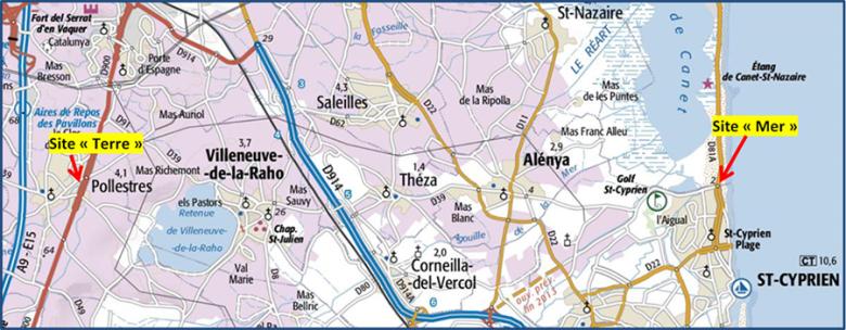
- Work on the first borehole (coastal site), located in the municipality of Canet-en-Roussillon, began on 26 February and will continue until October 2018.
- The second borehole (inland site), located in the municipality of Pollestres, should be drilled between April and June and be completed in December 2018.
The objective of these boreholes is to acquire samples of the geological formations crossed. This will provide a better understanding of the geometry of the deeper water tables and their hydraulic characteristics. They will also provide information about the exchanges that take place between surface and deep groundwater bodies.
This experimental phase will help us acquire a better understanding of the underground flows and the exchanges that occur between land and sea (which affect the risk of salt-water intrusion), and characterise the recharge areas for the Plio-Quaternary aquifer.
A complex, vulnerable and little-known aquifer
Located in one of the most arid regions of France, with an annual rainfall of 570 mm, the Plio-Quaternary aquifer is made up of many superimposed layers up to 250 m thick, through which the groundwater flows. This resource plays a key role in the urban and agricultural development across the Roussillon plain. It is therefore crucial to protect the aquifer, but this cannot be achieved without substantially improving our scientific knowledge of the aquifer system. There are still a number of questions that need to be answered: How far does the reservoir extend under the sea? Is the water in these zones fresh water? How will groundwater resources be affected by climate change in the future? How will water needs evolve? How can we make best use of new technologies to develop a real-time management tool? These questions are central to the research conducted by the partners in the Dem'Eaux Roussillon project.
What is an aquifer?
Geological formations that contain exploitable groundwater are called aquifers. An aquifer is a container, the groundwater is its content. Groundwater bodies are not underground lakes: the water that circulates in them actually occupies cavities in the rock (pores, cracks, fractures).

Project co-financed under the ERDF-ESF 2014-2020 Languedoc Roussillon Operational Programme.
Project co-financed under the ERDF-ESF 2014-2020 Languedoc Roussillon Operational Programme
About the project
The Dem'Eaux Roussillon project will last until 2020. It involves research organisations (BRGM - the coordinator; Irstea, the Universities of Montpellier and Perpignan Via Domitia), companies specialised in geosciences (BRL Ingénierie, Fugro-GEOTER and YellowScan) and in computer science (Synapse), as well as the region's water-management authorities (Syndicat Mixte des Nappes de la Plaine du Roussillon [Public-Private Syndicate for the Management of the Roussillon Aquifer] and Syndicat Mixte du Bassin Versant de la Têt [Public-Private Syndicate for the Management of the Têt Catchment Basin]) and local authorities (Pyrénées-Orientales Departmental Council, Urban Community Council, Regional Council). The breakdown of the project funding is as follows: 20% by the French Government and the Occitanie/Pyrénées-Méditerranée Regional Council (within the framework of the 2015-2020 State-Regional Planning Contract), 15% by Europe via the ERDF, 15% by the Rhône-Mediterranean-Corsica Water Agency, 5% by Perpignan Méditerranée Métropole Urban Community Council and 3% by the Pyrénées-Orientales Departmental Council. The remaining 42% of the project's funding comes from contributions made by the majority of the partners.


