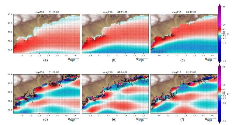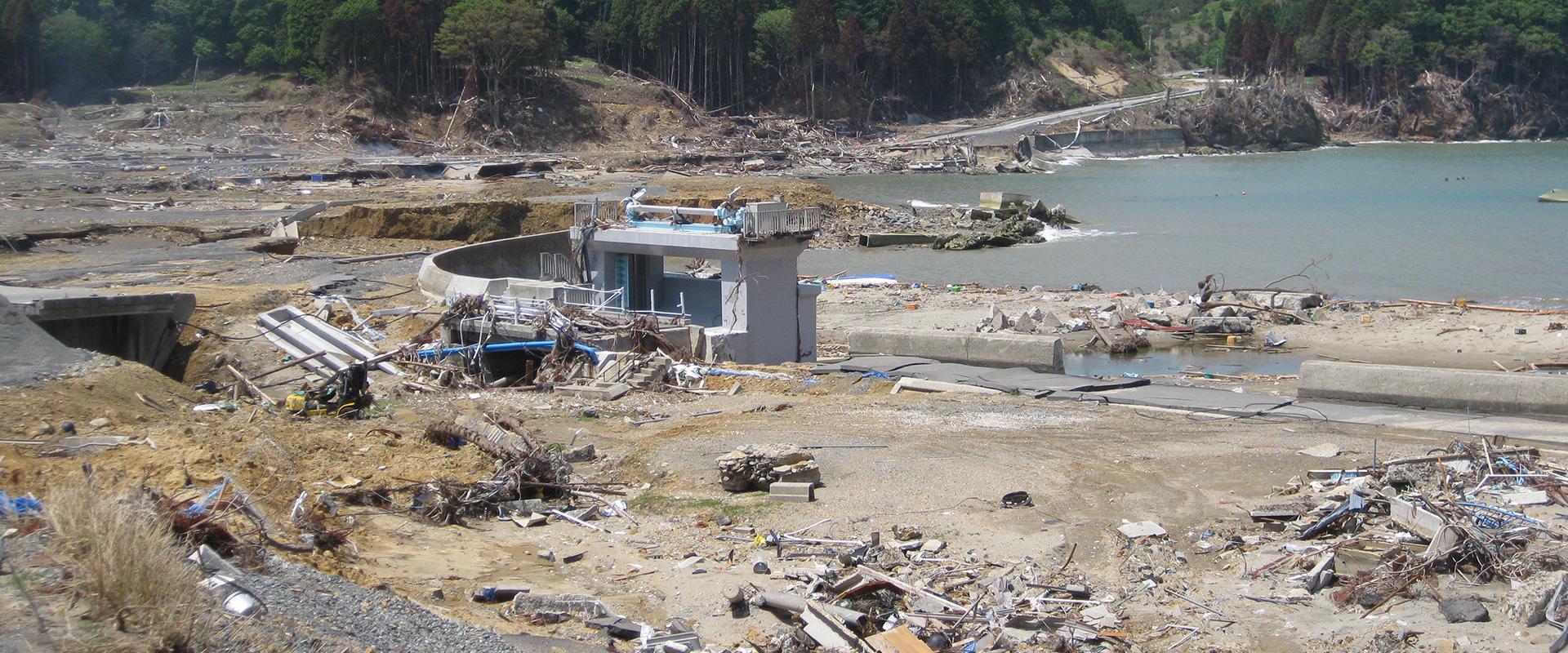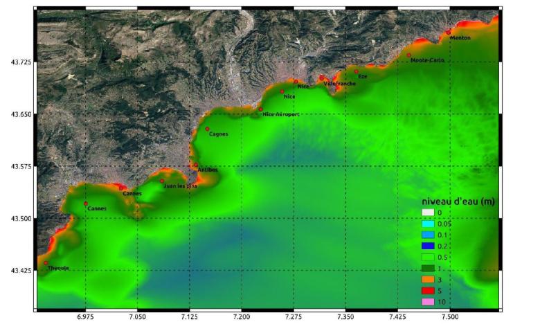
Simulation of the propagation of a tsunami off the coast of the Alpes-Maritimes département .
© BRGM
The need
Following research on tsunamis in the Mediterranean, the Alpes-Maritime Departmental Authority for Inland and Marine Areas (DDTM06) asked BRGM to model the most significant tsunami events for its entire coastline between Mandelieu-la-Napoule and Menton. The aim of the study was to identify the impact of tsunamis on the coastline and housing for two sources of earthquake tsunamis, based on the most severe hypotheses. The two seismic sources taken into account are the ones that seem most likely, based on historical analyses: a fault in the Ligurian Sea (responsible for the 1887 earthquake) and a fault to the north of the Maghreb margin (which caused the Boumerdes earthquake in 2003).
Results
Ultimately, 110 tsunami scenarios were defined (70 for the Maghreb margin and 40 for the Ligurian Sea), varying in particular the position of the epicentre, the orientation of the faults and the distribution of the co-seismic slip at the faults. In addition, scenarios for the Ligurian Sea considered three different earthquake magnitudes in order to take into account the latest research in this area.
The simulations determined the maximum water levels close to the shore, as well as the arrival times over the entire Alpes-Maritimes coastline (with a spatial resolution of 100 m):
- water levels reached more than 3 m in relation to mean sea level (NGF/IGN69), or even higher (> +5 m NGF/IGN69) in some places;
- arrival times ranged from 1h07 to 1h12 for sources from the Maghreb margin and from 2 minutes to 7 minutes for the Ligurian Sea, which in the latter case prevents any tsunami forecast and warning.
These simulations also made it possible to identify the scenarios with the biggest impact, by source type:
- the first wave is not always the highest and the sea does not systematically r recede before this first wave. This means that there is no “natural” alert, which means that people on the coastline could not see any signs that the tsunami was coming;
- the sea can remain rough for a long time after the arrival of the first wave, from one to several hours depending on the stretch of coastline and the type of source considered.
Using the results
The resulting map of flooded areas indicates that the airports of Cannes-Mandelieu and Nice Côte d'Azur are likely to be flooded to a greater or lesser extent. In addition, several sea fronts would potentially be flooded, with water heights exceeding 2 m and spreading inland over several hundred metres (e.g.: Cannes, Golfe-Juan, Antibes and Menton). Many harbours near these places would also be exposed to flooding.
The vulnerability of buildings to tsunami flooding is determined using a matrix based on different ranges of water heights on land, weighted by the distance of the building from the coastline, to qualify the level of exposure as low, moderate, high or very high. The study shows that 6,351 coastal buildings would potentially be exposed to seismic tsunami flooding, of which more than a third would be at very high risk.
The results of the study have been integrated into the ORSEC earthquake and tsunami plans of the Alpes-Maritimes Prefecture.
Partners
- Alpes-Maritime Departmental Authority for Inland and Marine Areas


