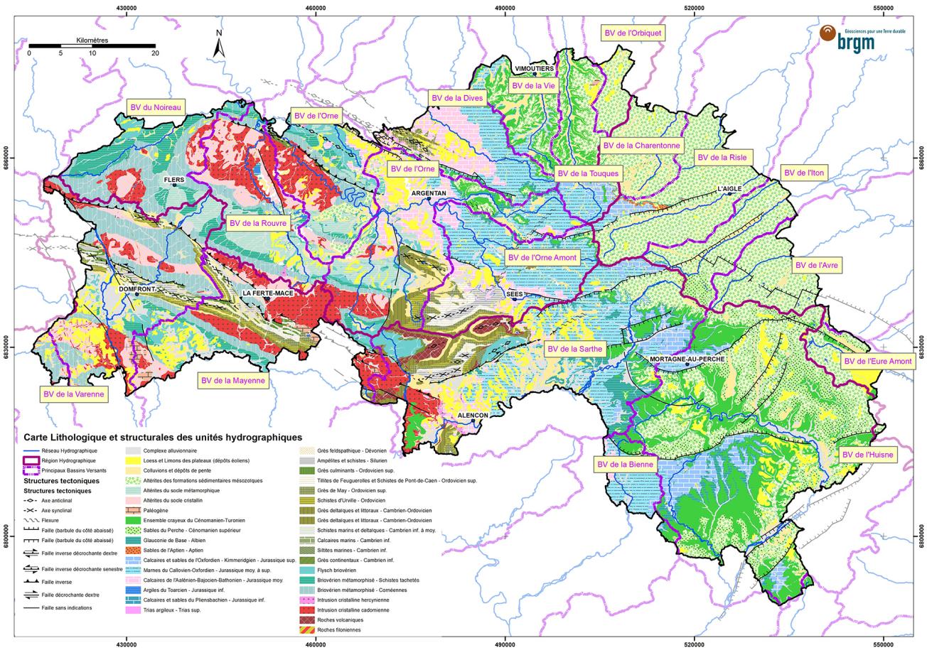
Simplified lithological map of the watersheds of the Orne département with clearer identification of water resources.
© BRGM
The need
Knowledge of the functioning of groundwater resources is now a key factor for developing the strategies necessary for their sustainable management, particularly in the context of climate change. Unfortunately, in the Orne département, the information required to understand how they work is often incomplete, which has led the Syndicat Départemental des Eaux (SDE61) and BRGM Normandie to work with their partners on a programme to improve geological and hydrogeological knowledge for the entire Orne département (AGHO programme).
The results
The geology of the Orne département is distinguished by its location between the Armorican Massif in the west, with what are known as basement rock geological formations, and the Paris Basin in the east, with its more recent sedimentary layers.
The work included:
- setting up a database for the Orne departmental water agency listing the available information, in particular coming from the various water research programmes or resource protection studies;
- describing the major geological complexes by detailing their lithology and distribution across the territory, in order to understand, as far as possible, the hydrogeological role of each complex;
- making a synthesis of their structure (faults, offsets/unconformities, folds/local rises, angle of inclination, etc.);
- proposing an identification of homogeneous aquifer compartments and summarising their main hydrogeological characteristics.

BRGM's work on improving the geological and hydrogeological knowledge of the Orne département is both useful and interesting. It was made possible by the dedication of a young team that was able to acquire and draw on a wide range of knowledge about this territory in a short time and to enhance BRGM's position as a reliable consultant in the region. We hope to move on to a digital atlas when certain financial limitations are overcome. While Orne is undoubtedly a rural territory, it is a strategic source of water for many surrounding urban areas.
Using the results
The documents produced provide a synthetic overview of current knowledge of the geological and hydrogeological functioning of the major aquifers in the Orne département. This synthesizing of current knowledge is an essential first step towards the creation of a departmental hydrogeological atlas, which will require in particular the production of a departmental piezometric map, and the availability of quantitative and qualitative indicators necessary for the optimal management of all these resources.
A database was created during this first phase. This will then be enriched by the various players in the water sector. The data produced will gradually be incorporated into BRGM's documentary repository and made available on BRGM's InfoTerre website and the relevant groundwater GIS (SIGES) sites.
The partners
- Syndicat Départemental des Eaux de l'Orne (SDE61)
- Agences de l’Eau Loire Bretagne et Seine Normandie
- DREAL Normandie


