ReunEM : heliborne geophysics in La Réunion
Transcription
Réunion Island, in the Indian Ocean, is unique. Its young volcanoes, among the most active in the world, and the humid tropical climate have shaped a territory with a unique relief and morphology. During the 2014 southern winter, the BRGM did some work in Réunion of a type already undertaken in Africa, in 4 French regions and 4 overseas departments: an operation to scan the entire substratum in Réunion up to a depth of 200m.
Réunion's geology is of great interest to the BRGM: the Geological and Mining Research Bureau, a reference in the field of applied earth sciences for resource and risk management in the land and underground. To understand Réunion's geology the BRGM scanned the island using magnetism and high-resolution electromagnetism. A Danish company, SkyTEM, won the BRGM tender to carry out these geophysical surveys. Their unique technology was developed at the University of Aarhus in Denmark.
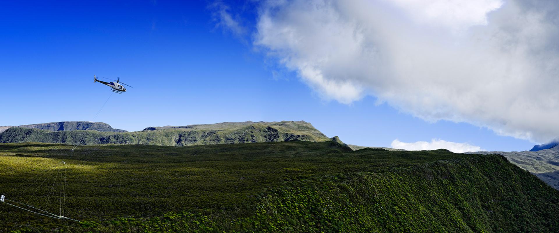
The helicopter's on-board device takes precise magnetic and electromagnetic readings to create an image of the first few hundred meters of substratum.
Réunion presents particularly steep reliefs with difficult or even impossible access in some places. The advantage of this unique, technically sophisticated device is its ability to cover the entire island, even the most inaccessible areas, to provide a global vision of geological objects, which is more difficult using a ground approach to geophysics.
On reaching the investigation area, the pilot approaches the relief and flies the device 50m above ground. Too high, beyond 100m, the data is unusable. The helicopter flies at about 80km/h each day following a flight plan. This technique was first used for mineral prospecting. It has been adapted to obtain a sharper image of the first few dozen meters down, crucial for human activity.
To fly low with this system, we are equipped with a laser. It gives the height relative to the ground.
The laser altimeter is operated by a technician, who monitors any obstacles around the structure that the pilot cannot see.
Tension is high because from takeoff to landing, we are flying very low above the relief. It's very tiring, constant vigilance is required.
The BRGM's airborne geophysics team draws up the helicopter's flight plan. In 10,500km of flight lines, almost all of Réunion's substratum has been analyzed. Urban areas cannot be scanned because of radio signals. Here, other techniques are used to analyze the substratum.
Here's the geophysical measuring device. It's a loop of more than 300m². We need to know where it is in space. The loop has a laser altimeter on each side, and another inclinometer behind the loop to measure its inclination in two planes. We also have two GPS. That way we have the loop's altitude, inclination and position. So this is the principal. The green part is the frame. The thick black cable running around is the transmitter loop. A current running through it generates a magnetic field.
Two currents of different intensity are generated alternately in a few microseconds. This particularity makes the device unique. An initial low-intensity current interacts with the first 50m of the substratum. Then a second high-intensity current interacts with up to 200m or more, depending on the nature of the substratum. As it moves, the device takes an electromagnetic sounding every 30m. The data collected from the signals is turned into images. The system produces a high-res image of the immediate substratum down to a considerable depth.
Fitted above the aileron is a horizontal loop which measures the secondary vertical magnetic field. The "egg" behind allows us, thanks to a vertical loop, to measure horizontal magnetic field.
The device is completed by a magnetic sensor, which measures the substratum's natural magnetism. The geophysicists then check that the data collected by the system is of high quality before validating the flight lines.
If necessary, they may request another flyover of the area.
Once the survey is finished, we are sure that the information is usable and can be used to produce a resistivity model.
It's crucial to monitor this survey every day, checking the quality of both flights.
The information collected as an electromagnetic signal indicates the resistivity of the substratum. This data will be transformed by BRGM geophysicists into a 3D representation. We are back in Réunion, a few months after the aerial survey. Software allows hydrogeologists to observe the substratum from all angles. One of its applications is prospecting new groundwater resources.
This electrical resistivity section shows the soil's capacity to conduct current. What interests us is these aquifers, or underground water tables.
The challenge is to preserve water resources. Near the coast, saltwater pollutes the fresh water. The phenomenon is known to the BRGM but thanks to 3D imagery, contact between saltwater and freshwater can be better identified and interpreted.
We see the salt intrusion, as seawater moves underground. Our air survey highlights the difference between the sea water, salty and electrically conductive, and fresh water, which conducts electricity less well. The air survey shows the geometry of the aquifers.
In the field, measurements taken in boreholes made by the BRGM and Office de l'Eau allow the interpretation of the airborne geophysics data to be confirmed. The airborne survey has many applications. As well as locating aquifers, it helps identify rock deposits and building materials... as well as landslides, such as those seen in Salazie. But there it has other applications. This unique technology produces a global vision of geological objects. All these applications are of interest to BRGM's partners.
We are interested in detail about the geometry of the aquifers, where Réunion's water resources are. We would also like, by the study of geology and hydrogeology and the nature of materials, so we can update our map of quarries.
We worked on cross-financing between the State, the region and Europe. The Ministry of Higher Education has contributed through LOLF 172 and the release of funds. The leverage effect of the ERDF has been optimal.
That's good, healthy management of the relevant European funding.
Data from the helicopter-borne geophysics survey will be made public. Given the large volume of data, it will be useful for many years. It will also bring new, as yet unsuspected perspectives. It's a real advance in our knowledge of Réunion's geology.
This is a huge source of information for scientists. Among the users of this data, the BRGM is working with the University of Réunion in producing a thesis in hydrogeophysics. Despite the use of a helicopter, operational costs were low considering the volume of data collected. Using on-the-ground techniques, it would have taken decades to obtain inferior results. So the BRGM has an outstanding tool to better analyse and understand the Réunion substratum.


